Dürnberg-Strecke

Logo Dürnberg-Strecke
Tour data
18.87km
721 - 974m
Distance
229hm
212hm
Ascent
01:30h
 
Duration
Brief description

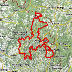
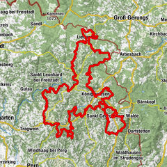
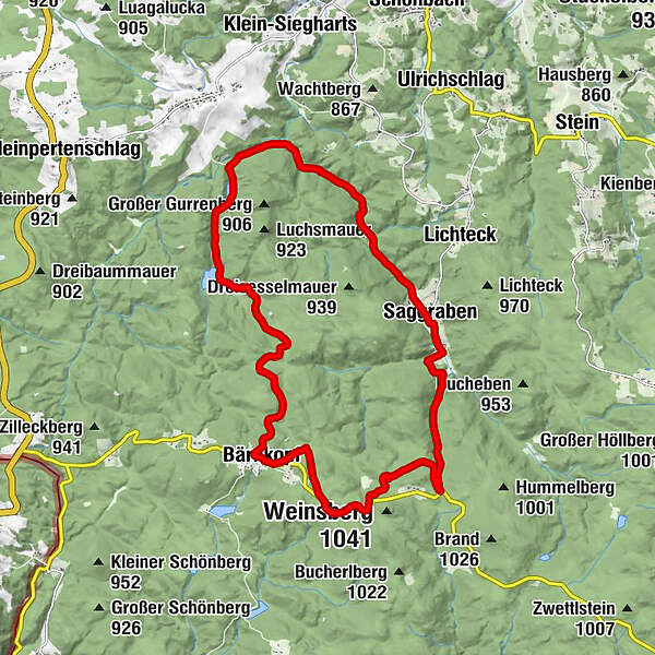
Bärnkopf – Annabild – Saggraben – Dürnberg – Bärnkopf

Difficulty
medium
Rating
Technique
Fitness
Landscape
Experience
Route
Einkehrstube Wackelstein
0.0 km
Pfarrkirche St. Anna
0.1 km
Bärnkopf
0.2 km
Saggraben
7.9 km
Bärnkopf
18.8 km

Best season
Jan
Feb
Mar
Apr
May
Jun
Jul
Aug
Sep
Oct
Nov
Dec
Highest point
974 m
Endpoint

Bärnkopf

Height profile

Author
The tour Dürnberg-Strecke is used by outdooractive.com provided.

4,0
Overall rating

5

0

%

4

100

%

3

0

%

2

0

%

1

0

%

GPS Downloads
  • GPX GPS Exchange Format (XML)
  • KML Google Earth, Google Maps
QR Download Codes for Mobile Phones
Other tours in the regions

Popular tours in the area

Tour de Alm EXTREM - 188Km, 5400Hm an einem Tag!

difficult Mountainbike
188.34km | 4398hm | 13:00h

Königswiesen circuit tour M3

difficult Mountainbike
28.04km | 865hm | 02:44h

Hirschalm Tour No. M4

medium Mountainbike
52.31km | 1237hm | 03:27h

Tour de Alm

difficult Mountainbike
187.88km | 4410hm | 17:08h