Mühlberg-Strecke

Logo Mühlberg-Strecke
Tour data
10.71km
232 - 485m
Distance
358hm
367hm
Ascent
01:00h
 
Duration
Brief description

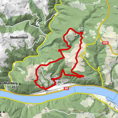
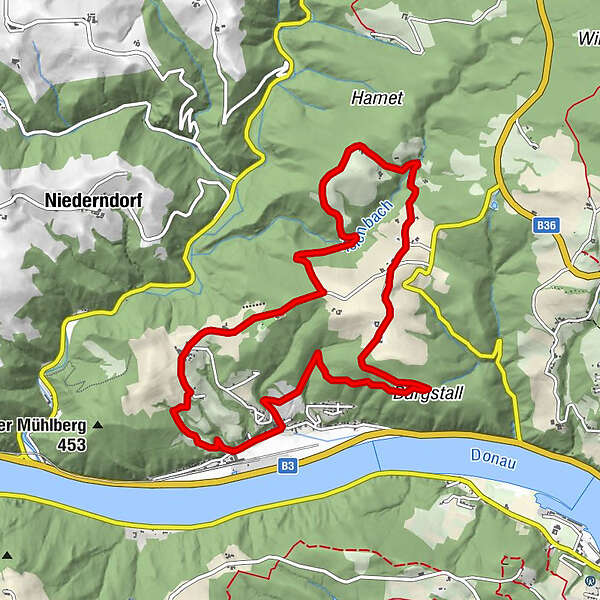
Weins - Viehtrift - Rottenberg - Weins

Difficulty
easy
Rating
Technique
Fitness
Landscape
Experience
Route
Kapelle Weins
0.0 km
Weins
0.1 km
Viehtrift
3.7 km
Rottenberg
8.8 km
Kapelle Weins
10.5 km
Weins
10.6 km

Best season
Jan
Feb
Mar
Apr
May
Jun
Jul
Aug
Sep
Oct
Nov
Dec
Highest point
485 m
Endpoint

Weins

Height profile

Author
The tour Mühlberg-Strecke is used by outdooractive.com provided.

Overall rating

5

0

%

4

0

%

3

0

%

2

0

%

1

0

%

Error
An error has occurred. Please try again.
Thank you for your review

Rating has been deleted

GPS Downloads
  • GPX GPS Exchange Format (XML)
  • KML Google Earth, Google Maps
QR Download Codes for Mobile Phones
Other tours in the regions

Popular tours in the area

St. Georgen/Walde route no. M1

medium Mountainbike
30.42km | 793hm | 02:45h

Grein - Bad Kreuzen - Speckalm - Sattl

medium Mountainbike
38.23km | 1048hm | 04:00h

Alpenvorlandtour

medium Mountainbike
20.9km | 369hm | 01:10h

Mühlberg-Strecke

Mountainbike
10.56km | 226hm | 00:35h