© RUNNERSFUN Consulting GmbH - Felix Ettinger

- Difficulty
-
medium
- Rating
-
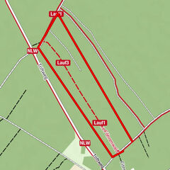
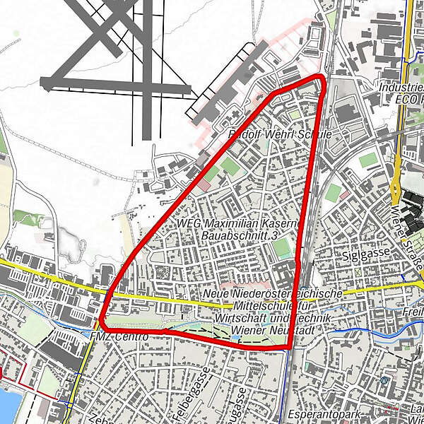
- Route
-
Wiener Neustadt (262 m)1.2 kmPfarre St. Anton am Flugfeld3.1 km
- Highest point
- 274 m
- Height profile
-


- Author
-
The tour SALOMON Runde - Salomon City Trail is used by outdooractive.com provided.
GPS Downloads


Other tours in the regions