Kremstal-Danube Long Distance Trail 15: Senftenberg – Krems


- Brief description
-
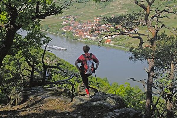
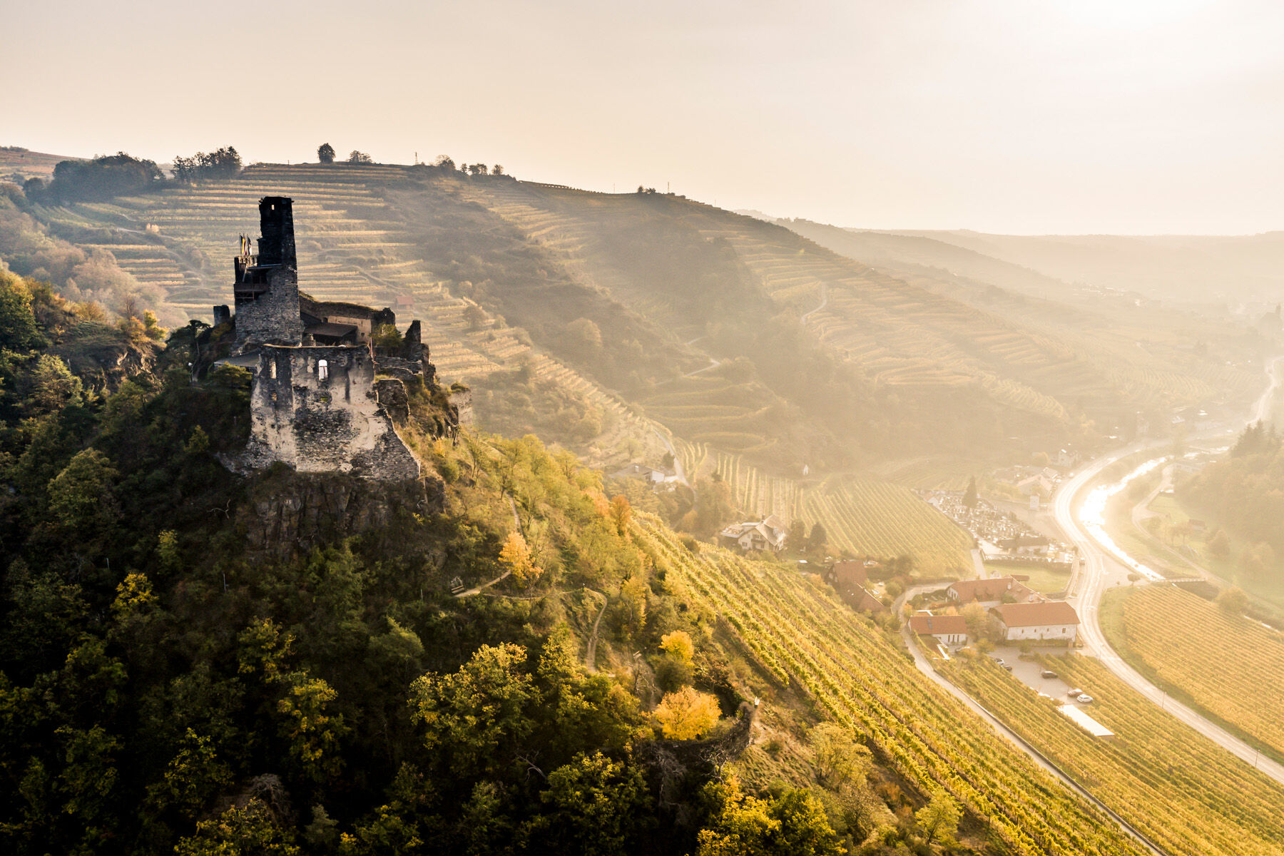
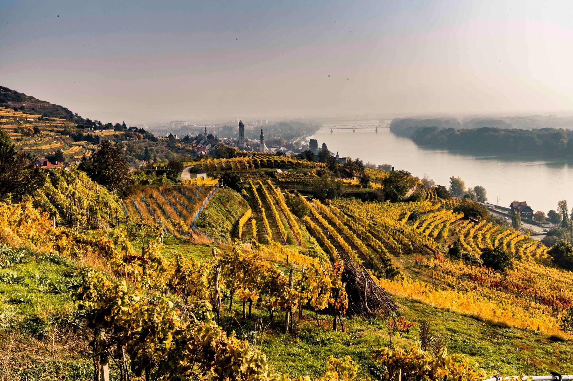
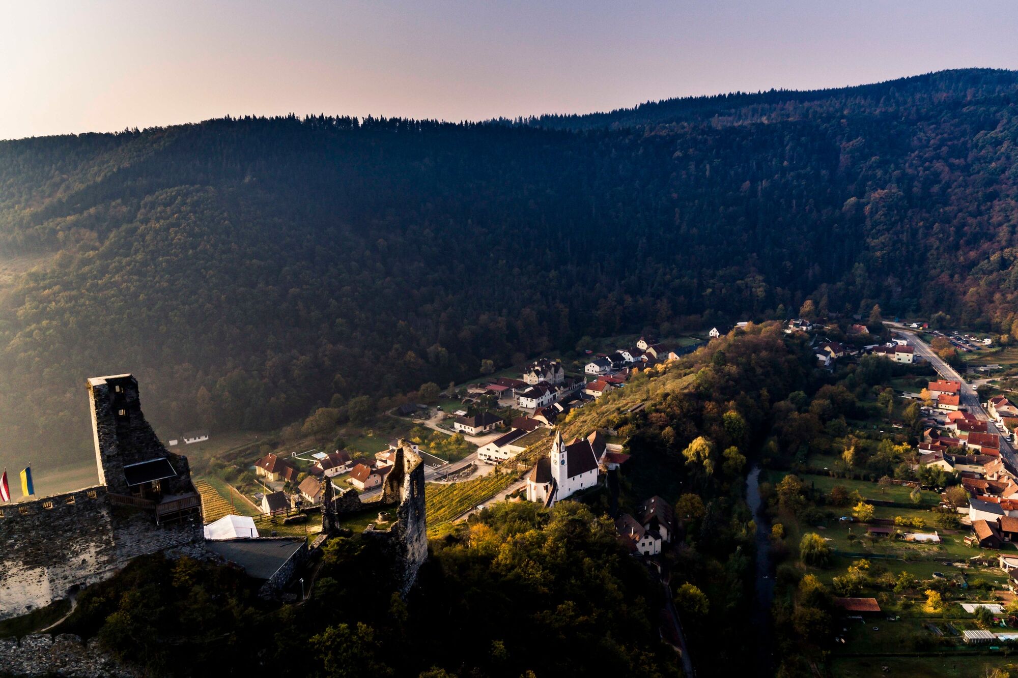
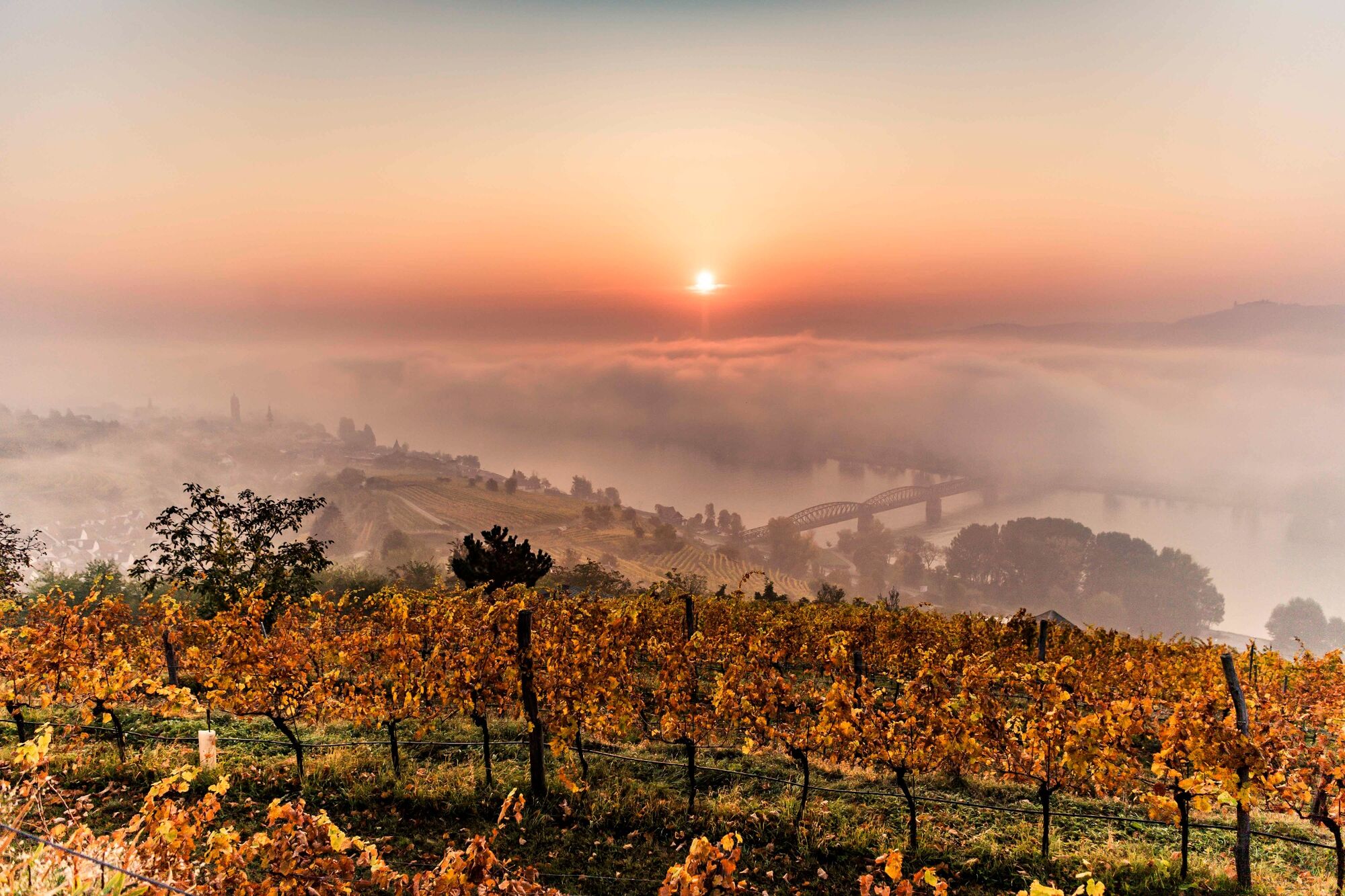
Past imposing vineyards and castle ruins, the last stretch of the long-distance hiking trail lead to the culturally lively centre of Krems - magnificent panoramic views included.
- Difficulty
-
medium
- Rating
-
- Starting point
-
Senftenberg, Municipal Office
- Route
-
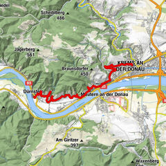
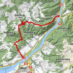
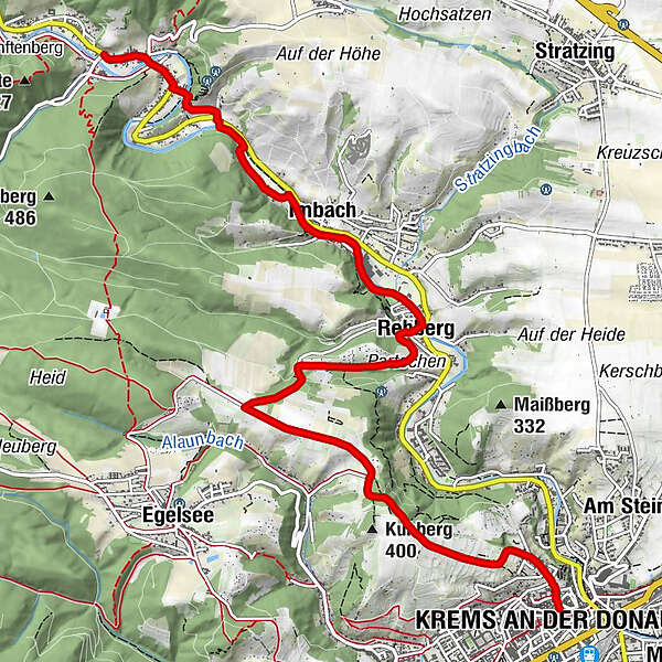
Senftenberg0.1 kmSchlapf'n Wirt Gasthaus Braun0.5 kmPfarrkirche hl. Andreas0.9 kmImbach2.5 kmKlosswaldhöhle3.1 kmRehberg3.7 kmPfarrkirche Rehberg3.9 kmErdstall7.8 kmInnenstadt8.8 kmKrems an der Donau8.9 km
- Best season
-
JanFebMarAprMayJunJulAugSepOctNovDec
- Description
-
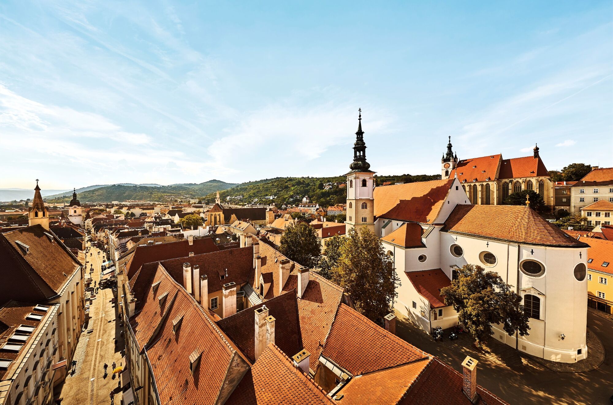
The last stretch of the Kremstal-Danube long-distance hiking trail is characterised by picturesque nature, impressive castle ruins and finally, urban flair and thus promises pure variety. The starting point is the wine town of Senftenberg, whose castle ruins already offer the first worthwhile diversion - the magnificent view over the Krems Valley convincingly proves this. The hike continues through tranquil forests and steep vine terraces via Imbach, with its magnificent Gothic parish church to another eye-catcher: the Rehberg ruins. Across the Kuhberg past the Schwarzalm inn, the route finally leads to Krems, the tour's destination. There, the cultural programme invites you to linger: The Kunstmeile Krems, the wine experience world Winzer Krems or the Landesgalerie Niederösterreich (Lower Austria State Gallery) guarantee true cultural delights here. For those who prefer culinary delights, however, the city's numerous restaurants offer the perfect opportunity to round off the hike in comfort.
- Directions
-
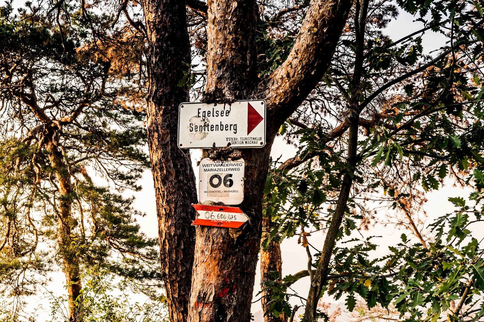
We walk through the Upper and Lower Market to Schulgasse, where we turn left and walk up to the Senftenberg Parish Church. Once at the top, dont’t be afraid to walk the 10minutes to the Senftenberg ruins, which are well worth seeing, with their magnificent view. The trail then descends again, above the well-known Ehrenfels vineyard, past the Nigl winery. We cross the main road and the Krems over the footbridge and hike through the district of Hofstatt to Imbach. The parish church is worth seeing, only 5 minutes off the trail. We continue along a quiet footpath on the right bank of the river, which takes us to Krems-Rehberg. Turn right under the Rehberg ruins and past the church via the Partschen vineyard to the Alauner Landesstraße. This leads us in a south-easterly direction through the Kühberg and Spiegel vineyards. Past the Schwarzalm Inn with its magnificent view of the Danube, through the Armesündergraben, and down through the Ried Wachtberg, we reach the stage destination of Hoher Markt in Krems.
- Highest point
- 378 m
- Endpoint
-
Krems, Hoher Markt
- Height profile
-

- Equipment
-
Sturdy hiking shoes, rain protection, sufficient food and drink, as well as a hiking map Kremstal-Donau and possibly a wine tavern calendar.
- Safety instructions
-
Please note the following tips and advice to ensure that your hiking holiday is a beautiful experience:
Stay on the marked trails and wear mountain/hiking boots. Please do not leave your rubbish along the path. Carry enough food (water/snacks) with you. Take the hiking map with you or use the free hiking app. Respect the sensitive habitats of flora and fauna. - Tips
-
In Krems, be sure to plan a visit to the Kunstmeile Krems with the new Landesgalerie Niederösterreich. Vinophile wanderers visit the Wine Experience World of the Krems Winegrowers. Tip: a walk through the Krems Old Town: charming alleys, fascinating house facades and lots of life!
- Additional information
- Directions
-
From Vienna: via A22 and S5, B 37 to Senftenberg
From the west: A1 and S33, B37 to Senftenberg
- Public transportation
- Parking
-
Car park at the Municipal Office, Oberer Markt
- Author
-
The tour Kremstal-Danube Long Distance Trail 15: Senftenberg – Krems is used by outdooractive.com provided.


General info
-
Donau Niederösterreich
2289
-
Kamptal - Manhartsberg
1158
-
Stein an der Donau
696