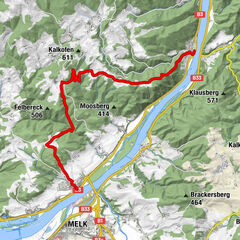
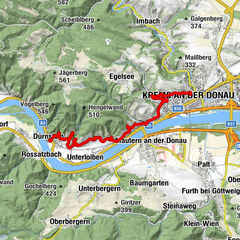
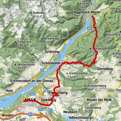
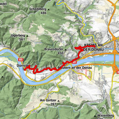
Kremstal-Danube Long Distance Trail 02: Mautern - Furth bei Göttweig


- Brief description
-
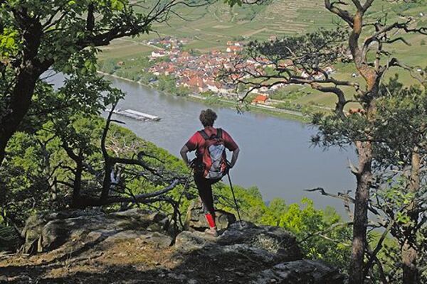
The hiking stage from Mautern to Furth impresses with unique views: Picturesque vineyards and spectacular natural phenomena make for an unforgettable hiking experience.
- Difficulty
-
easy
- Rating
-
- Starting point
-
Mautern an der Donau Municipal Office
- Route
-
Mautern an der Donau0.1 kmWeinbau Teufner3.8 kmPfarrkirche Furth bei Göttweig4.2 kmFurth bei Göttweig4.2 km
- Best season
-
JanFebMarAprMayJunJulAugSepOctNovDec
- Description
-
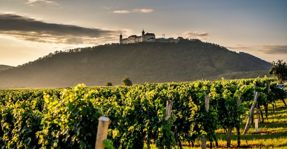
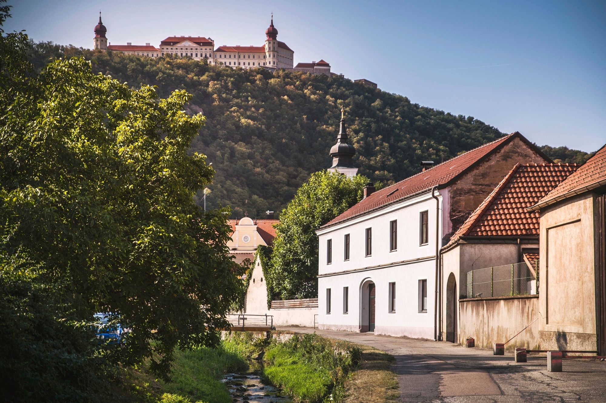
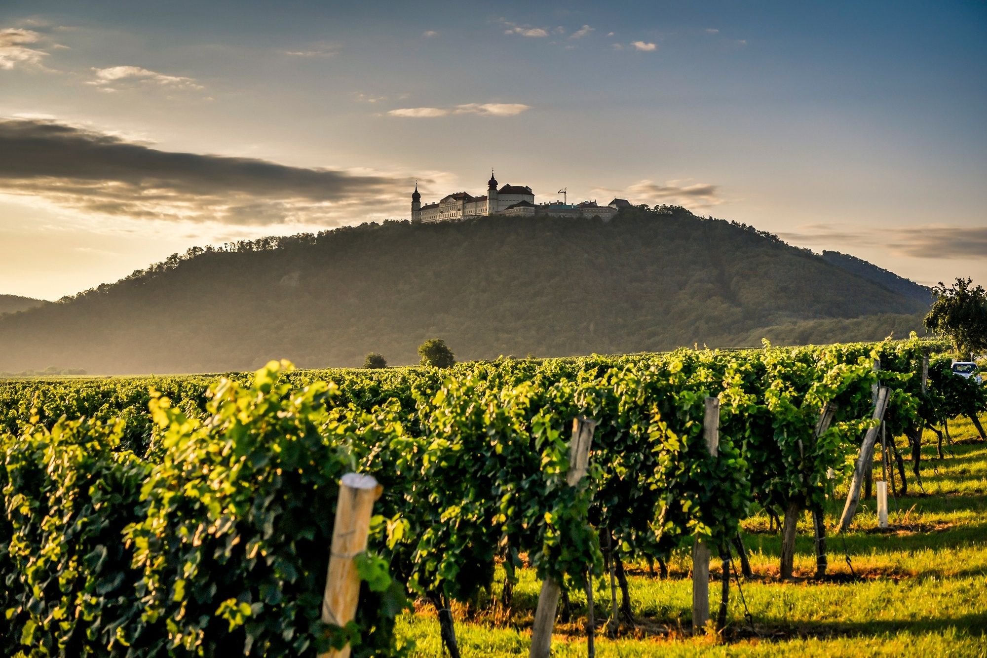
Between idyllic vineyards and imposing gorges, the second stage of the Kremstal-Danube long-distance hiking trail makes its way through nature. Starting from the Roman town of Mautern, the route, lined with vineyards and nut trees, first leads to the natural monument Hohlweg Zellergraben. Next, the impressive loess gorge with its walls up to twelve metres high leads straight to Furth, where numerous wine taverns invite you to take a relaxing break. Another route highlight is the UNESCO World Heritage Site Benedictine Abbey of Göttweig, which towers high above the trail throughout the hike. Due to the short distance and the few metres in altitude, the stage Mautern - Furth is also classified as easy. It is, therefore, suitable for pleasure and sport-loving novice hikers.
- Directions
-
The stage starts at Mautern town hall on St. Pöltner Straße in the direction of the Raab barracks. Shortly after the barracks gate, the Schanzweg branches off to the right, which we follow. At the Hauerkreuz, keep to the left, and you will reach the Neubergweg and its eponymous meadow. From the Zellerkreuz, the trail leads through the natural monument "Hohlweg Zellergraben", a loess gorge with walls up to 12 m high, to Furth. We hike through well-known vineyards such as Silberbühel, Oberfeld and Gottschelle and pass the Further Kellergraben with wine taverns. At the end of this loess path, we reach the settlement area, turn right into Kellergraben and turn left into St. Wolfgang-Weg at the kindergarten. We pass the Further Parish Church, which lies at the foot of the Benedictine Abbey of Göttweig, the "Austrian Montecassino", walk through the archway, over the Fladnitz Bridge and then reach our stage destination, the municipal office of the market town of Furth bei Göttweig.
- Highest point
- 253 m
- Endpoint
-
Municipal office of the market town of Furth bei Göttweig
- Height profile
-

- Equipment
-
Sturdy hiking shoes, rain protection, sufficient food and drink, as well as a hiking map Kremstal-Donau and possibly a wine tavern calendar.
- Safety instructions
-
Please note the following tips and advice to ensure that your hiking holiday is a beautiful experience:
Stay on the marked trails and wear mountain/hiking boots. Please do not leave your rubbish along the path. Carry enough food (water/snacks) with you. Take the hiking map with you or use the free hiking app. Respect the sensitive habitats of flora and fauna. - Tips
-
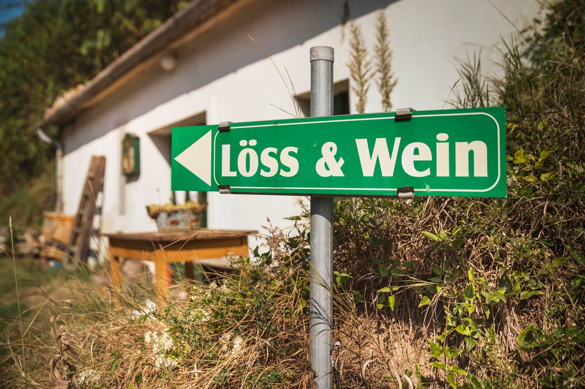
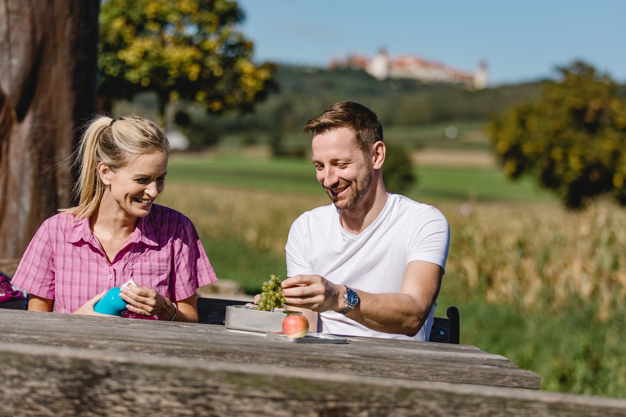
The combination of loess and wine can be seen in the natural monument Hohlweg Zellergraben. Be sure to plan a time for a visit to the Benedictine Abbey of Göttweig. Enjoy wine and regional delicacies of the Kremstal region. Check the Heurigen calendar, for open Heurigens!
- Additional information
- Directions
-
Mautern can be reached from the West via the Westautobahn A1/E4 exit Melk and then the Bundesstraße 33.
When travelling from the east, we recommend using the S33 (from St. Pölten) or S5 (from Vienna) motorways to the Danube bridge at Traismauer and then continuing via the B33.
- Public transportation
-
The nearest major railway station is in Krems an der Donau (connection to the Franz-Josefs-Bahn, Kamptalbahn and to St. Pölten). The train towards St. Pölten stops in the neighbouring village of Furth-Palt.
The journey to Mautern is possible with the Wachaulinie (WL 2 Krems-Rossatz-Melk or Melk-Rossatz-Krems) from Krems and Melk railway stations.
- Parking
-
Car park at the Römerhalle in Mautern.


- Author
-
The tour Kremstal-Danube Long Distance Trail 02: Mautern - Furth bei Göttweig is used by outdooractive.com provided.


General info
-
Donau Niederösterreich
2289
-
Dunkelsteinerwald
1373
-
Furth bei Göttweig
607