Winter
Summer
Weather
Webcams
Accommodations
Tours
Search history
Search suggestions
No results found
Search
Tours
Home
Summer Österreich
Lower Austria
Tours
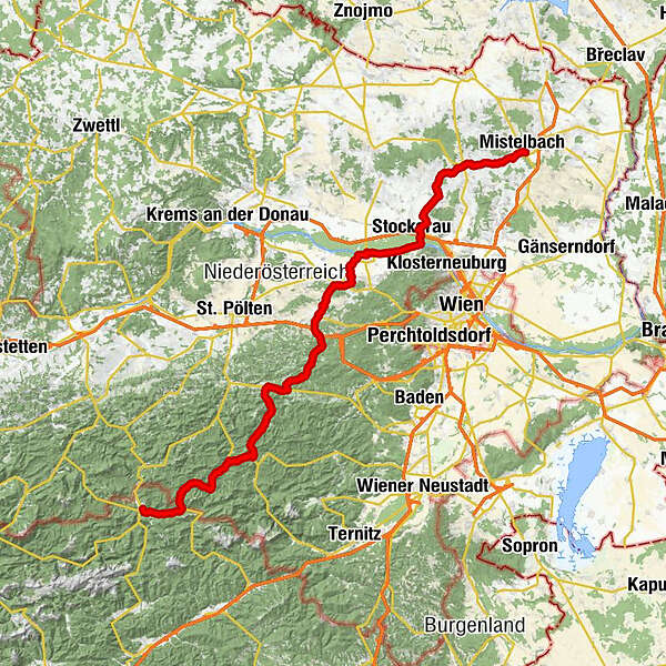
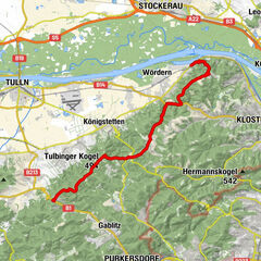
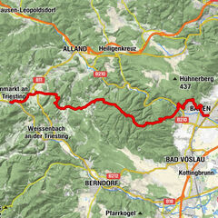
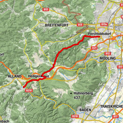
mariazell-mistelbach
Regions
Weather
Webcams
Tours
Highlights
Bathing lakes
Accommodations
Offers
Sports provider
Events
Ski resorts
Cross-country skiing
Snow parks
mariazell-mistelbach
long-distance walking trail
Bookmark
Map
show
hide
Print
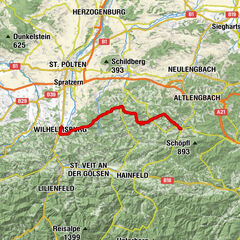
Tour data
182.9
km
166 - 971
m
Distance
910
hm
Ascent
21:42
h
Duration
ktmrace
created am 13.07.2011
672
Views
Brief description
tour
Rating
Technique
Fitness
Landscape
Experience
Highest point
971 m
Write a review
Overall rating
5
0
%
4
0
%
3
0
%
2
0
%
1
0
%
Reviews
(0)
0 Comments
Write a review
Error
An error has occurred. Please try again.
Thank you for your review
Rating has been deleted
Report tour
GPS Downloads
GPX
GPS Exchange Format (XML)
KML
Google Earth, Google Maps
QR Download Codes for Mobile Phones
mariazell-mistelbach
QR Codes - tour download for cell phones
GPX
KML
Other tours in the regions
Wienerwald
4219
Elsbeere-Wienerwald
1218
Altlengbach
267
Popular tours in the area
04 Voralpenweg, Etappe 02: Greifenstein - Riederberg
long-distance walking trail
22.58
km |
544
hm |
07:00
h
04A Voralpenweg, Etappe 03: Baden - Altenmarkt a. d. Triesting (Var...
easy
long-distance walking trail
28.69
km |
1066
hm |
09:00
h
01 Nordalpenweg, 01. Etappe: Perchtoldsdorf - Mayerling
easy
long-distance walking trail
19.07
km |
556
hm |
06:00
h
04 Voralpenweg, Etappe 05: Laaben - Wilhelmsburg
easy
long-distance walking trail
29.77
km |
946
hm |
08:30
h
No entries found.
The search is currently not available.
Please refine your search.
Local search results
(<= 25km)
More results
(> 25km)
%count% Search results
%name%
%type%
%elevation%
%population%
%lpButton%