


- Brief description
-
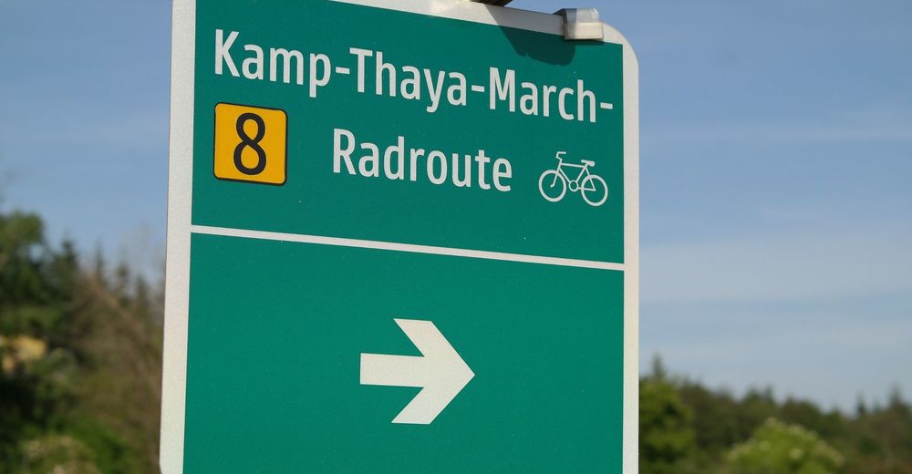
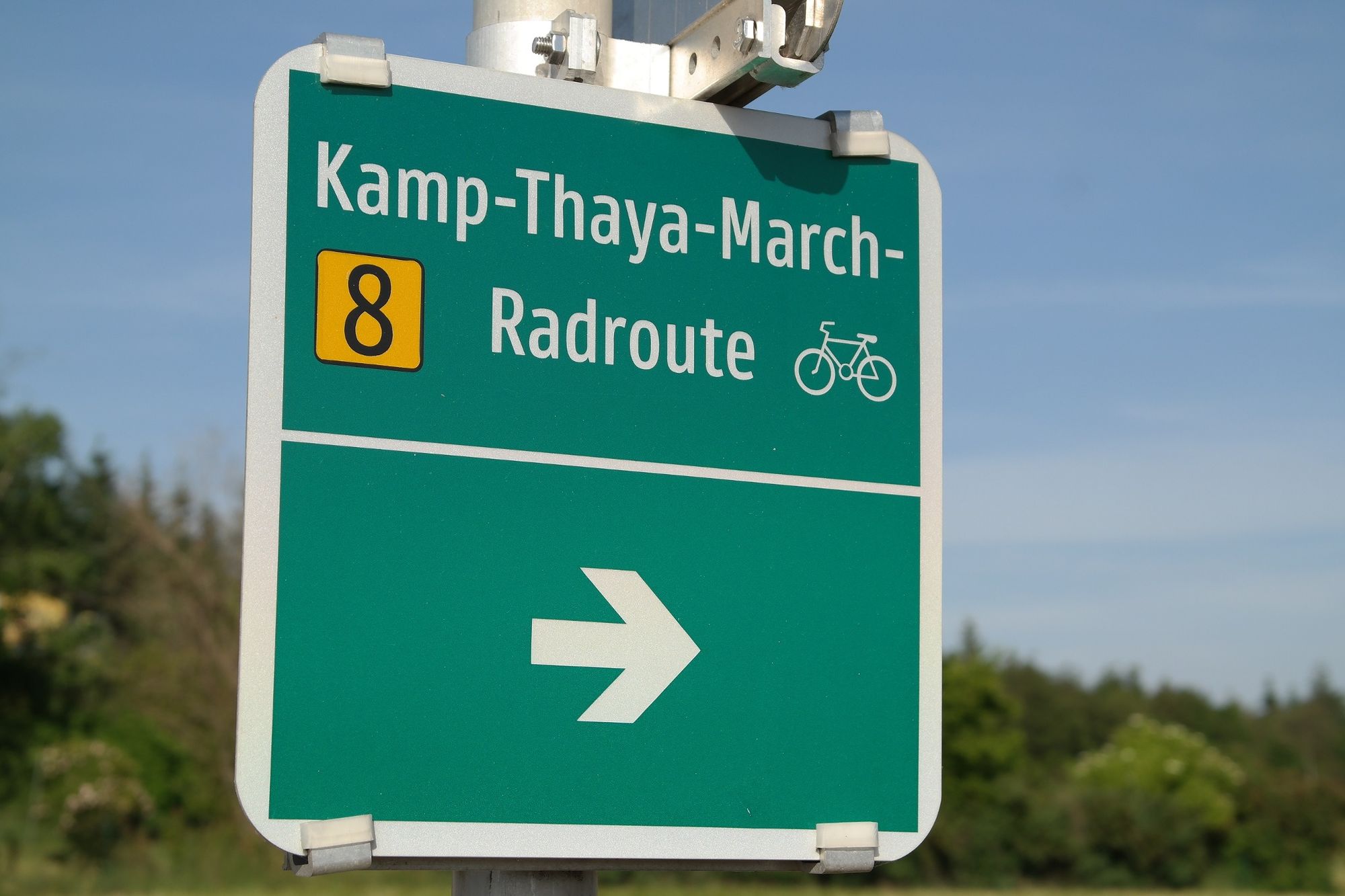
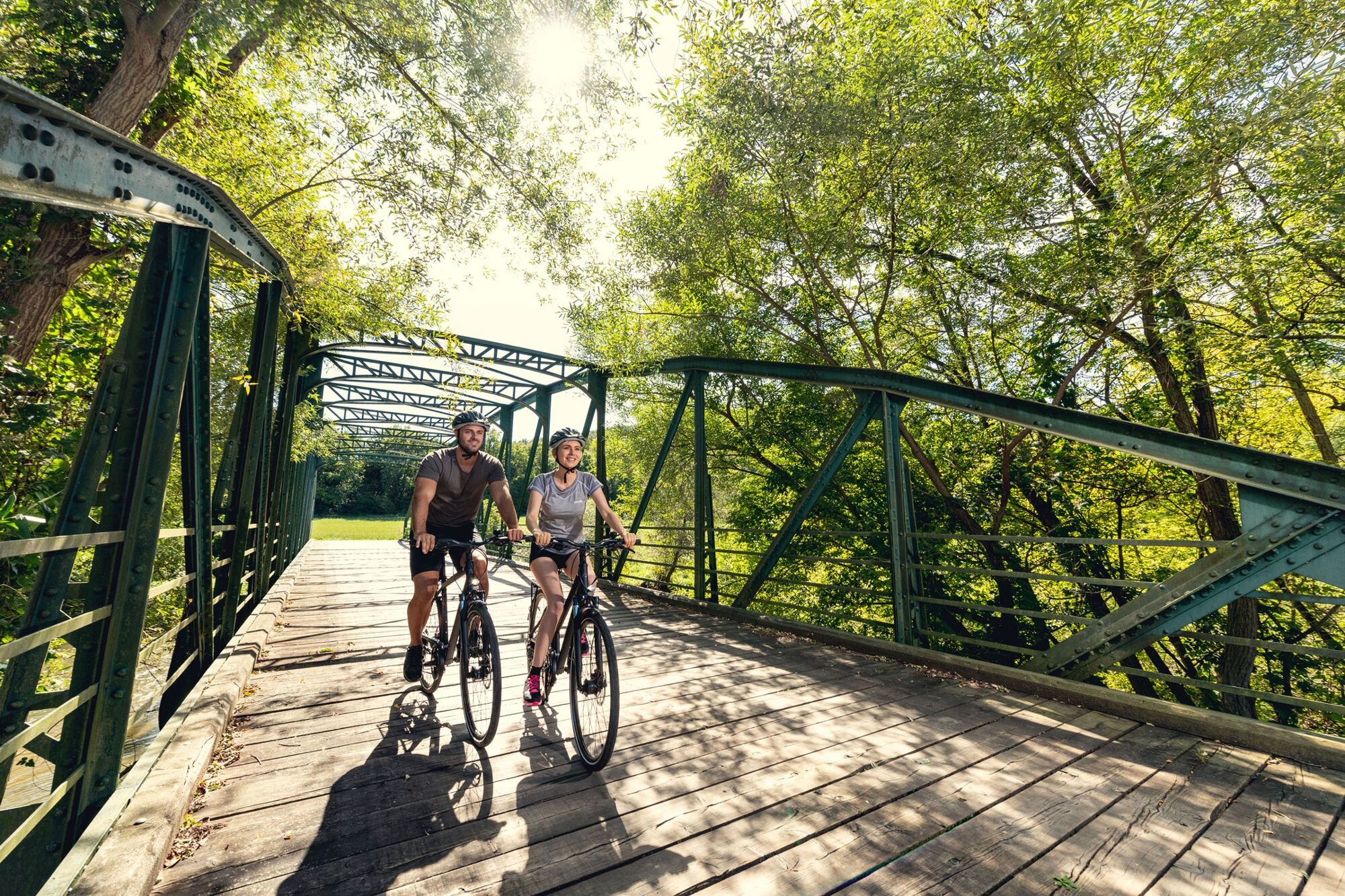
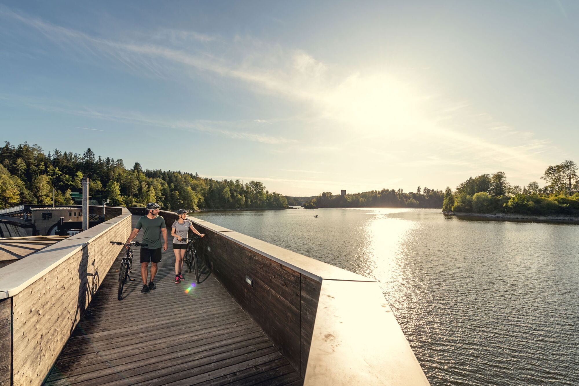
Escape from the Danube and bike on a discovery of Lower Austria along the Kamp-Thaya-March cycling route; one of the most beautifulcycling routes in Austria.
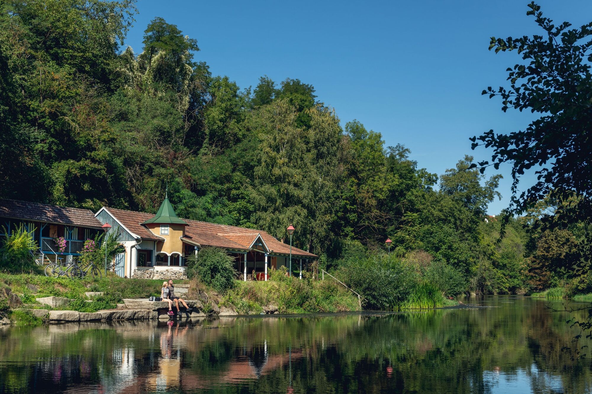
The attractive bike route, in the north-eastern part of Austria, follows three Rivers and in contrast permeates the Wald- and Weinviertel - two romantic Regions on the border to the Czech Republic. Scenic diversity, clever signs, friendly and helpful people and high recreational value - the German magazine "active cycling" describes the Kamp-Thaya March cycle path (KTM) as excellent.
With four stars and the label "Very recommended" did the editorial staff describe the 400 km long route from Krems an der Donau through Wald- and Weinviertel in the vast landscape of the March to Vienna through a largely undiscovered cycling region beyond main roads and mass tourism. Peace, tranquility and idyllic scenery make this trip an experience. The stages with a length between 30 and 55 km can be varied, while the busiest routes are mainly confined to the Waldviertel. Thanks to the perfect KTM route guide the orientation on the route is easy. On the route, wheel-friendly restaurants and accommodation facilities are included.
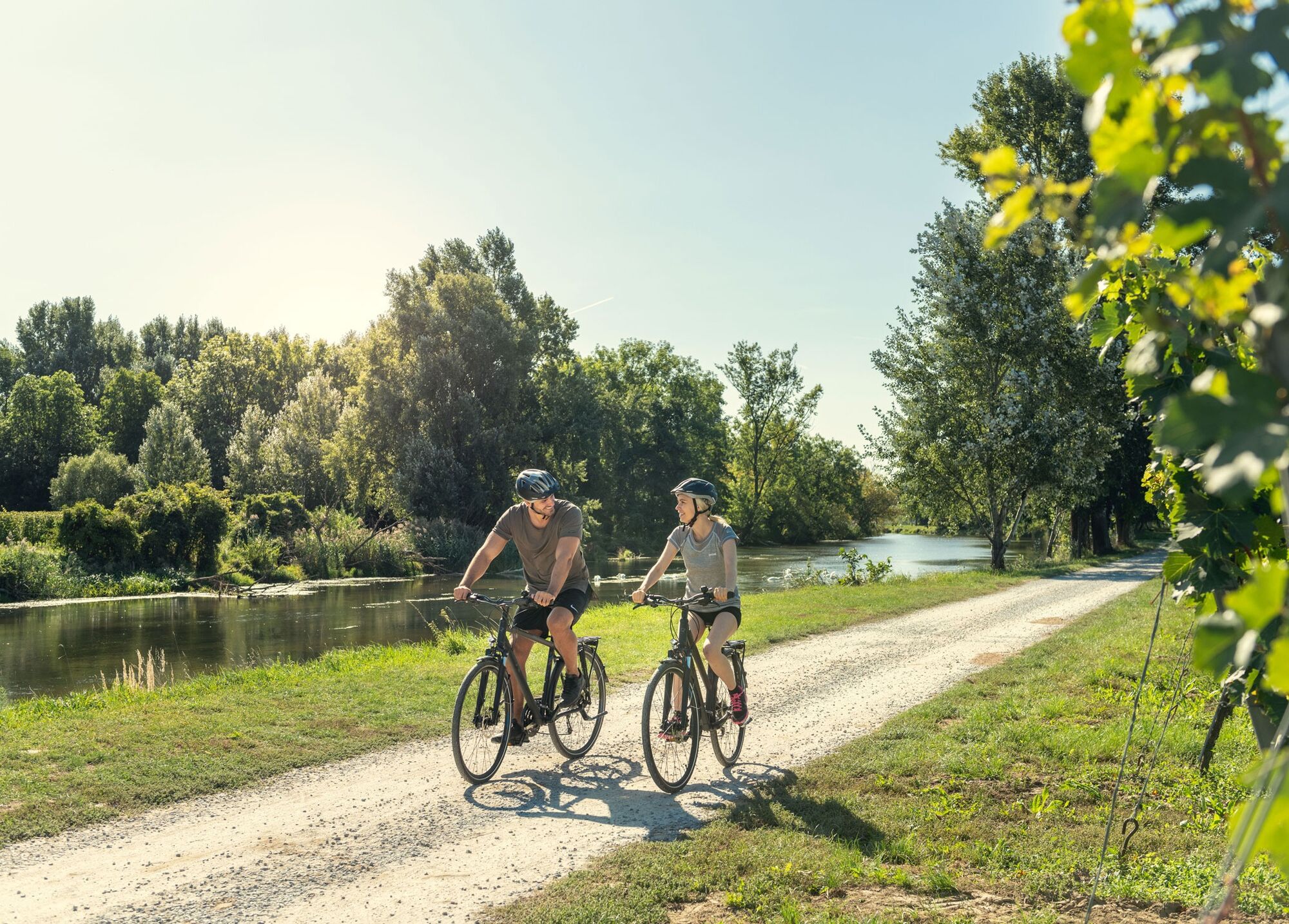
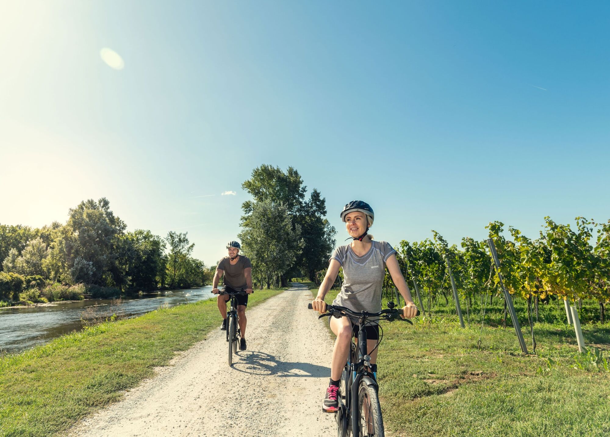
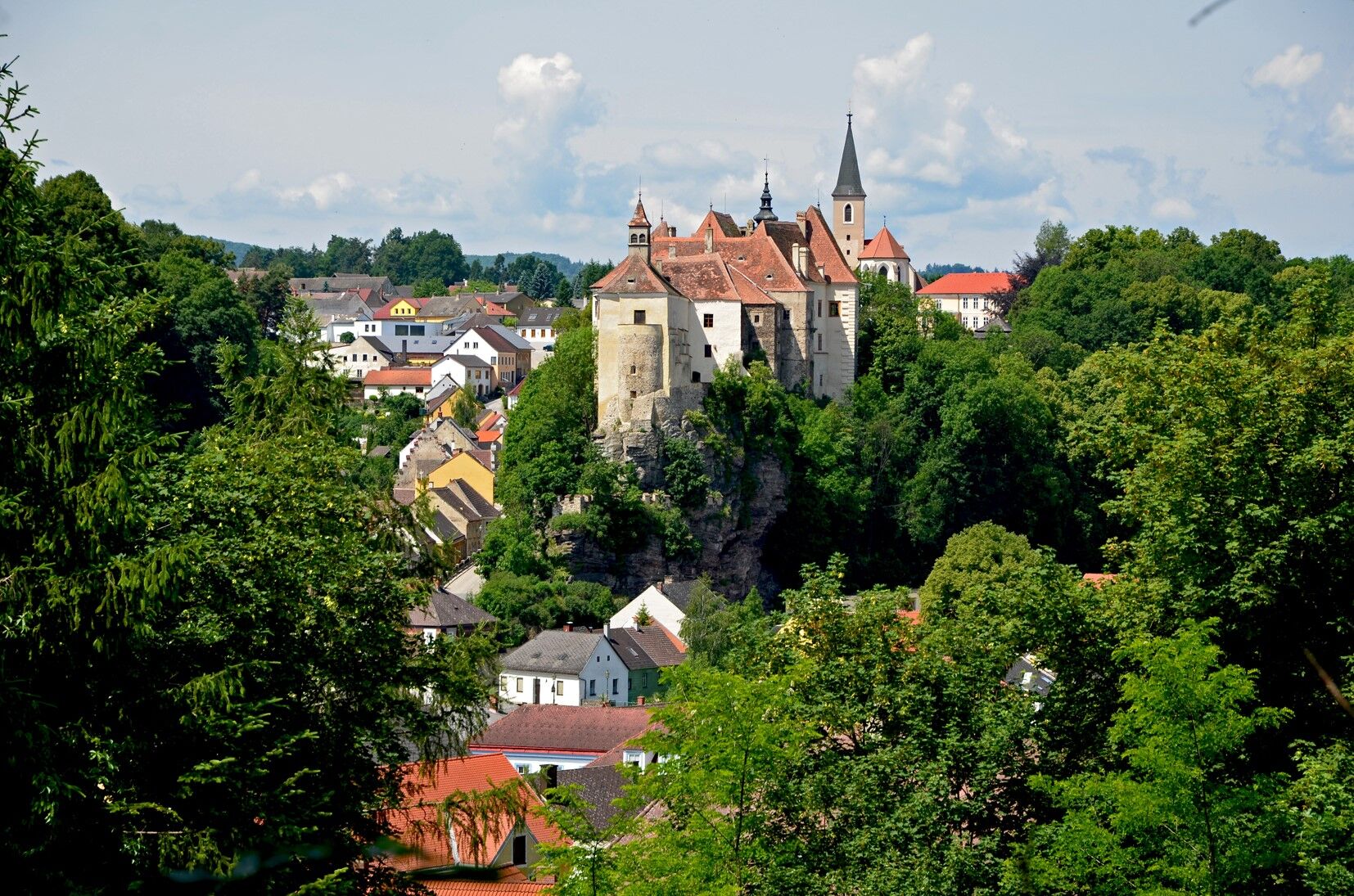
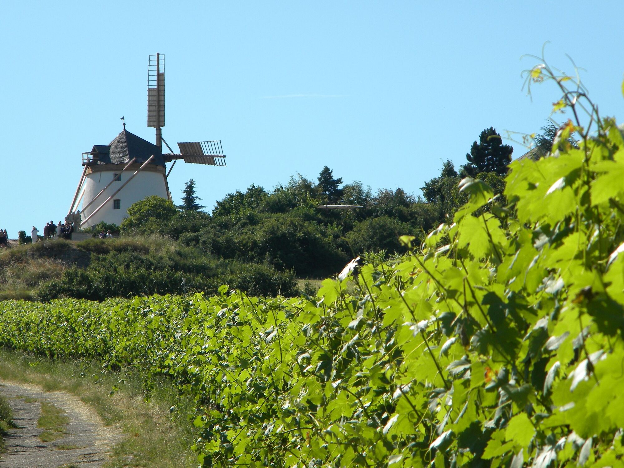
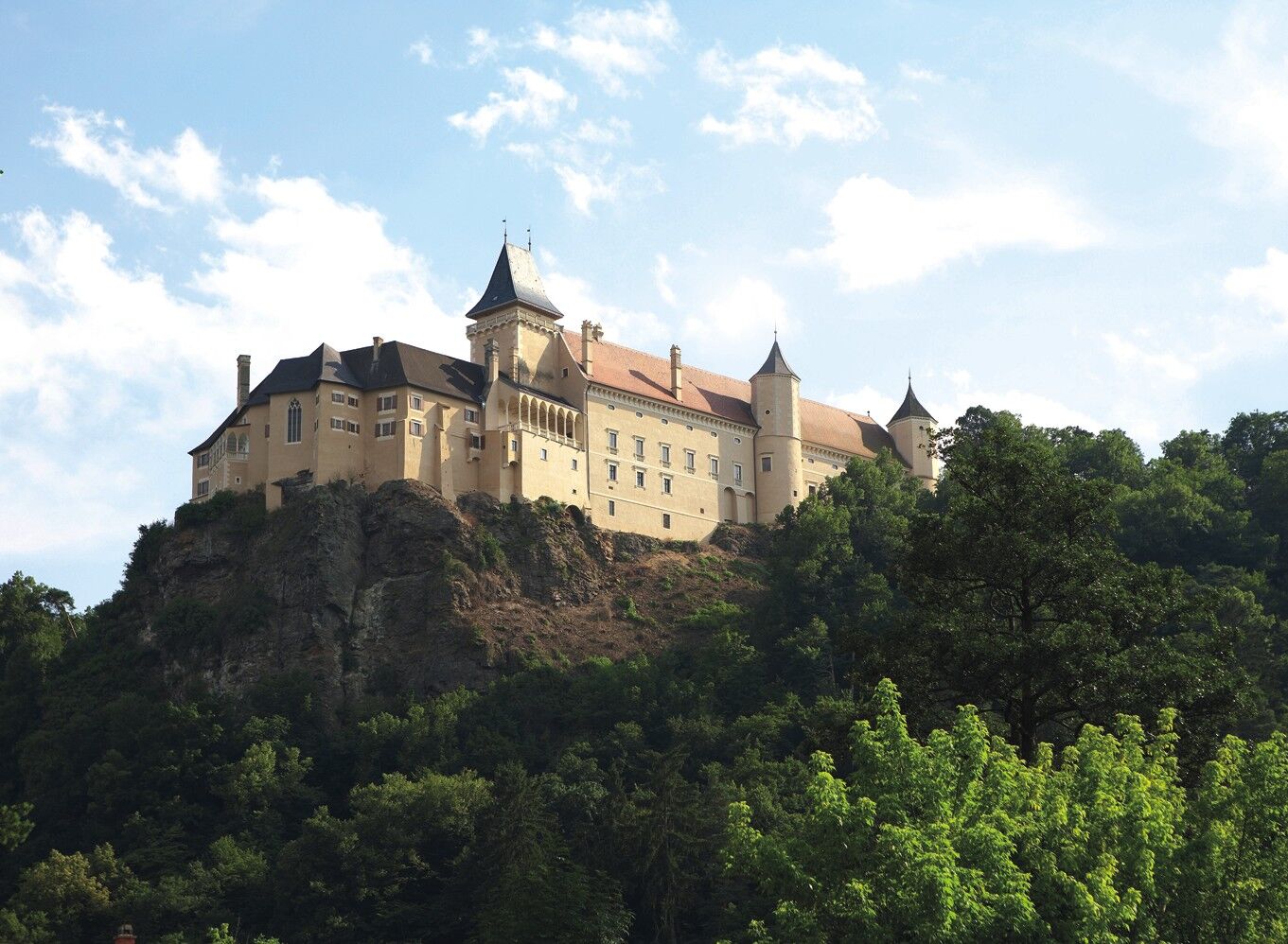
Wild nature, deserted villages, medieval castles and cultivated wine make the tour an unforgettable experience on the most beautiful detour from Krems to Vienna.
- Difficulty
-
medium
- Rating
-
- Starting point
-
Krems
- Route
-
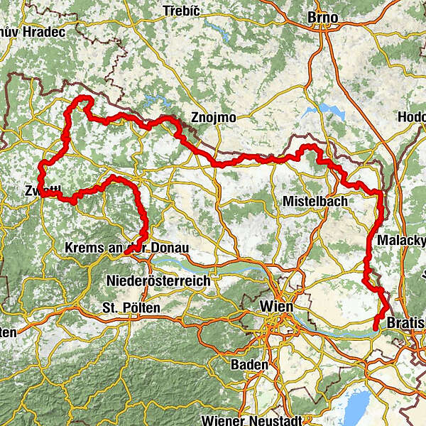
Krems an der Donau0.3 kmInnenstadt0.3 kmKönigreichssaal von Jehovas Zeugen1.2 kmAntonikirche1.3 kmHeuriger Donnemiller3.0 kmOberrohrendorf5.2 kmHeuriger Dagmar Kohl5.4 kmPfarrkirche Hl. Koloman5.6 kmRohrendorf bei Krems5.6 kmSchmankerlstube Schagerl8.0 kmGobelsburg12.9 kmWeinhof Kreitner-Sax13.0 kmHaindorfer Kapelle14.7 kmLangenlois16.0 kmElisabethkirche16.1 kmZöbing18.9 kmHeiligensteinerhof19.0 kmGutmann19.4 kmSchönberg-Neustift20.4 kmMantlermühle22.6 kmGasthof zur Schonenburg22.7 kmSchönberg am Kamp22.8 kmBadbuffet23.1 kmHeuriger Staritzbichler-Deibler25.6 kmPfarrkirche hl. Johannes der Täufer25.6 kmStiefern25.7 kmAltenhof27.1 kmPlank am Kamp29.9 kmOberplank30.9 kmThunau am Kamp35.8 kmGars am Kamp36.5 km"Platzlwirt" - Gasthaus Falk36.5 kmGars-Thunau (250 m)37.0 kmKamegg38.9 kmRosenburg am Kamp41.8 kmHotel Restaurant Landgasthof Mann41.9 kmHofmühle42.8 kmAltenburg46.9 kmMahrersdorf49.6 kmGobelsdorf52.0 kmFeinfeld53.2 kmGreillenstein54.9 kmRöhrenbach55.4 kmRamsau58.1 kmAltpölla60.4 kmGasthof Speneder60.6 kmPfarrkirche Mariae Himmelfahrt61.1 kmSteinbigl (507 m)61.9 kmOrtskapelle Hl. Dreifaltigkeit63.8 kmKleinraabs64.0 kmNondorf66.0 kmPfarrkirche hl. Martin68.5 kmFranzen68.5 kmOttenstein75.7 kmRistorante Vita78.3 kmOrtskapelle hl. Anna78.5 kmPeygarten-Ottenstein78.6 kmGedächtniskapelle81.1 kmFaulenzerhotel84.8 kmJagastubn84.9 kmFriedersbach85.2 kmGasthof Hanni87.5 kmMitterreith87.8 kmEdelhof90.6 kmSauberg91.8 kmJohanneskapelle von Nepomuk Kapelle92.7 kmZwettl Stift92.7 kmPfarrkirche Maria Himmelfahrt97.4 kmZwettl98.0 kmBügerspitalskirche98.0 kmGradnitz101.3 kmGroßhaslau (611 m)103.5 kmRitzmannshof105.0 kmWirtshaus zur Minidampfbahn106.1 kmTeichhäuser106.2 kmGroßglobnitz108.4 kmOttenschlag111.4 kmWarnungs113.5 kmWolfenstein114.5 kmRieweis116.1 kmEchsenbach118.3 kmGasthaus Klang118.3 kmModlisch121.3 kmSchwarzenau123.4 kmGasthaus Kaminstube Zlabinger123.6 kmMeierhofkapelle123.9 kmLimpfings125.2 kmWillings127.3 kmMarkl127.6 kmPfarrkirche hl. Laurentius127.9 kmWindigsteig128.0 kmKottschallings129.6 kmMeires129.8 kmVestenpoppen132.1 kmOrtskapelle132.1 kmWohlfahrts133.5 kmGötzweis135.2 kmJasnitz136.1 kmOrtskapelle136.2 kmWaidhofen an der Thaya (510 m)138.9 kmBürgerspitalkirche hl. Geist139.1 kmVestenötting141.9 kmDobersberg154.5 kmLexnitz156.3 kmHanftal158.8 kmWaldhers161.4 kmOrtskapelle hl. Bartholomäus'161.5 kmWetzles164.8 kmThures167.1 kmMünchreith an der Thaya170.1 kmKirche Karlstein172.2 kmKarlstein an der Thaya172.3 kmStollenloch172.8 kmEggersdorf175.2 kmPfarrkirche hl. Nikolaus176.6 kmSpeisendorf176.6 kmBirkenhof Heuriger176.6 kmTenniscafé Steffi181.9 kmRaabs an der Thaya182.6 kmStadtkrug182.6 kmRaabs an der Thaya182.9 kmRaabser Uferhöhle183.0 kmModsiedl184.5 kmZemmendorf185.9 kmNonndorf190.1 kmMaterl192.9 kmAutendorf192.9 kmJohannes Nepomuk-Kapelle194.2 kmGasthof zum Goldenen Lamm195.3 kmPfarrkirche hl. Martin195.3 kmDrosendorf195.4 kmMoKa195.5 kmDrosendorf Altstadt196.7 kmPfarrkirche hll. Peter und Paulus196.9 kmGalgenberg (464 m)198.4 kmWolfsbach200.3 kmMariä Himmelfahrt205.3 kmLangau205.4 kmSchaffinger Feld206.6 kmRiegersburg212.1 kmFelling214.5 kmSt. Peter und Paul214.6 kmGasthof Hammerschmiede219.8 kmVorstadt219.9 kmHardegg220.3 kmRastplatz Hardegg220.4 kmMerkersdorf223.9 kmNiederfladnitz231.1 kmHofern234.0 kmBuschenschank Schauaus234.5 kmParapluieberg (367 m)236.9 kmRetz239.0 kmRagelsdorf246.8 kmGruftkapelle Magdalena von Ehrenfels247.3 kmPeigarten249.5 kmJetzelsdorf251.1 kmKapelle heiliger Johannes Nepomuk252.5 kmAuggenthal253.0 kmHaugsdorf254.1 kmAlberndorf im Pulkautal256.6 kmUntermarkersdorf258.5 kmHadres259.6 kmSchnitzerkapelle261.3 kmSeefeld264.0 kmPernhofen275.3 kmGasthaus Bsteh277.2 kmSt. Johannes der Täufer277.3 kmWulzeshofen277.3 kmLaa an der Thaya (183 m)284.4 kmPizzaria Venezia284.8 kmSpitalskirche St. Jakob284.9 kmHubertus Stüber'l "Zur Reblaus"286.5 kmSt. Josef286.8 kmHeurigen Diem287.4 kmWildendürnbach297.7 kmSt. Petrus298.7 kmGasthaus zum Böhmen298.7 kmBruckner298.9 kmKellergassen-Blick300.1 kmHubertuskapelle300.3 kmSt. Florian303.9 kmPottenhofen304.0 kmOttenthal307.1 kmSt. Martin307.2 kmFalkenstein313.1 kmSieben Schläfer313.3 kmGmoakeller313.3 kmSt. Dorothea316.5 kmHeuriger Zum Zehner Zeiler316.5 kmPoysbrunn316.8 kmHerrnbaumgarten324.3 kmGroßkruter Hof333.1 kmGroßkrut333.1 kmAlthöflein334.5 kmErdstall335.3 kmKapellenberg (294 m)335.3 kmKellerheuriger Nagl340.4 kmAltlichtenwarth340.8 kmHausbrunn343.6 kmPizzeria Riviera351.1 kmHohenau an der March (155 m)351.3 kmKreuzauffindung352.1 kmKuse355.3 kmNeues Feld356.4 kmSierndorf an der March (150 m)365.4 kmCafe & Restaurant - Jana Knapkova371.9 kmStillfried378.4 kmKlein Stillfried379.6 kmAngern an der March - Záhorská Ves383.3 kmAngern an der March383.7 kmZwerndorf389.1 kmPfarrkirche hl. Leopold394.4 kmWeydner Wirtshaus394.9 kmOberweiden394.9 kmMarchegg403.5 kmFünfhaus405.5 kmPizza & Kebap Haus406.9 kmMarchegg-Bahnhof407.0 kmSiedlung Heimatland410.3 kmGasthof Prinz Eugen412.3 kmSchloss Hof412.3 kmPizzeria Belforno418.0 kmEngelhartstetten418.7 kmStopfenreuth422.7 km
- Description
-
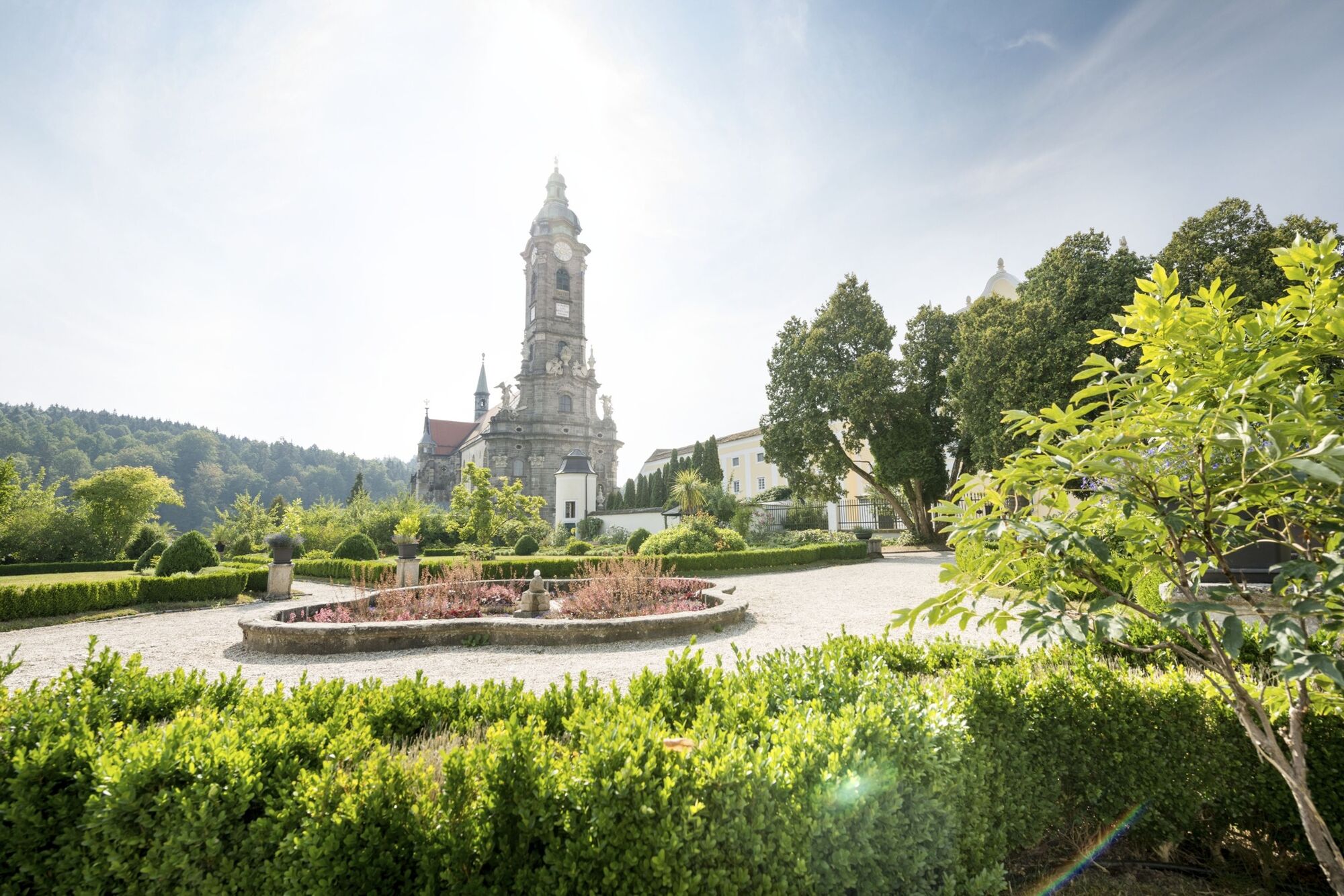
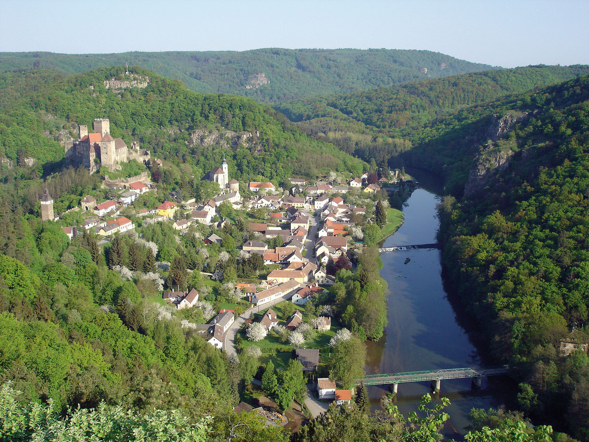
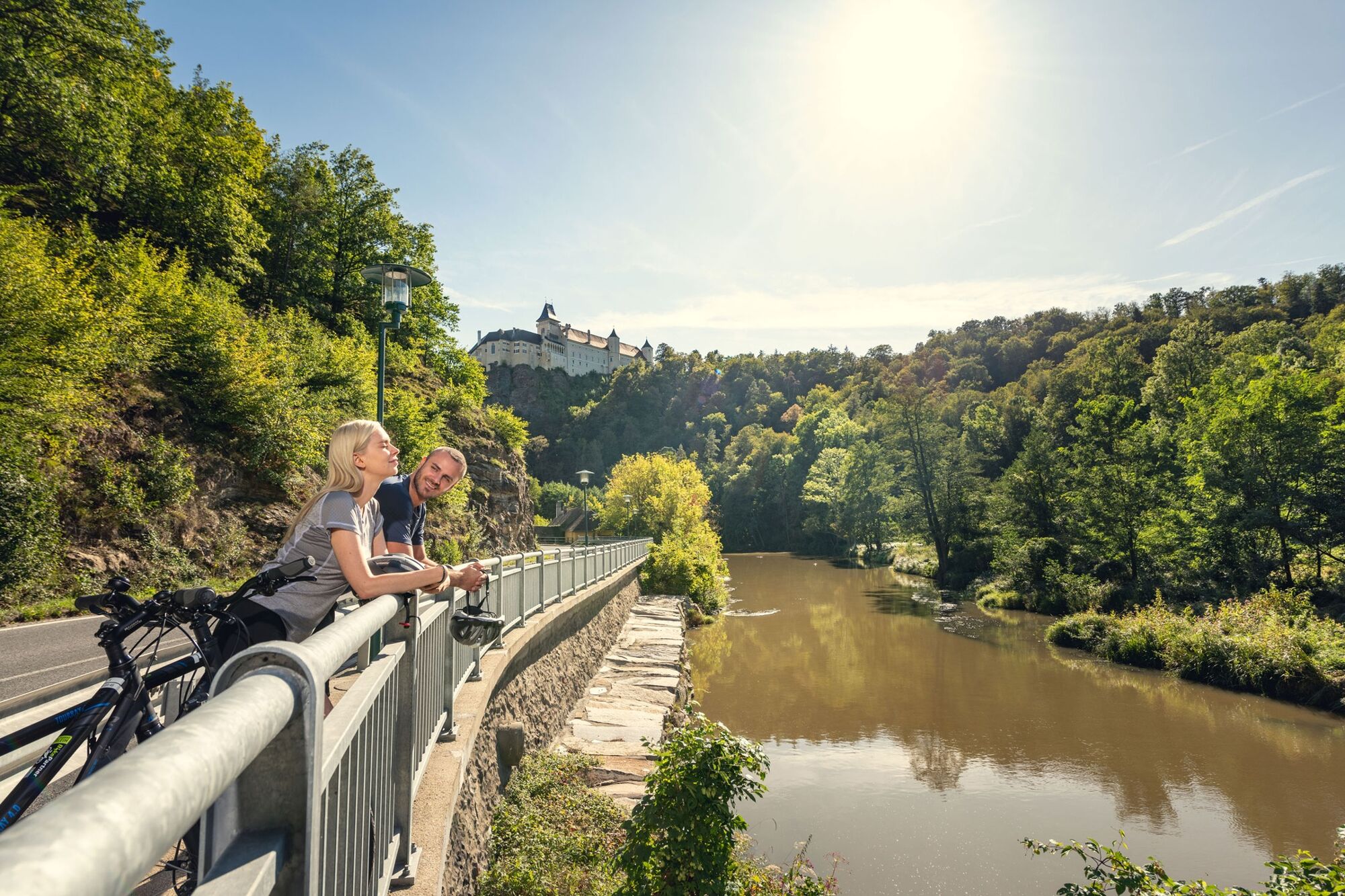
At the beginning of the tour, you can enjoy beautiful cycling along the Kamp (river), then you can expect steep sections in the Waldviertel. Go through the Weinviertel mostly downwards as the route continues through the soft hilly landscape to reach the Danube. The route is largely on traffic-free freight routes and secondary roads. The line in the Waldviertel is mostly paved, however in the Weinviertel you can also encounter gravel paths. The Kamp-Thaya March cycle path is consistently well signposted. Along the way you can encounter also road signs to the smaller regional round tours (such as the Teich-Tümpel-Tour) and to tours which are named after grape sorts (e.g. Welschriesling). Information about the smaller tours are found in the Weinviertel OST and Weinviertel West maps. On the line a variety of destinations are also offered, such as the Loisium wine world, Schloss Rosenburg, Stift (abbey) Zwettl, National Park Thayatal, Retzer Wine Cellar, Therme (thermal springs) Laa, wine experience world Poysdorf, Schloss Hof (castle) and more.
- Directions
-
Length: 422 km
Description: Varied cycling along three rivers; physically stimulating with some heavy gradients in the Waldviertel; in the Weinviertel the route goes down mostly, then through soft hilly landscapes around Retz and Laa/Thaya to Marchegg. The route is at least a week's tour or longer to plan (e.g. for culinary discovery trips or tours by the nostalgia train and bike into the Thayatal (Valley), the smallest national park in Austria). Highlights along the route: the wine world Loisium in Langenlois, the Renaissance Castle Rosenburg, the Stift (abbey) in Altenburg, Zwettl and Geras, the Retzer experience cellar or the Therme (thermal springs) Laa.
- Highest point
- 623 m
- Endpoint
-
Stopfenreuth
- Height profile
-

- Tips
-
Stage proposals:
The 420 km long cycle path can be divided into smaller stages. This way the routes are easily cycled.
Section Kamptal: Krems Gars/Kamp - Horn, length: 54 km
Section castles in the Waldviertel: Waidhofen/Thaya - Raab, length: 50 km
Section National Park Thayatal: Raab - Riegersburg - Retz, length: 55 km
Section Kellergassen: Retz - Haugsdorf - LAA / Thaya, length: 50 km
Section Weinviertel: LAA/Thaya - Hohenau, length: 65 km
Section Hohenau - Dürnkrut - Marchegg Length: 62 km - Additional information
- Author
-
The tour Kamp-Thaya-March-Bike Route is used by outdooractive.com provided.


General info
-
Weinviertel
16
-
Schmidatal
5

