
© Tourismuszentrale Südmähren - Tomáš Hájek
© Tourismuszentrale Südmähren - JMK
© Tourismuszentrale Südmähren - Igor Zehl
© Tourismuszentrale Südmähren - T. Havlíčková

© Tourismuszentrale Südmähren - Katka Kührova
© Tourismuszentrale Südmähren - JMK
© Tourismuszentrale Südmähren - J. Žemlík
© Tourismuszentrale Südmähren - J. Žemlík
© Tourismuszentrale Südmähren - J. Žemlík
- Difficulty
-
medium
- Rating
-
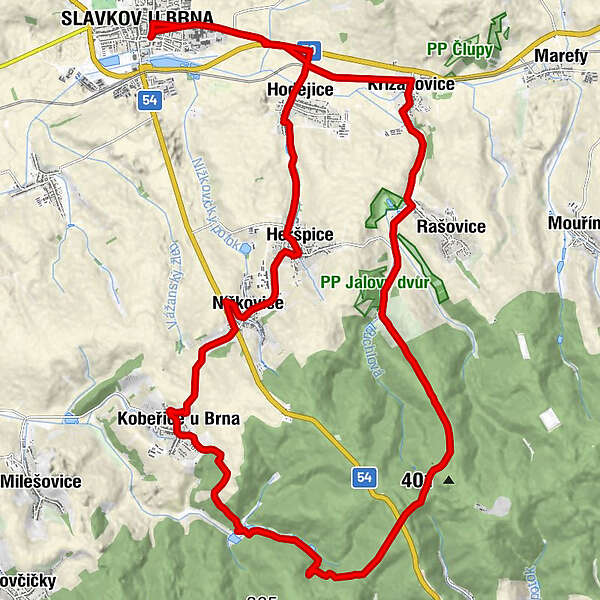
- Route
-
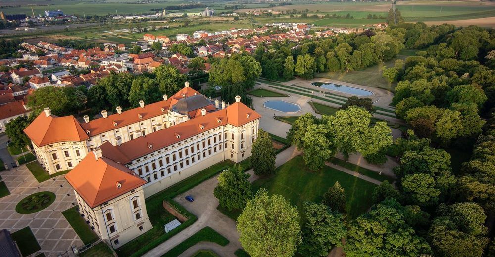
Austerlitz0.2 kmMotorest U Vlka2.6 kmKřižanovice5.2 kmKobeřice u Brna20.0 kmNížkovice23.5 kmSv. Matouš25.4 kmHeršpice25.5 kmHodějice28.2 kmMotorest U Vlka29.1 kmAusterlitz31.6 km
- Best season
-
JanFebMarAprMayJunJulAugSepOctNovDec
- Highest point
- 415 m
- Height profile
-
 © outdooractive.com


- Author
-
The tour From Slavkov to the Zdanice Forest (Ždánický les) is used by outdooractive.com provided.
GPS Downloads


General info
Refreshment stop
Cultural/Historical
Flora
A lot of view
Other tours in the regions