- Brief description
-
Cycling between rivers and lakes
- Difficulty
-
medium
- Rating
-
- Starting point
-
Wittenberge
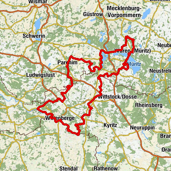
- Route
-
Sandkrug0.7 kmKarbow2.1 kmVietlübbe3.8 kmKlein Dammerow5.8 kmWangelin12.5 kmGnevsdorf15.1 kmGanzlin (86 m)18.4 kmTwietfort21.7 kmDresenower Mühle22.4 kmSilbermühle24.4 kmPlötzenhöhe27.3 kmPlau am See (72 m)29.8 kmHotel Rosenhof34.2 kmQuetzin35.8 kmHeidekrug36.7 kmDorfkirche Alt Schwerin45.6 kmAlt Schwerin46.3 kmAlt Schwerin46.4 kmSparow48.4 kmGutshofkapelle St. Hubertus49.0 kmSilz52.1 kmNossentin53.1 kmNossentin54.0 kmJabel60.3 kmGasthof "Wirtshaus zur Eibe"60.6 kmGrabowhöfe66.7 kmSommerstorf69.0 kmMarxhagen71.7 kmRambow76.2 kmAm Burggraben77.6 kmUlrichshusen77.7 kmHinrichshagen Ausbau79.5 kmKapelle St Maria Magdalena Hinrichshagen . Mecklenburger Kapellenweg81.1 kmHinrichshagen81.4 kmLevenstorf83.2 kmNeu Falkenhagen90.8 kmPaulshöhe93.6 kmWaren (Müritz) (70 m)95.6 kmStrandkorb96.5 kmZum Klönpott97.6 kmKamerun-Lodge98.3 kmEldenburg100.1 kmKlink (65 m)105.7 kmSembzin108.1 kmSietow Dorf112.5 kmKirche Sietow112.6 kmZierzow114.0 kmGotthun117.5 kmMarienfelde122.3 kmRöbel, Stadthafen125.7 kmRöbel/Müritz (65 m)125.8 kmMinzow134.5 kmDambeck137.2 kmBütow (78 m)139.0 kmFincken (70 m)142.2 kmKnüppeldamm145.1 kmDammwolde148.2 kmAltenhof150.7 kmTönchow153.7 kmWendisch Priborn158.2 kmPizza Rialto + Döner + indisch161.7 kmMeyenburg (82 m)161.8 kmStadtkirche Meyenburg162.0 kmKapelle "St. Maria Hilf162.5 kmDorfkirche Schmolde167.0 kmSchmolde167.4 kmWarnsdorf169.8 kmBrügge171.7 kmRohlsdorf175.3 kmSadenbeck (87 m)181.0 kmStreckenthin (71 m)184.0 kmRestaurant Forsthaus Hainholz186.5 kmImbiss186.9 kmSt. Nikolai189.5 kmPritzwalk (63 m)189.6 kmGiesensdorf (85 m)191.9 kmMesendorf (97 m)198.4 kmDorfkirche Mesendorf198.7 kmGroß Woltersdorf201.9 kmZur Hexe202.2 kmDorfkirche Groß Woltersdorf202.2 kmBrünkendorf203.7 kmBrünkendorf204.0 kmDorfkirche Lindenberg207.4 kmLindenberg (66 m)207.5 kmGarz211.4 kmDeutscher Hof230.5 kmBad Wilsnack (27 m)231.1 kmSteakhaus231.1 kmRoddan (31 m)239.2 kmQuitzöbel241.8 kmGnevsdorf (24 m)252.4 kmRühstädt (22 m)255.2 kmEiskellerberg255.5 kmBälow (23 m)259.0 kmSandkrug (22 m)260.5 kmScharleuk (20 m)261.5 kmHinzdorf (24 m)263.6 kmGarsedow (20 m)267.7 kmWittenberge (22 m)270.6 kmDie Schafweide279.2 kmMüggendorf (23 m)281.5 kmCumlosen (20 m)286.0 kmDer Elbdeich287.9 kmLütkenwisch (20 m)291.3 kmLenzen (Elbe) (19 m)303.8 kmCafe "Am Markt"303.9 kmSt. Katharinenkirche304.0 kmLeuengarten309.0 kmBoberow (37 m)315.5 kmDorfkirche Boberow315.6 kmMankmuß (26 m)318.6 kmStavenow322.9 kmKarstädt (34 m)327.1 kmLandgasthof Graf327.4 kmGlövzin330.5 kmBlüthen334.7 kmStrehlen335.6 kmDorfkirche Strehlen335.6 kmDallmin (34 m)339.9 kmKribbe341.9 kmDorfkirche Kribbe342.2 kmNeuhof343.8 kmNeuhof Ausbau344.6 kmDorfkirche Neuhausen345.7 kmNeuhausen346.4 kmBerge (57 m)348.5 kmKleeste350.7 kmPampin353.3 kmGrenzheim355.1 kmMuggerkuhl357.8 kmLeppin363.6 kmDorf Poltnitz367.9 kmPoitendorf369.7 kmSlate374.8 kmParchim (50 m)380.3 kmNeuapostolische Kirche Parchim380.7 kmDarze388.0 kmStralendorf390.0 kmLancken392.0 kmLübz (51 m)398.7 kmBenzin403.1 kmKritzow405.1 kmSchlemmin409.7 km
- Best season
-
JanFebMarAprMayJunJulAugSepOctNovDec
- Description
-
The beautiful landscape between the river Elbe and the Mecklenburgische Seenlandschaft (Mecklenburg lake district ) stretches far and is slightly hilly. Not only the lively towns and dreamy villages promise unforgettable experiences, but also untouched nature, regional cuisine and warm hospitality invite you to feel good.
- Directions
-
From river to lake, from lake to river - the circular route leads on a stretch of 410 kilometres from the city Wittenberge via the towns Parchim and Röbel/Müritz to Pritzwalk through a landscape rich in nature with numerous rivers and lakes. It connects the river Elbe with the lake Plauer See and the lake Müritz.
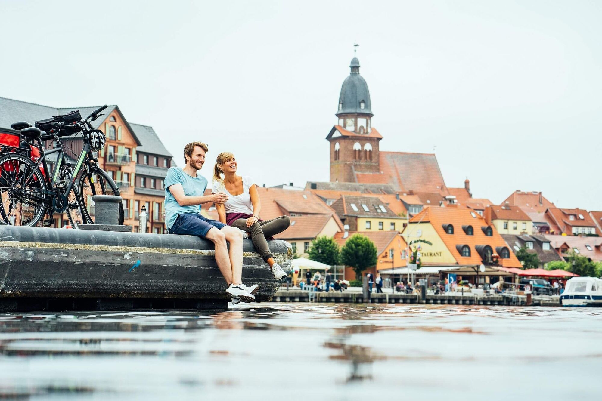
The route leads along the beautiful Elbe river landscape to the town with the most storks in Germany - Rühstädt. Hardly any chimney is not inhabited by a pair of black and white feathered lucky charms. The state towers of the town of Wittenberge can be admired from afar. Among them is the second largest clock tower in Europe.
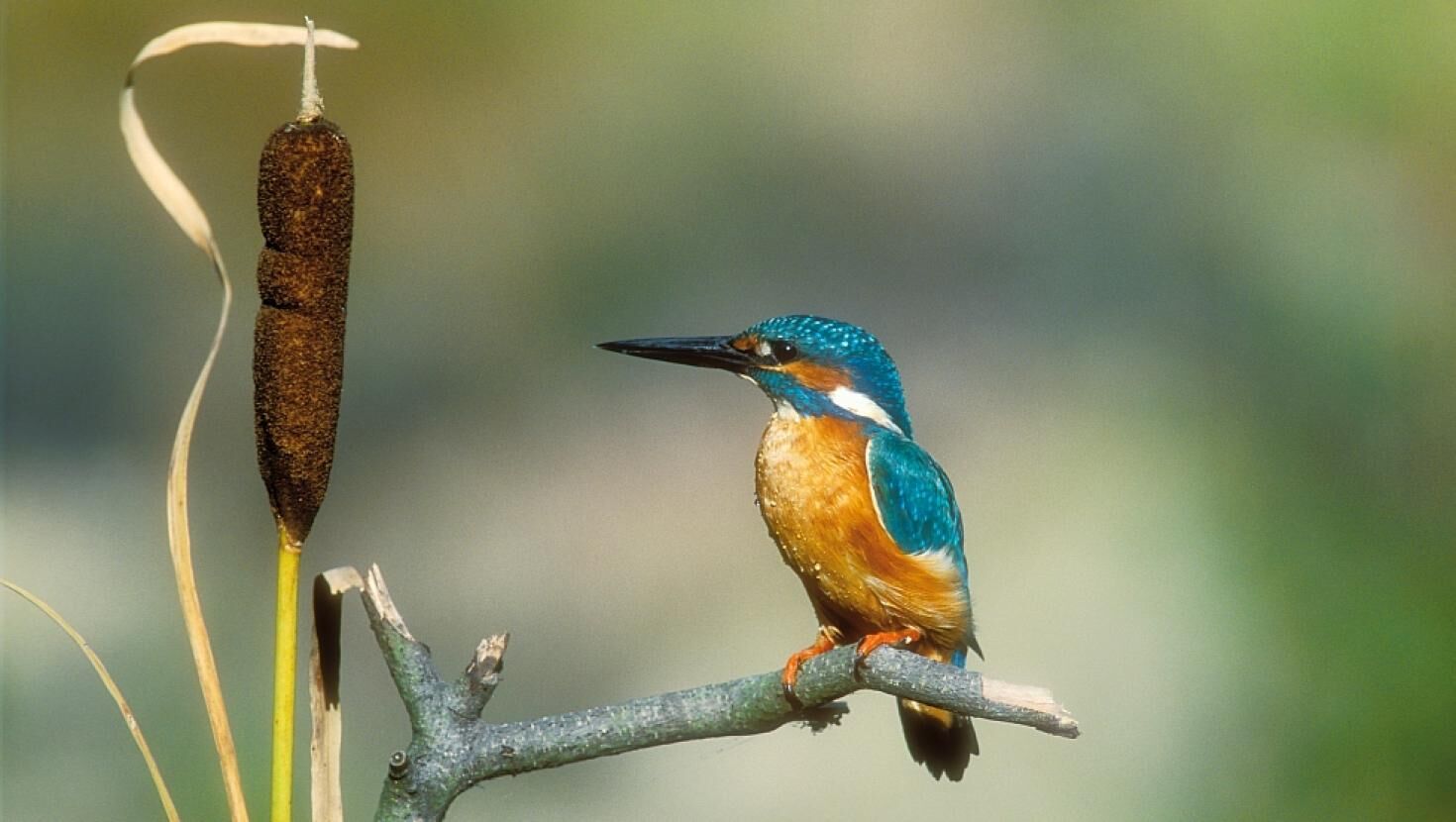
It continues to the town Lenzen (Elbe), where the cycle path leaves the river Elbe behind and meanders through green meadows and forests to Parchim. On the way, the Elefantenhof (elephant farm) in the town Platschow and the sculpture park in the village of Pampin invite you to explore. The lake Plauer See awaits cyclists with a refreshing swim behind the brewery town of Lübz. Further lakes line the route to Waren (Müritz), the ideal place to recharge your batteries with delicious fish sandwiches and a beautiful view of the lake. Afterwards we continue along the Müritz shore to Röbel/Müritz. On the way, the cyclists can listen to the calls of herons, bittern and cranes. Sea eagles and ospreys circle over the waters in search of prey.
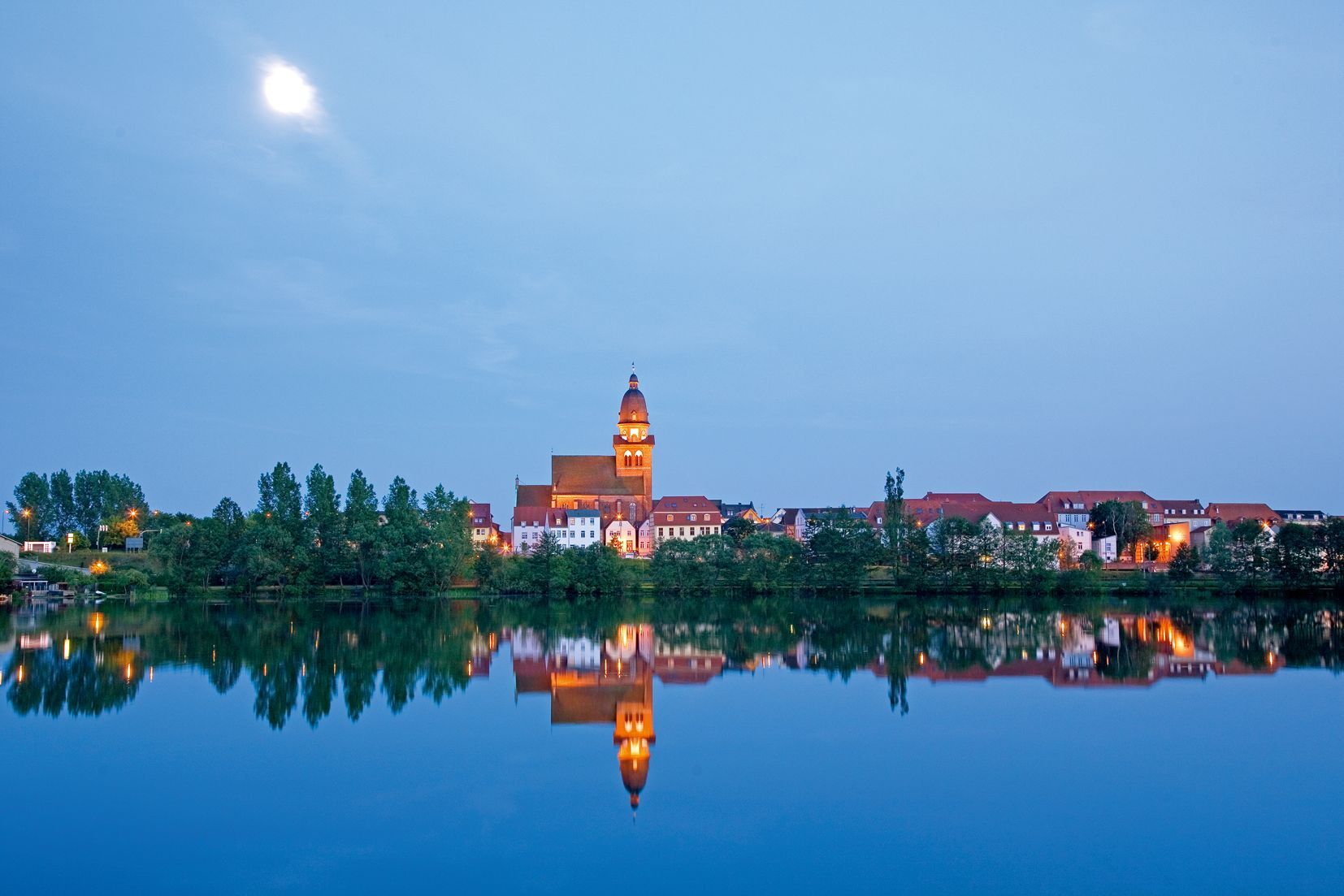
The journey continues through the relatively flat Prignitz to Pritzwalk, where the town and brewery museum invites you to take a break. Much too fast it goes back again to the starting point where car or train already wait for the cyclists.
- Highest point
- 155 m
- Endpoint
-
Wittenberge
- Height profile
-
 © outdooractive.com
 - Tips
-
The Plauer observation tower with its 8 meters height offers a fantastic panoramic view over lake Plauer See. Binoculars and camera should not be forgotten here.
- Additional information
- Public transportation
-
With the regional train (RE) from Berlin or with the IC from Hamburg to Wittenberge
Railway stations on the route with regular rail connections are located, among other places, in:
- Wittenberge
- Parchim
- Waren (Müritz)
- Author
-
The tour Elbe-Müritz-Radweg (Elbe-Müritz Cycling Path) is used by outdooractive.com provided.