
- Brief description
-
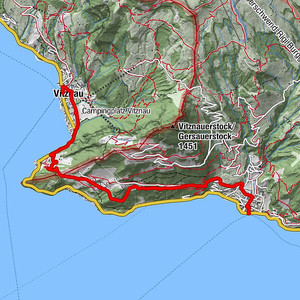
The complete Rigi Chestnut Trail stretches from Immensee to Brunnen.
- Route
-
Vitznau (1,025 m)0.0 kmRestaurant Rütli0.1 kmRütli0.1 kmSt. Hieronymus0.1 kmVitznau0.4 kmGartenwirtschaft Kuorez2.9 kmGersau6.6 kmGersau (See) (435 m)6.9 km
- Best season
-
JanFebMarAprMayJunJulAugSepOctNovDec
- Description
-
The trail provides information about the sources of chestnuts in the Mt. Rigi region.
- Directions
-
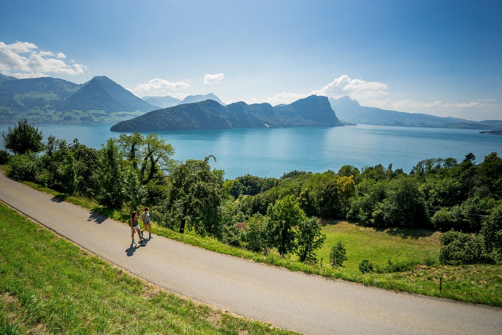
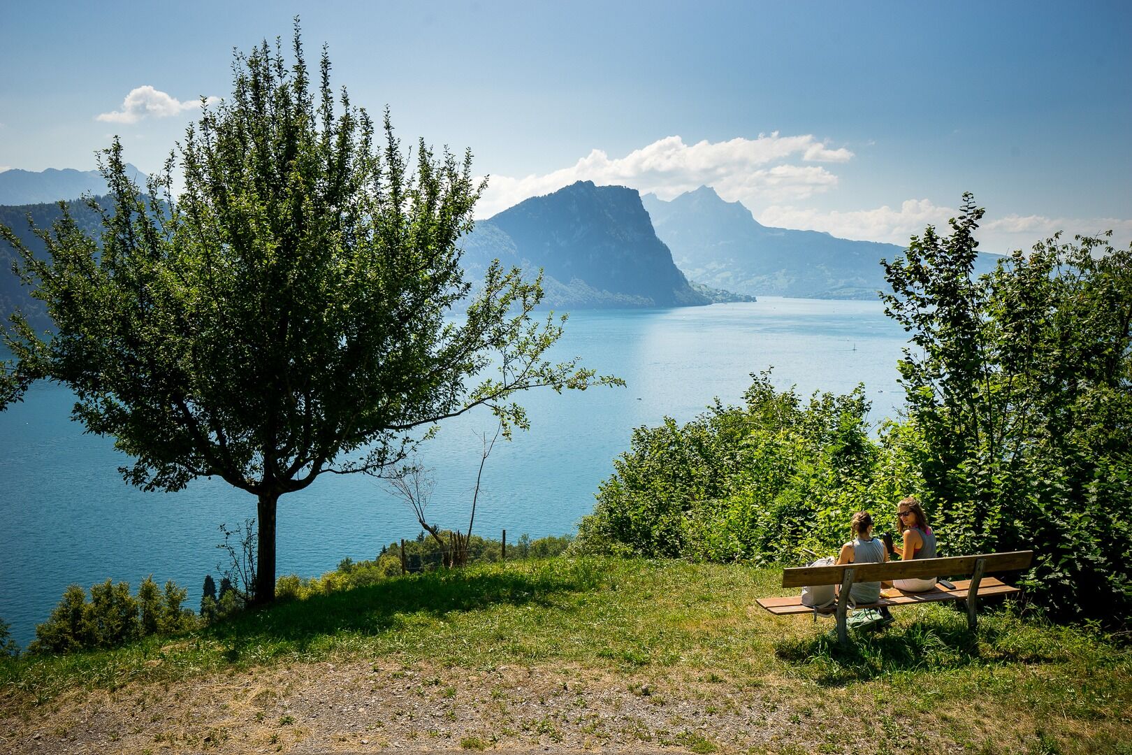
Leaving Vitznau, the path continues southwards along the Gotthardstrasse towards Gersau and the County of Schwyz. En route enjoy the wonderful views of the bay of Lucerne. From the “Milch Bänkli” continue through the woods and meadows to Unterlinden. From here the route becomes more challenging, passing an area rich in flora to “Menschenacher” 750 m a.s.I. This superb lookout point has a panoramic view comprising of the Klewenalp, the Stanserhorn, the Bürgenstock and the Pilatus, as well as the bays of Lucerne, Horw, Gersau and Buochs. The last part of the walk passes through meadows and woods before descending into the historic Republic of Gersau. Here you can either take the bus or boat back to your starting point.
- Highest point
- 650 m
- Height profile
-
 © outdooractive.com
 - Directions
-
From the motorway exit Küssnacht follow the main street to Vitznau
- Public transportation
-
- By boat from Lucerne to Vitznau
- With train and bus from Lucerne via Küssnacht to Vitznau
- Bus and boat from Gersau
- Parking
-
Parking in the centre of Vitznau
- Author
-
The tour Rigi Chestnut Trail: sector Vitznau - Gersau is used by outdooractive.com provided.


-
Nidwalden
1832
-
Klewenalp-Vierwaldstaettersee
965
-
Vitznau
346