- Brief description
-
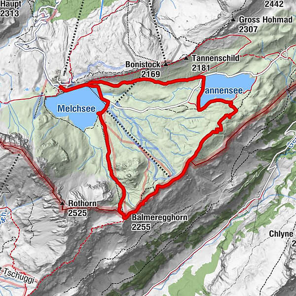
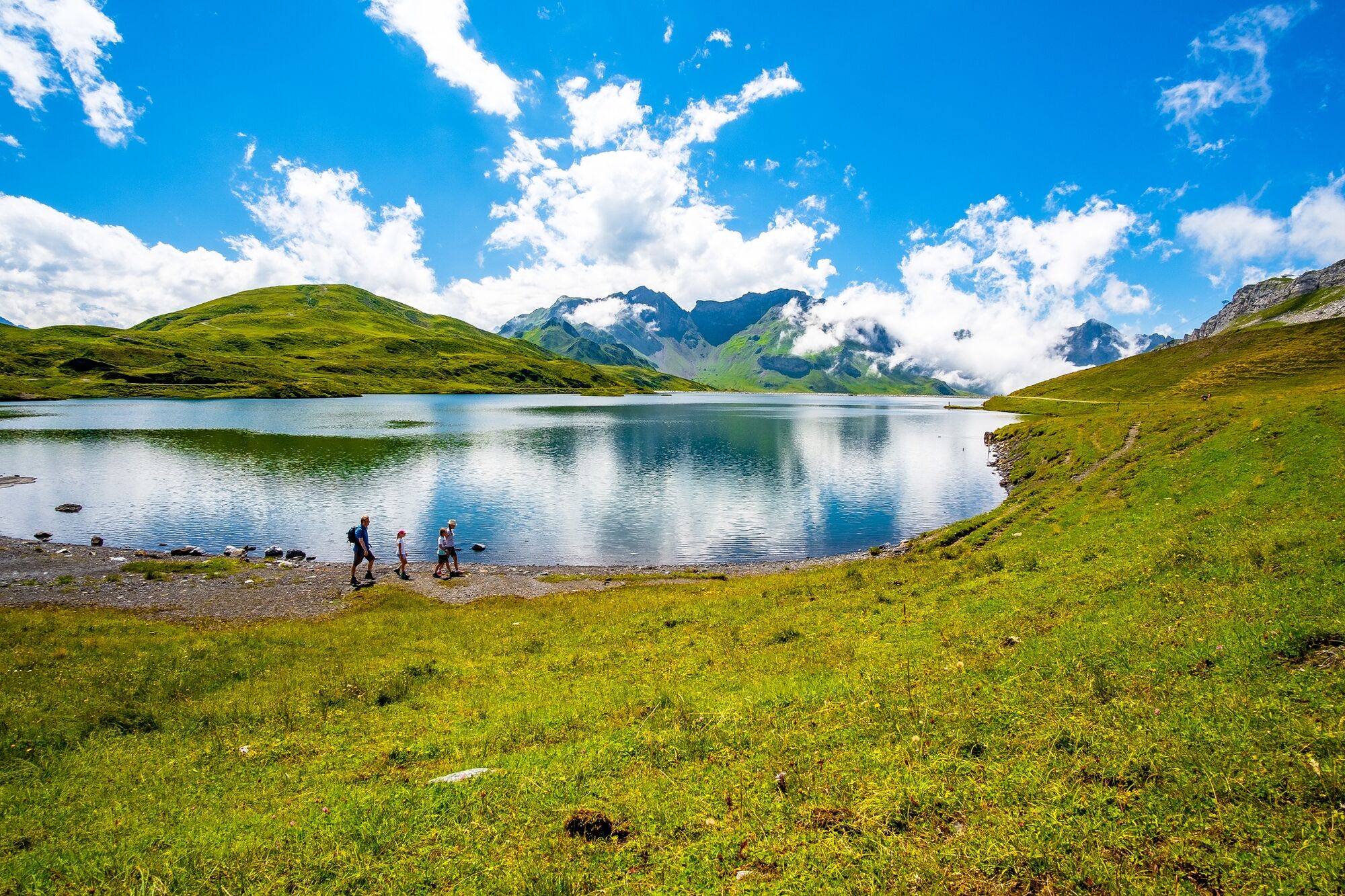
This circular tour takes in two deep-blue mountain lakes and spectacular views over the entire Melchsee-Frutt high plateau and neighbouring Bernese valleys.
- Difficulty
-
medium
- Rating
-
- Starting point
-
Old cableway terminus, Melchsee-Frutt
- Route
-
Fruttkapelle0.8 kmBalmeregghorn (2,255 m)3.7 km
- Best season
-
JanFebMarAprMayJunJulAugSepOctNovDec
- Description
-
The starting point for this Erzegg round tour is the old upper terminus of the aerial cableway at Melchsee-Frutt. The path leads along deep-blue Lake Melch to Distelboden and on to the Balmeregg ski lift. This is where the ascent to the Balmeregghorn begins. The strenuous climb of around three hundred metres of elevation gain is compensated by the mountain panorama and magnificent views. The passage over the ridge to Erzegg with views of the Gen valley and picturesque Engstlenalp is an unforgettable experience. You continue towards the Erzegg cross and down to Lake Tannen, where ore was mined in the past. From Fachshubel (barbecue spot, alpine refuge), you pass the lake following the road to the dam then take the path below the Bonifelsen to Strandguet. From here it is worth taking the Panoramic Lift and enjoying the view from the platform forty metres above Lake Melch.
- Highest point
- 2,249 m
- Endpoint
-
Old cableway terminus, Melchsee-Frutt
- Height profile
-
 © outdooractive.com
 - Tips
-
Alternatively you can take the Frutt-Zug road train from Fachshubel back to Frutt.
-

-
AuthorThe tour Erzegg circular tour is used by outdooractive.com provided.


-
Obwalden
2028
-
Melchsee - Frutt
861
-
Gadmen
173