© Region Luzern-Vierwaldstättersee - outsideisfree.ch

© Region Luzern-Vierwaldstättersee - outsideisfree.ch

© Region Luzern-Vierwaldstättersee - outsideisfree.ch

© Region Luzern-Vierwaldstättersee - outsideisfree.ch

© Region Luzern-Vierwaldstättersee - outsideisfree.ch

© Region Luzern-Vierwaldstättersee - outsideisfree.ch

© Region Luzern-Vierwaldstättersee - outsideisfree.ch

© Region Luzern-Vierwaldstättersee - outsideisfree.ch

- Brief description
-
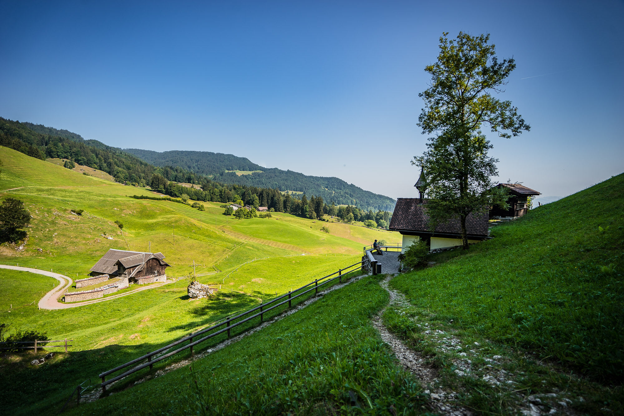
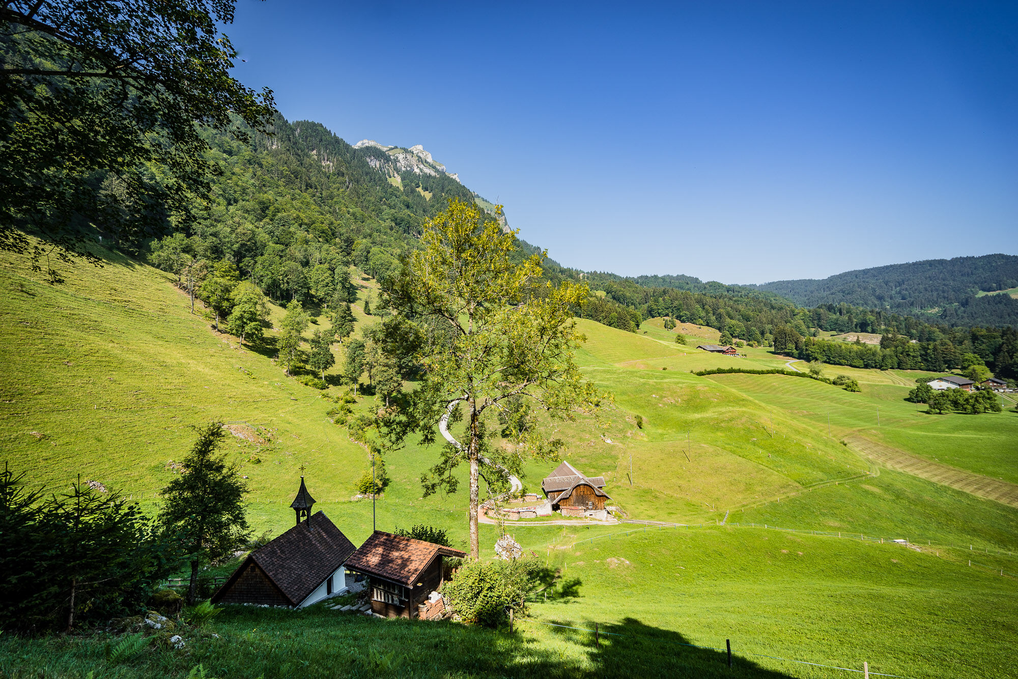
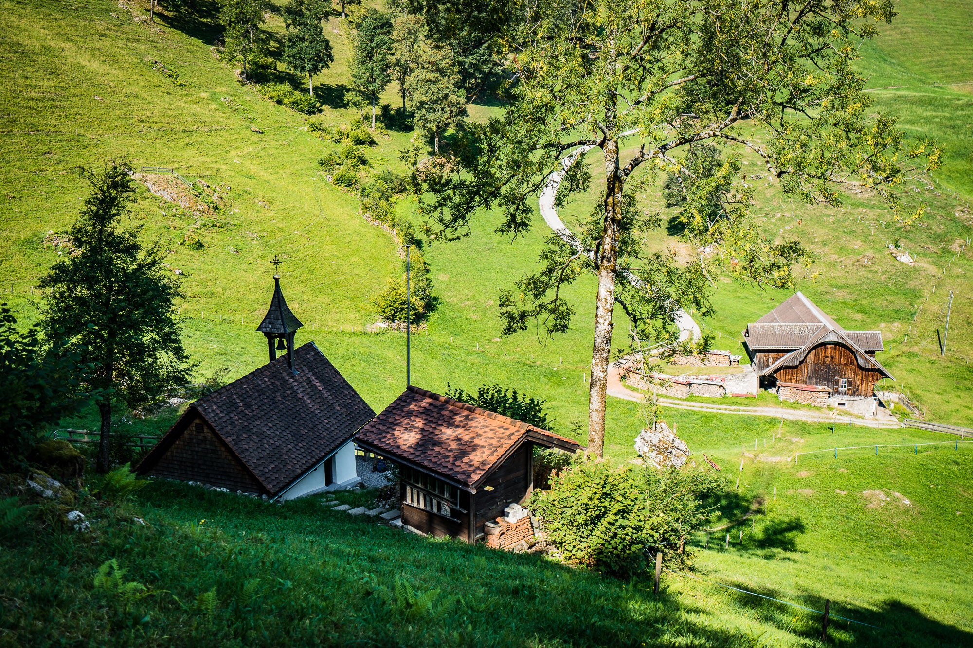
Die Königsetappe über den Renggpass.
- Difficulty
-
difficult
- Rating
-
- Starting point
-
Luzern, boat station
- Route
-
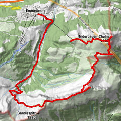
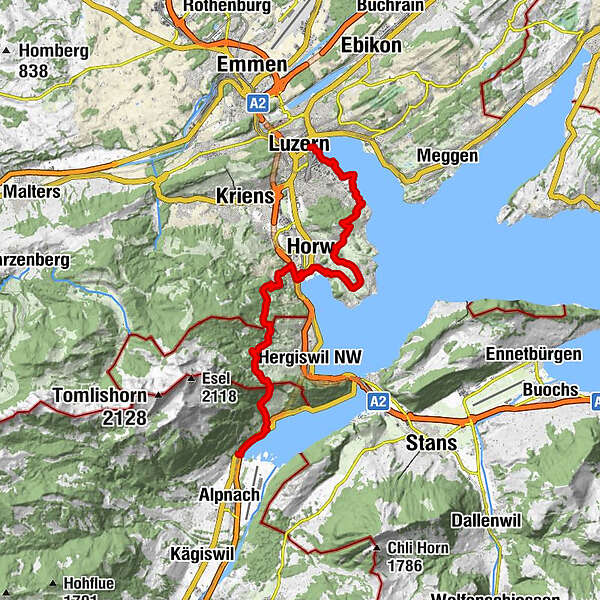
Lucerne (436 m)Landungssteg 1 (SGV) BahnhofquaiLandungssteg 2 (SGV) Bahnhofquai0.0 kmLandungssteg 6 (SGV) Bahnhofquai0.1 kmLandungssteg 3 (SGV) Bahnhofquai0.1 kmEuropaplatz0.1 kmLandungssteg 4 (SGV) Bahnhofquai0.1 kmLandungssteg 5 (SGV) Bahnhofquai0.1 kmInseli0.3 kmTribschenmoos1.6 kmStutz3.6 kmSeeblick4.7 kmFelmis5.7 kmKastanienbaum7.6 kmWinkel9.7 kmHorw10.1 kmEnnethorw11.3 kmDie rumänisch-orthodoxe Kirche in der Zentralschweiz - Die "Mariä Geburt" Pfarrei Luzern11.8 kmRestaurant Schwendelberg13.5 kmRenggeli17.6 kmHinter Rengg18.3 kmRengg-Kapelle18.5 kmRenggkapelle18.5 kmAlpnachstad (See) (436 m)22.1 kmAlpnachstad (436 m)22.3 kmAlpnachstad (Pilatus-Bahn) (436 m)22.4 kmPilatus Châlet22.4 km
- Description
-
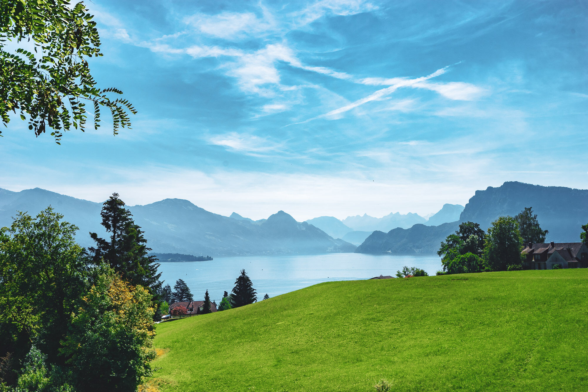
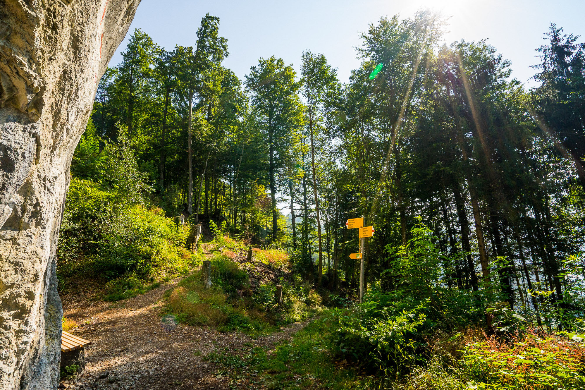
Crowning stage over the Renggpass - Past the KKL and Tribschen estate via the Horwer peninsula at the foot of Mount Pilatus. Passage over the Renggpass, the only overland link to Obwalden in the 1860s before the construction of the Brunigstrasse.
Note(s)
Route number 98 is always signposted. As regional route of the SwitzerlandMobility network, it is signposted throughout and in both directions.
See also
Luzern Tourismus AG
Tourist Information
Zentralstrasse 5
CH-6002 Luzern
Tel.: +41 (0)41 227 17 17
E-Mail: luzern@luzern.com
Internet: www.luzern.com
Verein Weg der Schweiz & Waldstätterweg
Geschäftsstelle Brunnen Tourismus
Bahnhofstrasse 15
CH-6440 Brunnen
Tel.: +41 (0)41 825 00 40
E-Mail: info@waldstaetterweg.ch
Infos zum Waldstätterweg: www.waldstaetterweg.ch - Directions
-
Luzern - Horw - Alpnachstad
- Highest point
- 874 m
- Endpoint
-
Alpnachstad
- Height profile
-
 © outdooractive.com


-

-
AuthorThe tour Waldstätterweg: Stage 4 Luzern - Alpnachstad is used by outdooractive.com provided.
GPS Downloads


General info
A lot of view
Other tours in the regions
-
Luzern und Umgebung
1710
-
Weggis Vitznau Rigi
894
-
Horw
205