- Brief description
-
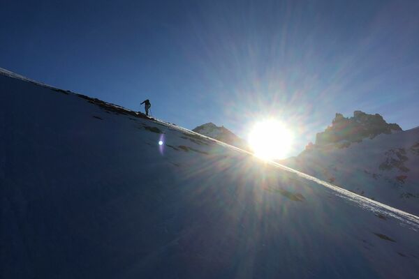
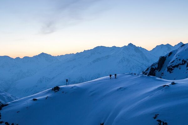
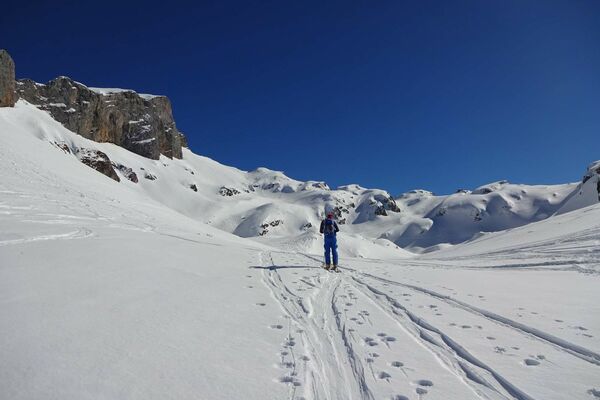
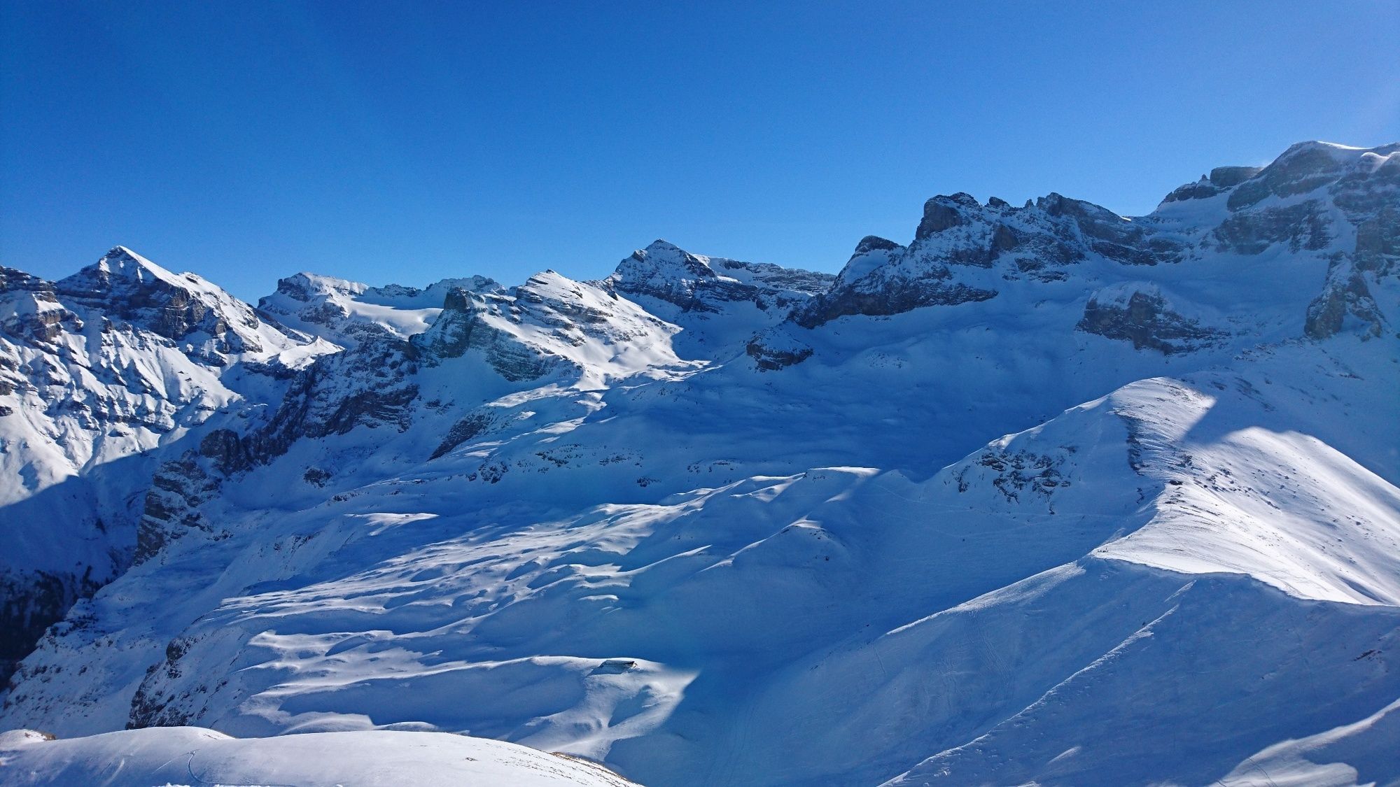
This is a relatively easy ski tour with beautiful views and conditions dependent a nice descent.
- Difficulty
-
medium
- Rating
-
- Starting point
-
Kreuzhutte (Banalp)
- Route
-
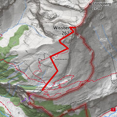
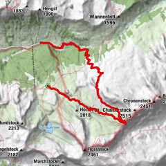
Station Chrüzhütte0.0 kmChrüzhütte0.1 kmStation Räckholteren1.1 kmChaiserstuel (2,400 m)3.8 kmOberspis (1,198 m)9.1 kmFellboden10.0 km
- Best season
-
AugSepOctNovDecJanFebMarAprMayJunJul
- Description
-
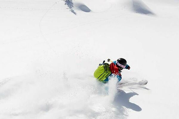
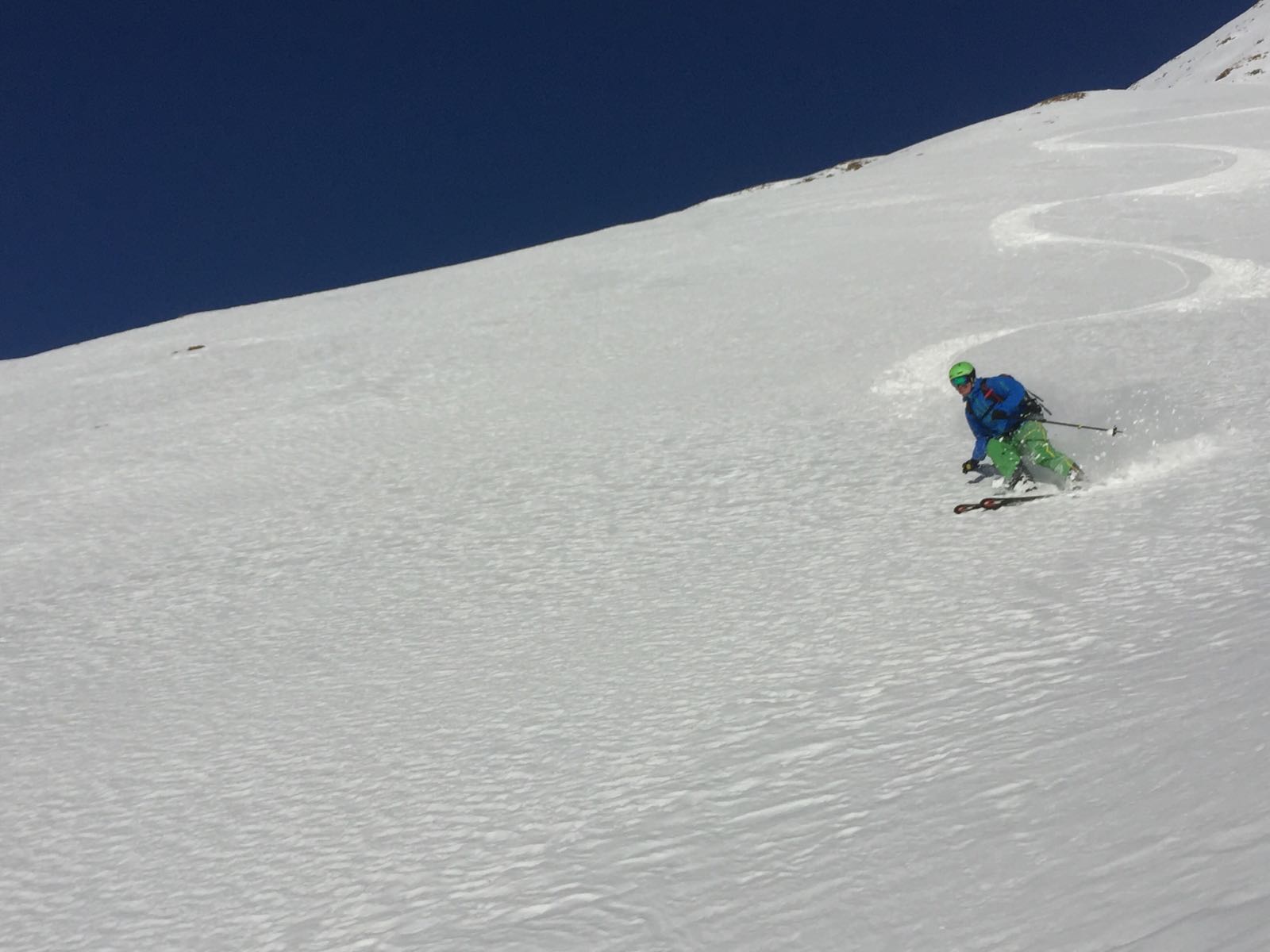
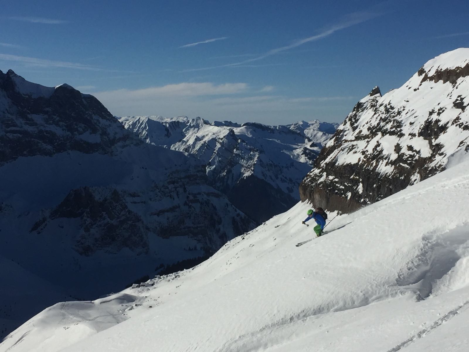
A fun ski tour with a relatively short ascent and quite a long descent. In good conditions the descent from Chaiserstuehl to Buelenboden can be very good. The further descent to the valley is nice with good snow conditions, but quite a lot of work if the snow gets crusty and tracked out.
- Directions
-
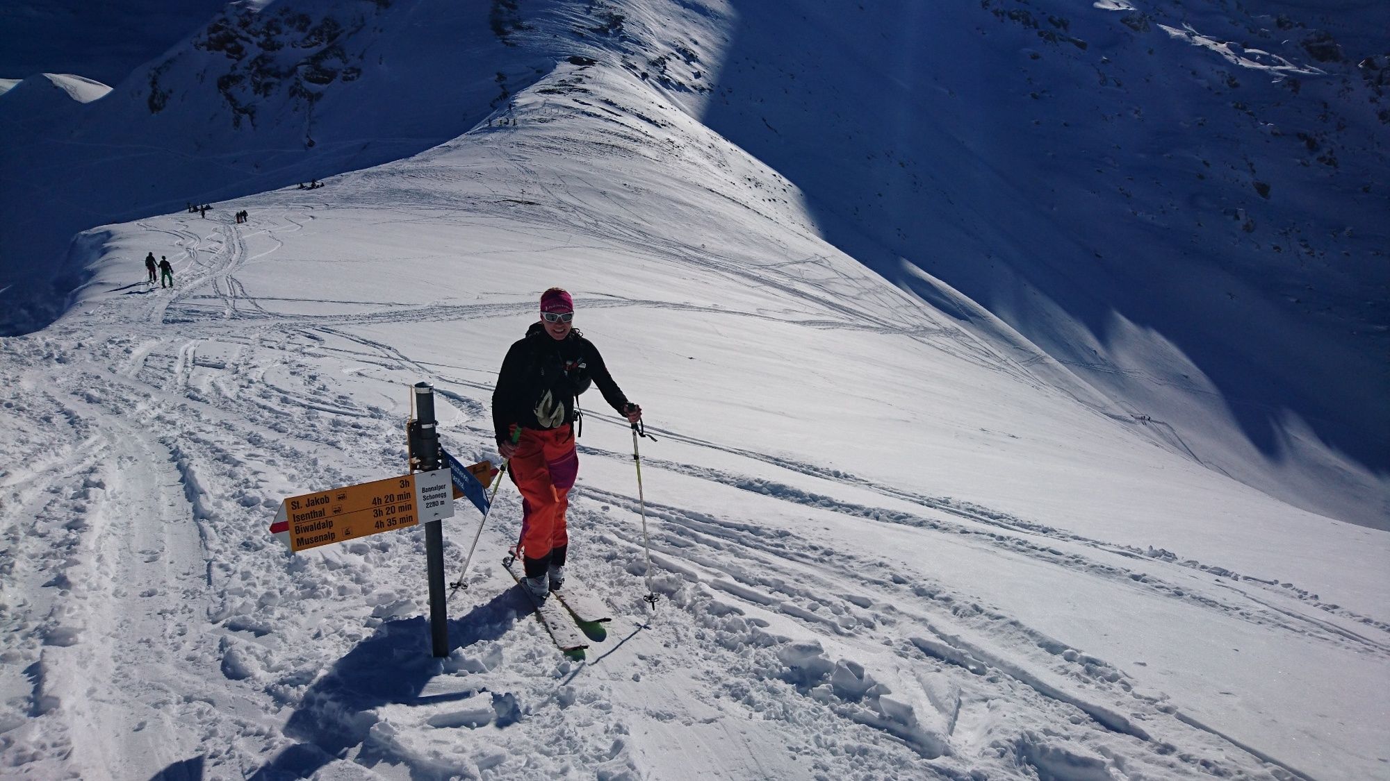
From Oberrickenbach take the Banalp Cablecar to Kreuzhutte. From here mount your skins and follow the path towards Pt 1721 and Pt 1783. If the avalanche conditions are critical or it is very warm it might be wise to skirt around more towards Metzggaden and ascent towards Rossboden.
The normal ascent route follows a small plateau heading mainly eastwards towards Buelenboden roughly along the summer hiking trail. From here ascent follows the summer path towards Gruenboden after which the route gets steeper (slope 30-35deg) and requires a couple of kick turns to get to Banalppass.
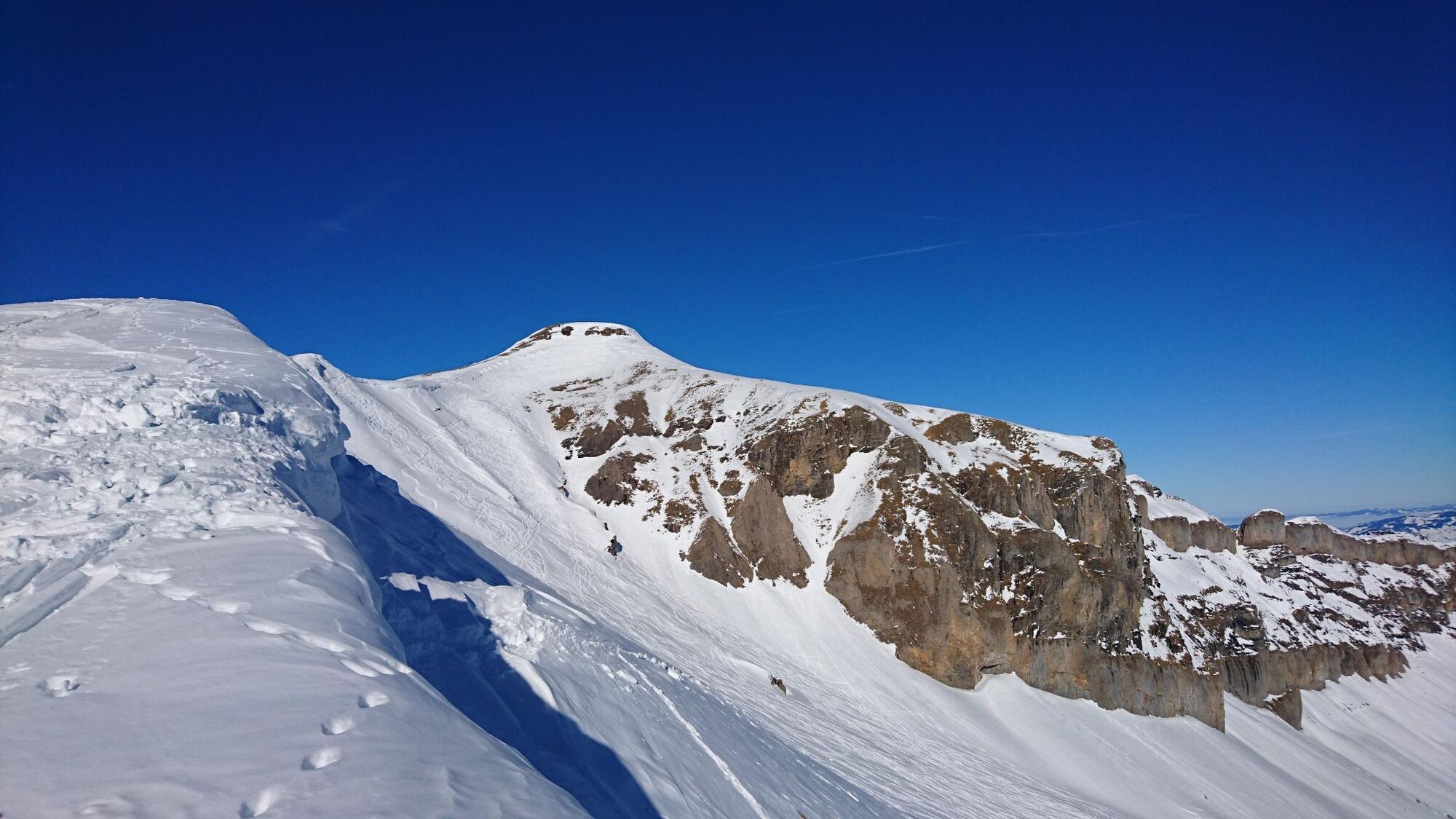
From Banalppass head north along the ridge past Banalperschonegg and on to Chaiserstuehl. Depending on snow conditiosn the sumit may be accessed from the West or Southeast sides.
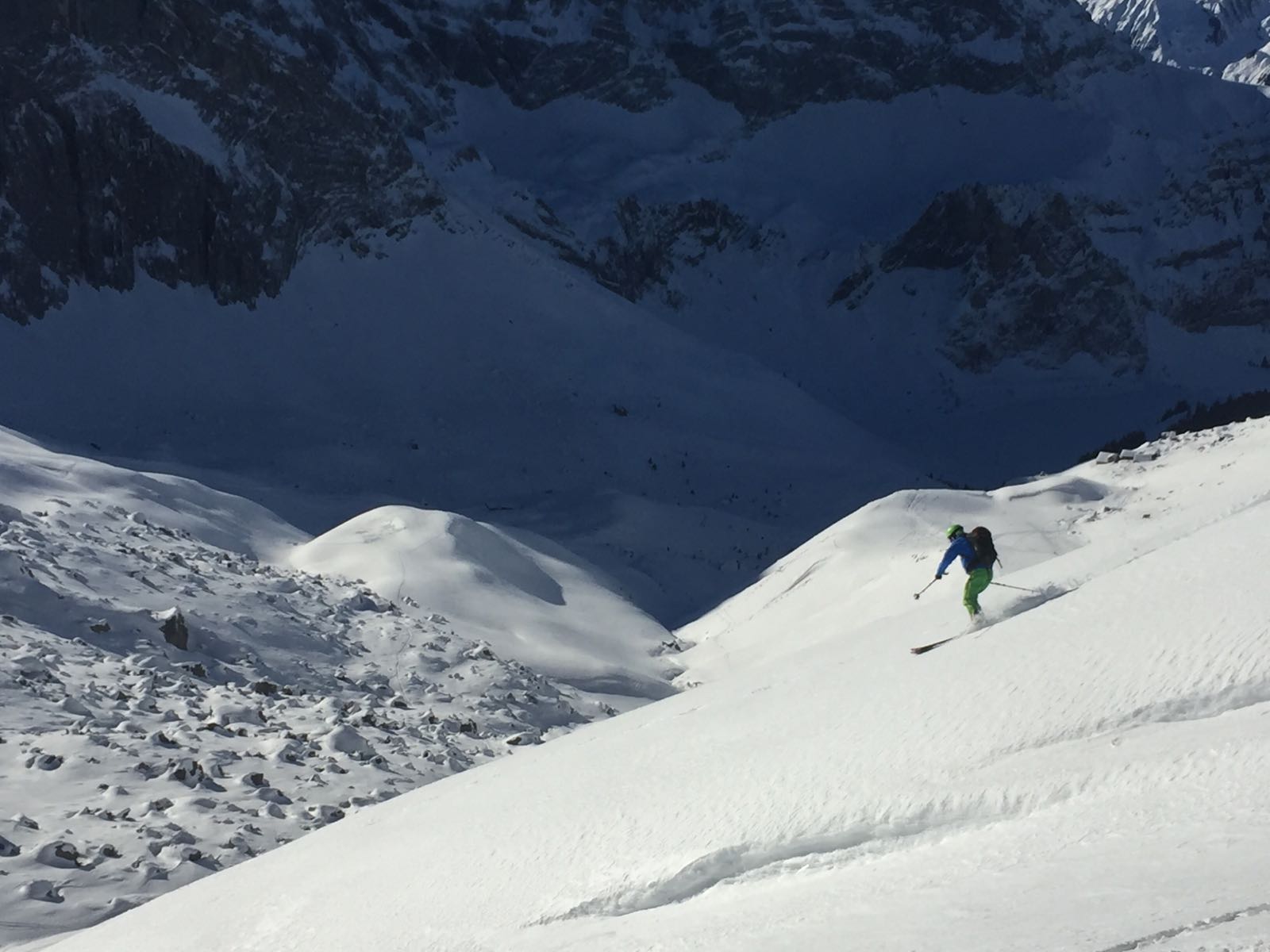
The descent route can either be back along the ridge to descend the ascent route or if Avalanche conditions allow from under Pt. 2328 directly SW towards Rossboden or Buelenboden. Then follow the ascent route back to Rackholteren where you can enjoy a few more turns down to the bottom of the lift at Urnerstafel.
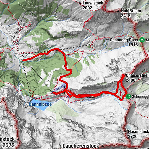
The lift from Urnerstafel to Naetschboden costs 2CHF and from here you can ski approximately along the hiking trail to Schwandboden and directly down to Oberrickenbach.
Note, there are a few places on this descent where there is a danger of falling over a rock band.
- Highest point
- 2,390 m
- Endpoint
-
Oberrickenbach
- Exposition
- Height profile
-
 © outdooractive.com
 - Equipment
-
Normal skitouring equipment is sufficient for this route.
- Safety instructions
- Tips
-
This is a nice half day tour that can be extended to a full day tour by making it a round tour into Grosstal
- Additional information
-
This can also be done as a round tour descending into Grosstal and then taking the lift to Egg, Then skinning over the Schoeneggpass and descending to Oberrickenbach again.
- Directions
-
A2 to Stans, then follow signs for Engelberg until Wolfenschiesen. Here turn left and follow signposts for Banalp. Drive through Oberrickenbach and the lift/carpark is about 500m past the village.
- Public transportation
- Parking
-
There is parking available at the valley station of the Banalp lift.
-

-
AuthorThe tour Chaiserstuehl is used by outdooractive.com provided.