- Brief description
-
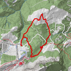
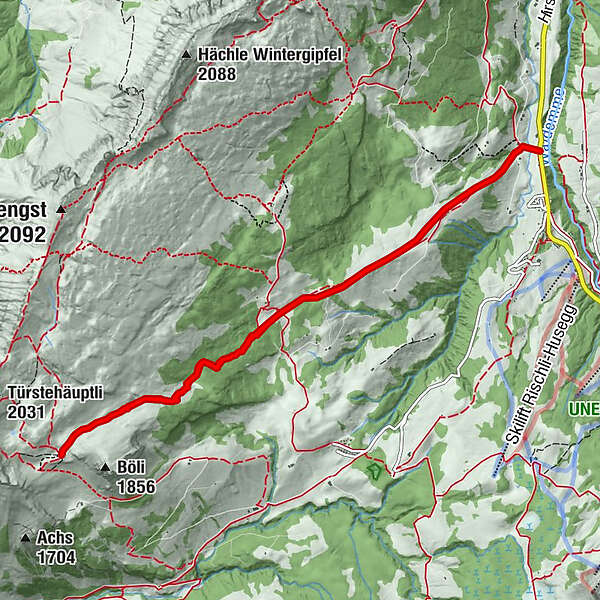
This somewhat more challenging tour leads through the stunning landscape beneath the Schrattenfluh and its striking karst formations. The hike ends at the Chlushütte (mountain hut), located at the foot of the Böli, where incredible panoramic views across the Brienzer Rothorn range and the Bernese Alps await you.
- Difficulty
-
difficult
- Rating
-
- Best season
-
AugSepOctNovDecJanFebMarAprMayJunJul
- Description
-
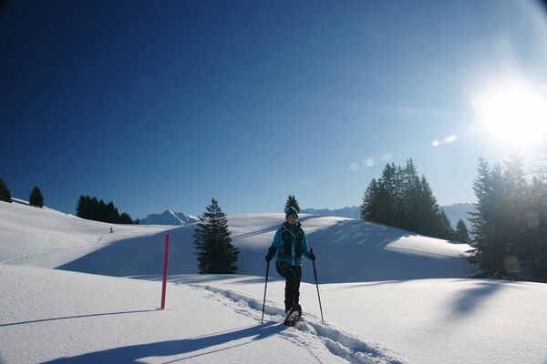
The well-marked snowshoe trail first leads from Hirsegg up to Alp Schlund. To the left soars the snow-covered Brienzer Rothorn, the highest mountain of the canton of Lucerne. The distinctive and rugged Schrattenfluh is also in plain sight. The UNESCO Biosphere Reserve was recognized for its pre-alpine moorlands and its unique karst landscapes. The Schrattenfluh, the best-known karst formation in the Entlebuch Biosphere, is part of the strictly protected core zone. It’s one of Switzerland’s most unspoilt karst landscapes.
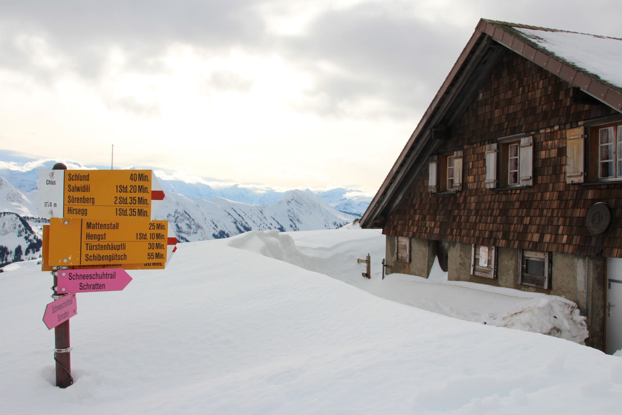
When the flag is up at Alp Schlund, refreshments are available at the small mountain restaurant – a coffee with schnapps is the perfect drink to warm you up on cold winter days. The trail continues through a scenic forested section of gnarled mountain pines and spruces. Time and again, you can catch a glimpse of the Giswilerstock, the Brienzer Rothorn range or the “Böli”. The snowshoe tour ends at the foot of the imposing rock formations of the Schrattenfluh. The route continues moderately uphill, as the forest thins out. Other rock formations of the Schrattenfluh come into view, notably the Schibengütsch, which is soon clearly visible to the right of the Böli. Pass it, and you’ve made it! Tugged away on the other side, lies the Chlushütte. Every drop of sweat will be well worth it – the panoramic views from the Chlus are spectacular: The Brienzer Rothorn range and the Bernese Alps present themselves on a silver platter. Eiger, Mönch and Jungfrau, Schreckhorn and Finsteraarhorn – to name but a few of the imposing Alpine peaks.
After the break or even an overnight stay, the snowshoe trail takes you back to the valley. Don’t worry – the views will let you forget that you’re on the same path. Enjoy sweeping views over a sprawling mountain scenery, from Giswilerstock, Rossflue, Schafnase, Nünalpstock and Haglere to Fürstei and Schwändeliflueh. With its different habitats, the Schrattenfluh is home to a wide variety of wildlife, including unique and endangered species. In order not to disturb them, you should stay on the trail at all times. In addition to sharp limestone rocks, the Schrattenfluh features deep caves and furrows that are barely visible when covered in snow. Follow the marked trail back to your starting point.
- Highest point
- 1,783 m
- Endpoint
-
Sörenberg, Bushaltestelle Hirsegg
- Height profile
-
 © outdooractive.com


-

-
AuthorThe tour Schneeschuhtrail Hirsegg–Chlus is used by outdooractive.com provided.


General info
-
Obwalden
122
-
Brienzersee
73
-
Sörenberg
27