


- Brief description
-
Ideal für Familien und BikeeinsteigerInnen. Der grösste Teil der Strecke verläuft über Natursträsschen, der einzige Abschnitt auf Singletrails ist zwischen Zumdorf und Steinbergen.
- Difficulty
-
medium
- Rating
-
- Starting point
-
Andermatt, Tourismusbüro
- Route
-
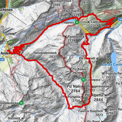
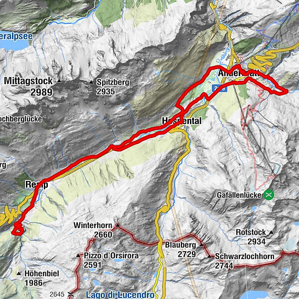
Andermatt (1,436 m)Andermatt (1,447 m)0.1 kmBahnhofgebäude3.3 kmHofacher3.4 kmHospental (1,493 m)3.6 kmSteinbergen8.2 kmKapelle Steinbergen8.5 kmPfarrkirche Heilig Kreuz9.3 kmRealp (1,538 m)9.3 kmRealp DFB (1,538 m)9.7 kmWitenwasserntal13.2 kmRealp DFB (1,538 m)14.0 kmPfarrkirche Heilig Kreuz14.5 kmRealp (1,538 m)14.5 kmKapelle Steinbergen15.4 kmSteinbergen15.7 kmZum Dörfli18.0 kmObergadmen19.9 kmKath. Kirche Mariä Himmelfahrt20.3 kmHimmelbiel20.4 kmGüetli20.5 kmHospental (1,493 m)20.5 kmBahnhofgebäude20.9 kmHofacher20.9 kmDendlen21.6 kmMarcht22.1 kmAndermatt (1,447 m)23.7 kmMariahilfkapelle24.0 kmAndermatt (1,447 m)28.0 kmAndermatt (1,436 m)28.4 km
- Best season
-
JanFebMarAprMayJunJulAugSepOctNovDec
- Description
-
Start at the tourism office in Andermatt. Here, the route passes the station and crosses the Unteralpreuss. Shortly after leaving the village, the Reuss intersects with the trail as it flows down from Hospental. Shortly afterwards, your first demanding ascent starts.
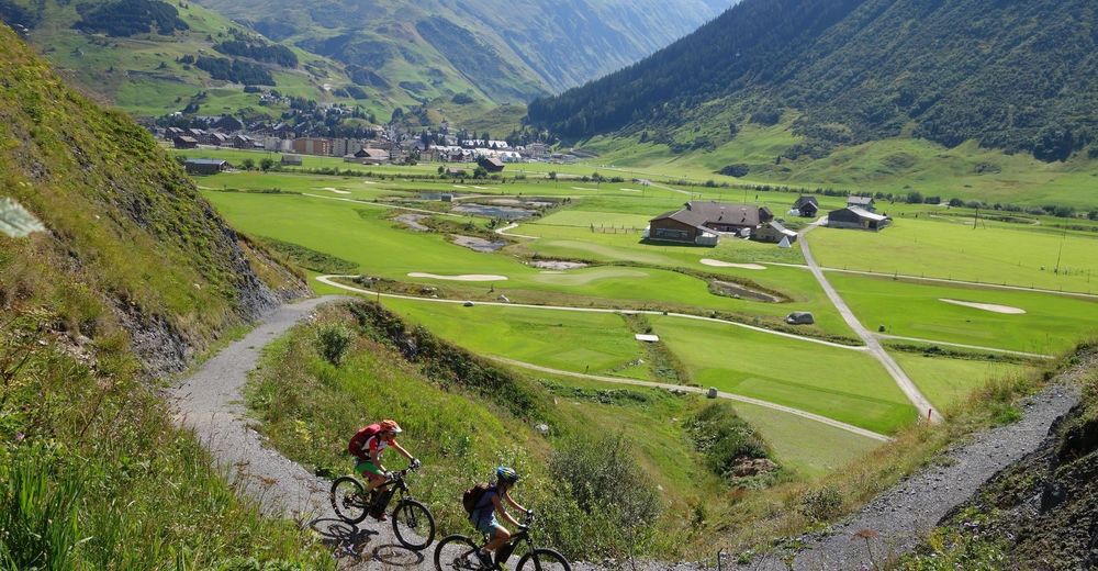
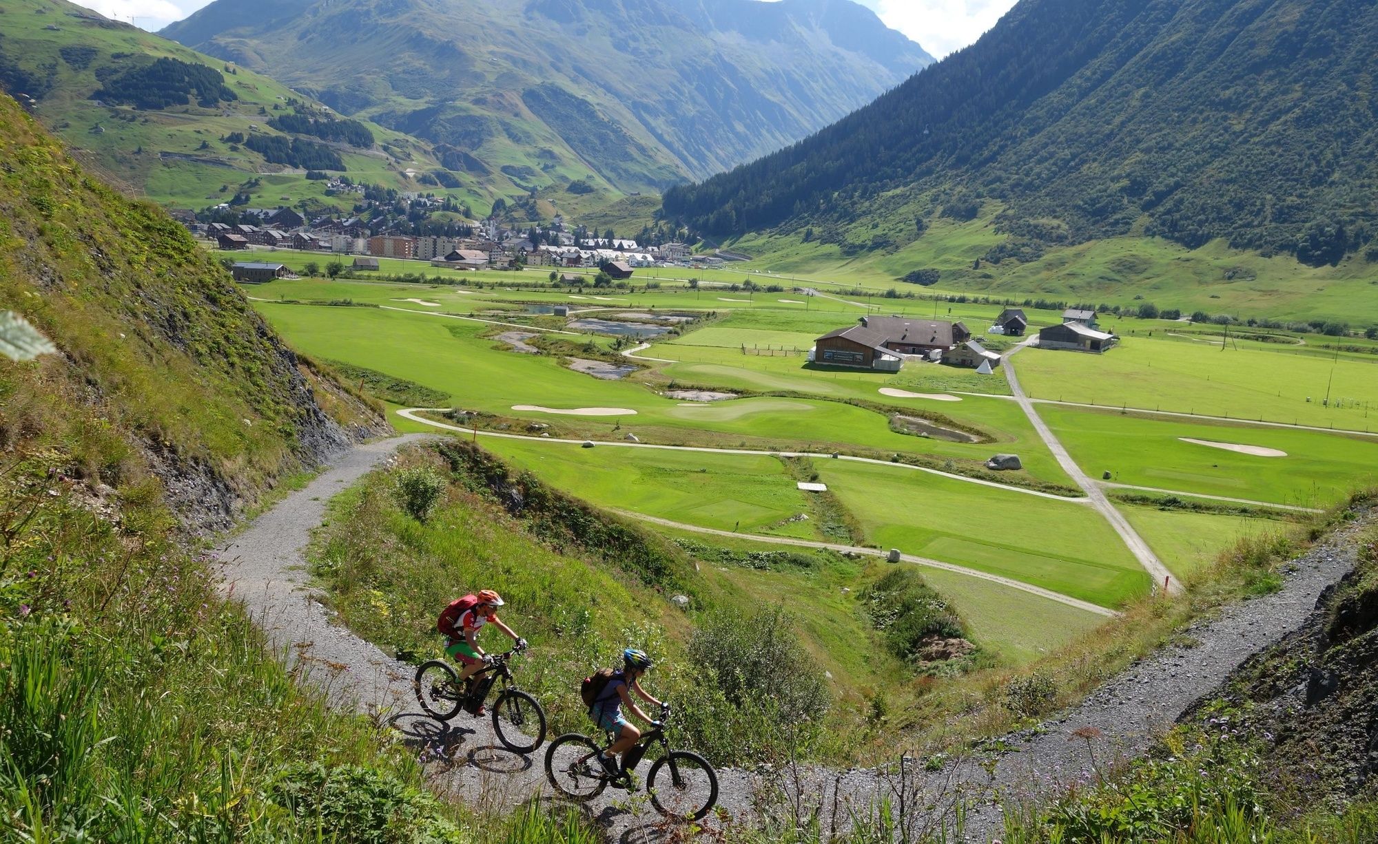
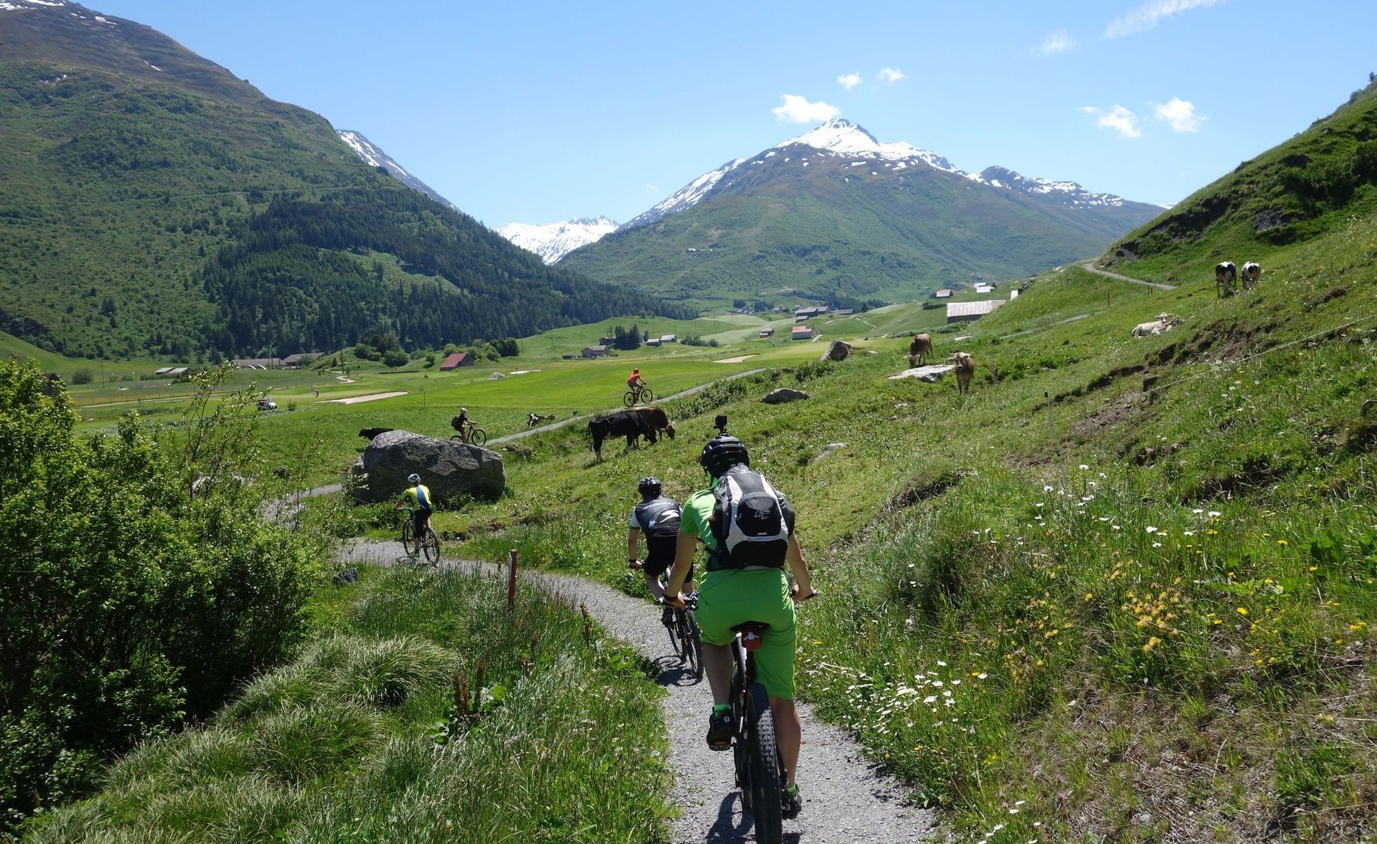
Your reward is a magnificent view of Andermatt and the new golf course. After a short downhill run, you continue along a gravel road on the valley floor until you get to Zumdorf. Here, at the Restaurant Zumdorf, you have your first chance to buy a meal.
Shortly after passing the gravel pit, the small road becomes a fast-flowing shore trail (watch out for walkers!) that leads to the hamlet of Steinbergen. Then you do a quick uphill sprint to the little chapel of «Lieg» before going down to Realp.
After leaving the village you pass the station for the Furka mountain route. It is from here that the steam train starts on the historic route to Gletsch and on to Oberwald in Goms.
However, the bike route soon takes you in the direction of Schweig in the Wytenwasserental valley. Shortly before reaching Schweig, the route turns right.
There is a short but very steep climb ahead of you before a beautiful single trail takes you back towards Realp.
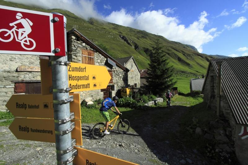
Until you reach Zumdorf you take the shore trail for the second time along the Reuss via Steinbergen, but this time it is slightly downhill. In Zumdorf the trail follows the main road to Hospental for a short distance.
Right at the entrance to the village, you turn left into a narrow trail which runs in the direction of the old tower and leads directly to the church square in the very well-preserved village centre.
In Hospental there are various food and drink options. The route continues along the Reuss River back to Andermatt. At the village entrance, in front of the petrol station where James Bond filled his Aston Martin while chasing Goldfinger, you turn right. The ascent starts on a small tarred road. Shortly before the barbecue site at Fliess this changes to gravel and you have to scale this section's final few ramps. You are rewarded with a short but fast-flowing trail descent to the barbecue site at Rohr in the Unteralp Valley. Do take care, because you will often come across walkers on this trail.
As you go back towards Andermatt the route takes you along a small Alpine road where you need to watch out for increased numbers of cars and agricultural vehicles.
This tour ends up back at the tourist office in Andermatt.
Note(s)
Take care:
Walkers: Panorama trail near the golf course, Reuss riverbank trails, final descent towards Unteralp.
See also
Ferienregion Andermatt
Andermatt-Urserntal Tourismus GmbH
Gotthardstrasse 2
6490 Andermatt
Tel.: +41 (0)41 888 71 00
E-Mail: info@andermatt.ch
Internet: www.andermatt.ch - Directions
-
Andermatt - Mülibach - Richleren - Zumdorf - Kapelle Lieg - Realp - Biel - Laubgädem - Biel - Realp - Kapelle Lieg - Zumdorf - Hospental - Mettlen - Matill - Andermatt
- Highest point
- 1,721 m
- Endpoint
-
Bahnhof Andermatt
- Height profile
-
 © outdooractive.com
- Author
-
The tour Urseren Rally is used by outdooractive.com provided.
GPS Downloads


Surfaces
Trial
General info
Refreshment stop
A lot of view