
- Brief description
-
Sportliche Mountainbiketour durch das wildromantische Göschenertal.
- Difficulty
-
medium
- Rating
-
- Starting point
-
Andermatt, tourist office
- Route
-
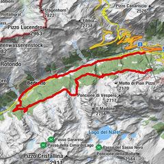
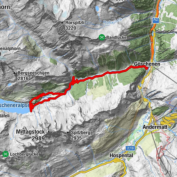
Göschenen (1,106 m)0.1 kmGöschenen (1,111 m)0.2 kmGöschenen (Rötiboden)1.2 kmAbfrutt1.7 kmGasthaus Göscheneralp7.7 kmGwüest7.7 kmGöscheneralp10.1 kmBerggasthaus Dammagletscher10.2 kmGrundablass (1,651 m)10.4 kmWindenkammer (1,745 m)11.3 kmAbfrutt19.4 kmGöschenen (Rötiboden)20.0 kmGöschenen (1,111 m)21.0 kmGöschenen (1,106 m)21.2 km
- Best season
-
JanFebMarAprMayJunJulAugSepOctNovDec
- Description
-
Start off at the tourism office in Andermatt. First, follow the hiking trail through the Schöllenen Gorge. You are likely to see many hikers along the way. When you see how high the rock walls are you will understand why this gorge was such an obstacle to travelers in bygone times. At the end of the Schöllenen, you cross the Häderlis Bridge and follow the main road to Göschenen.
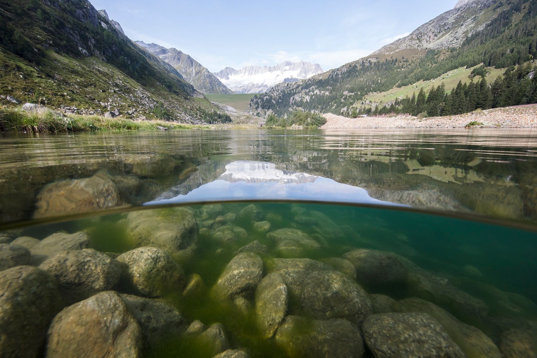
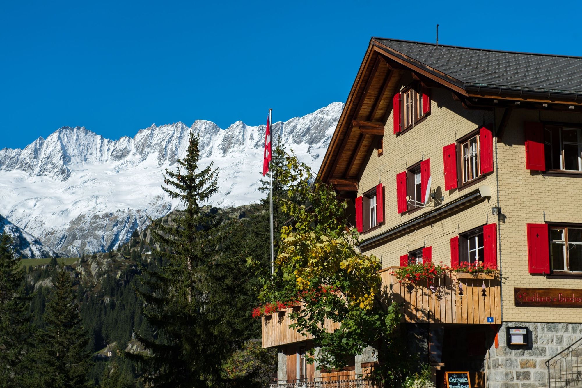
Cross the bridge in the centre of Göschenen and go left towards Göscheneralp. Outside the village you come to a sloping terrace, which extends until shortly before you reach Abfrutt; before you reach the hamlet, you turn left onto an unpaved road. The valley narrows in Wiggen, and once you are over the Göschenerreuss you are back on a tarred road that runs through a few unlit tunnels - you will need to bring your own torch to light the way! After the first few turns you reach a small road that takes you through a tunnel and through a rock wall before you arrive at a deep circular depression near the campsite in Gwüest. Here the view opens up to the grassy dam.
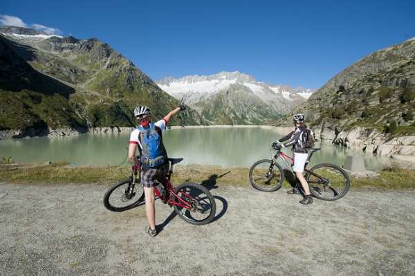
The Restaurant Göscheneralp in Gwüest is the first rest stop for hungry and thirsty bikers and there is also a simple bivouac available. There is a small roadway from the restaurant to the dam. The restaurant at the Damma Glacier is also the perfect place to be if you are hungry or thirsty.
Directly above the dam, the path takes you to where your descent will start. It is a good place to linger a while and marvel at the views of the Göscheneralpsee, the glaciers and the mountains. The Tiefenstock, Rhonestock, Dammastock, Schneestock and Eggstock peaks are also covered with snow in summer.
The descent takes you directly over the dam to the «old valley floor»; the initial road ends in a narrow pathway. Just before the pathway becomes a small road again, there are a couple of large boulders that will force even the experienced biker to dismount for a few metres.
The next challenge in store for you is after you leave the campsite. Here the path runs over some very rocky passages and affords a real treat for expert bikers. If you are not all that technically skilled then you might have to push your bike for about 15 minutes. From Wiggen and until you almost arrive at Göschenen you follow the same route as on your uphill run - you are on the hiking trail the whole way.
Note(s)
Food and drink:
Gasthaus Göscheneralp
Tel.:+41 (0)41 885 11 74
Berggasthaus Dammagletscher
Tel.: +41 (0)41 886 88 68
See also
Andermatt-Urserntal Tourismus GmbH
Gotthardstrasse 2
CH-6490 Andermatt
Tel.: +41 (0)41 888 71 00
Fax: +41 (0)41 888 71 01
Email: info@andermatt.ch
Internet: www.andermatt.ch - Directions
-
Andermatt - Schöllenenschlucht - Göschenen - Göscheneralp - Göschenen
- Highest point
- 1,797 m
- Endpoint
-
Bahnhof Göschenen
- Height profile
-
 © outdooractive.com

- Author
-
The tour Round trip Göscheneralp is used by outdooractive.com provided.
GPS Downloads


Surfaces
Trial
General info
Refreshment stop
A lot of view