


- Brief description
-
The CFL rail trails take you from one station to another, so you can easily get back to your starting point by train.
- Difficulty
-
medium
- Rating
-
- Starting point
-
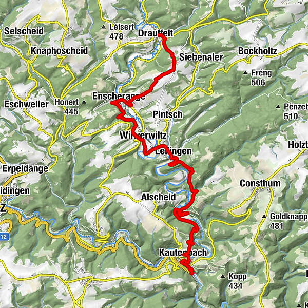
At the station in Drauffelt / Kautenbach
- Route
-
DrauffeltEnscheringen3.8 kmNew Shanghai6.2 kmWilwerwiltz6.3 kmChapel St. Willibrord6.7 kmChapelle Saint-Pierre7.9 kmLellingen7.9 kmKautenbach15.1 kmHuberty15.3 kmSaint-Bernard15.4 kmKautenbach16.1 km
- Best season
-
JanFebMarAprMayJunJulAugSepOctNovDec
- Highest point
- 423 m
- Endpoint
-
At the station in Kautenbach / Drauffelt
- Height profile
-
 © outdooractive.com

- Author
-
The tour CFL-Bahnwanderweg 4 (Drauffelt - Kautenbach) is used by outdooractive.com provided.
GPS Downloads


General info
Refreshment stop
Cultural/Historical
A lot of view
Other tours in the regions


