© Visit Éislek

- Brief description
-
Up to the mighty fortress
- Difficulty
-
medium
- Rating
-
- Starting point
-
Bourscheid-Moulin
- Route
-
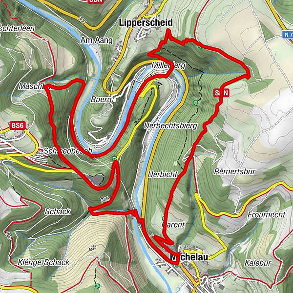
Moulin de Bourscheid0.1 kmLipperscheid0.6 kmGringlay1.2 kmViewpoint on the Sure2.2 kmMichelau3.9 kmBramillen4.6 kmBourscheid-Plage8.1 kmLipperscheid8.9 kmMoulin de Bourscheid9.1 km
- Best season
-
JanFebMarAprMayJunJulAugSepOctNovDec
- Description
-
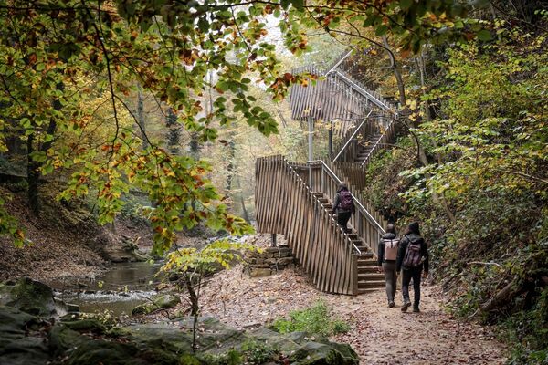
Bourscheid Castle towers above the valley in which the Sûre River makes loop after loop. You walk along the river and up to the fortress. Once you have reached the Gringlee viewpoint on the opposite side of the valley, you will be offered one of the most impressive views of the Éislek.
- Directions
-
The hiking trail is marked in both walking directions. Please follow the white-blue "BS 4" waymarks.
- Highest point
- 465 m
- Endpoint
-
Bourscheid-Moulin
- Height profile
-
 © outdooractive.com
 - Equipment
-
Sturdy shoes and something to drink.
- Safety instructions
-
Weather conditions such as wetness, ice and wind can make a tour difficult. The information given refers to optimal conditions.
- Tips
-
Highlights: Bourscheid Castle, Views "Ierwëscht Fuusslee" & "Gringlee"
- Additional information
- Public transportation
- Parking
-
A parking place is located directly at the starting point.
- Author
-
The tour Local hiking trail BS 4 - Bourscheid-Moulin is used by outdooractive.com provided.
GPS Downloads


General info
Refreshment stop
A lot of view
Other tours in the regions
-
Eifel/ Rheinland-Pfalz
1057
-
Guttland
413
-
Bourscheid
163