
- Brief description
-
Passing God's Finger
- Difficulty
-
medium
- Rating
-
- Starting point
-
Car park at the church, Groussgaass, Bourscheid
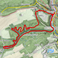
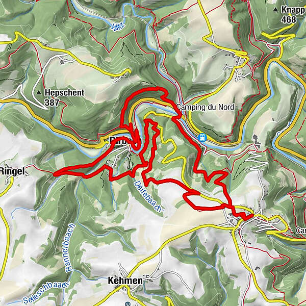
- Route
-
Saint-MichelBurscheidDirbach8.4 kmDirbach-Plage8.5 kmAuberge de la Sûre8.5 kmGoebelsmühle12.3 kmSaint-Michel14.7 kmBurscheid14.8 km
- Best season
-
JanFebMarAprMayJunJulAugSepOctNovDec
- Description
-
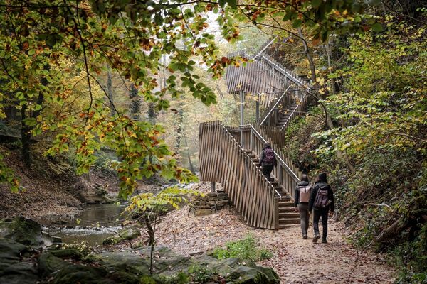
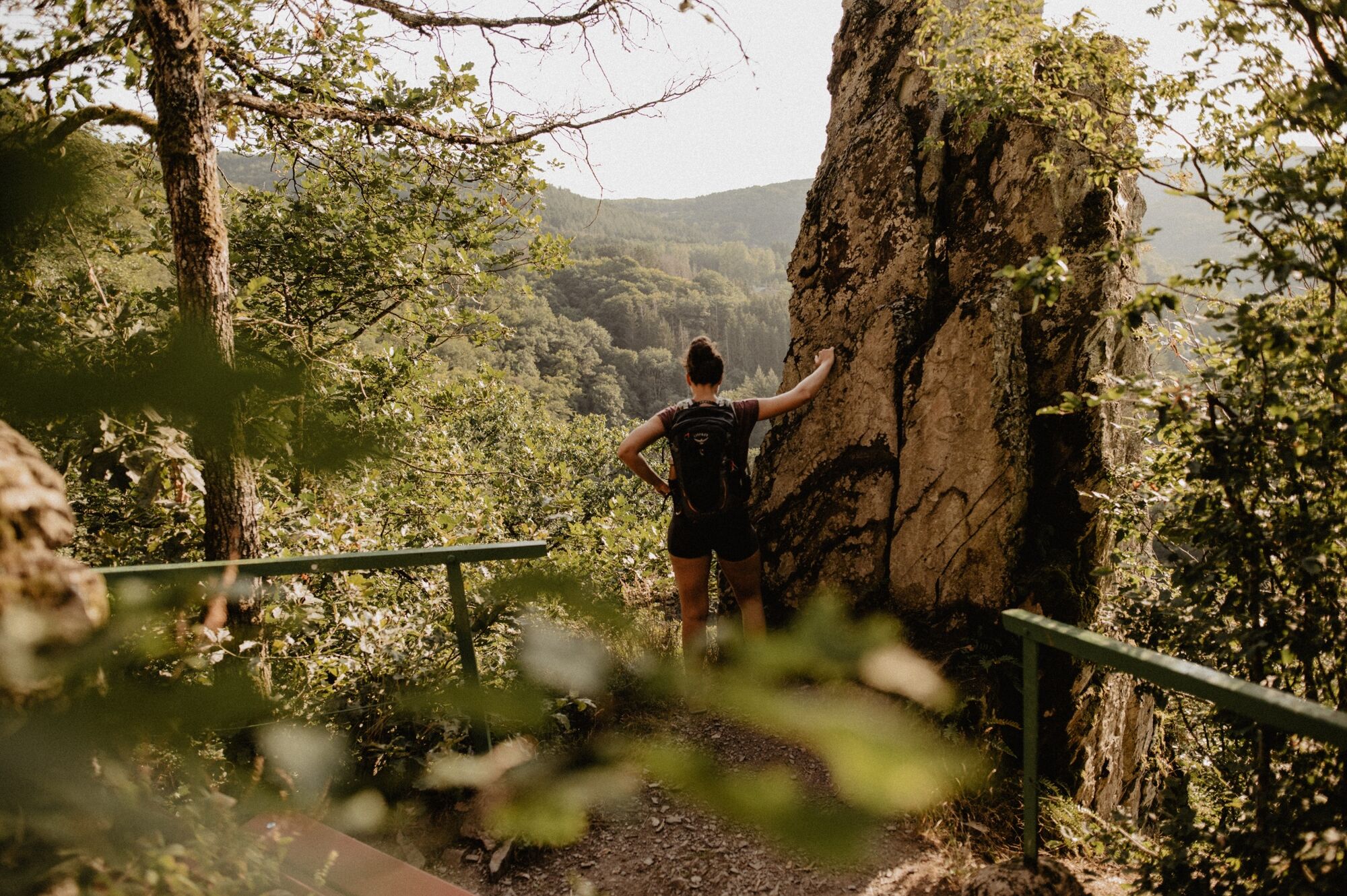
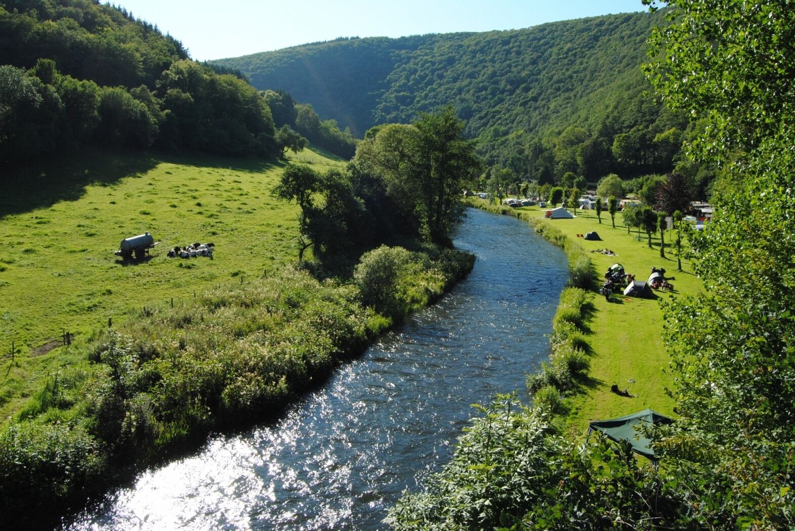
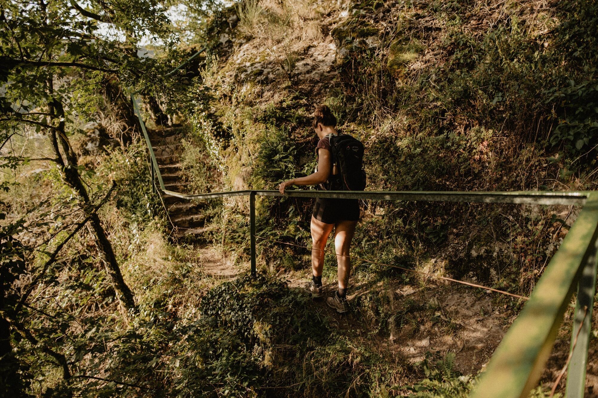
On this tour you will encounter two special monuments. At the Napoléonsknäppchen, an oak tree rises in honour of Napoléon's son and a viewing platform presents the plateau to you. Doigt de Dieu means Finger of God and even if this natural stone monument does not point you in the right direction, it offers you a magnificent view.
- Directions
-
The hiking trail is marked in both walking directions. Please follow the Éislek waymarks.
- Highest point
- 502 m
- Endpoint
-
Car park at the church, Groussgaass, Bourscheid
- Height profile
-
 © outdooractive.com
 - Equipment
-
Sturdy shoes and something to drink.
- Safety instructions
-
Weather conditions such as wetness, ice and wind can make a tour difficult. The information given refers to optimal conditions.
- Tips
-
Highlights: Views Napoléonsknäppchen & Rouschtert, Doigt de Dieu (God's Finger)
- Additional information
- Public transportation
- Parking
-
A parking place is located directly at the starting point.

- Author
-
The tour Éislek Pad Bourscheid is used by outdooractive.com provided.

General info
-
Eifel/ Rheinland-Pfalz
1057
-
Guttland
413
-
Bourscheid
163