© Visit Éislek

© Visit Éislek - DAN CASTIGLIA 2020

© Visit Luxembourg - Visit Éislek

© Visit Luxembourg - Visit Éislek

© Visit Éislek - dcastigl@pt.lu2019


- Brief description
-
Near the big city
- Difficulty
-
medium
- Rating
-
- Starting point
-
Field path at the end of the road, In Bedigen, Diekirch
- Route
-
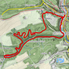
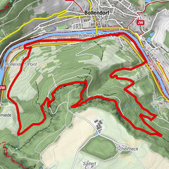
DiekirchEttelbrück5.9 kmDiekirch14.2 km
- Best season
-
JanFebMarAprMayJunJulAugSepOctNovDec
- Description
-
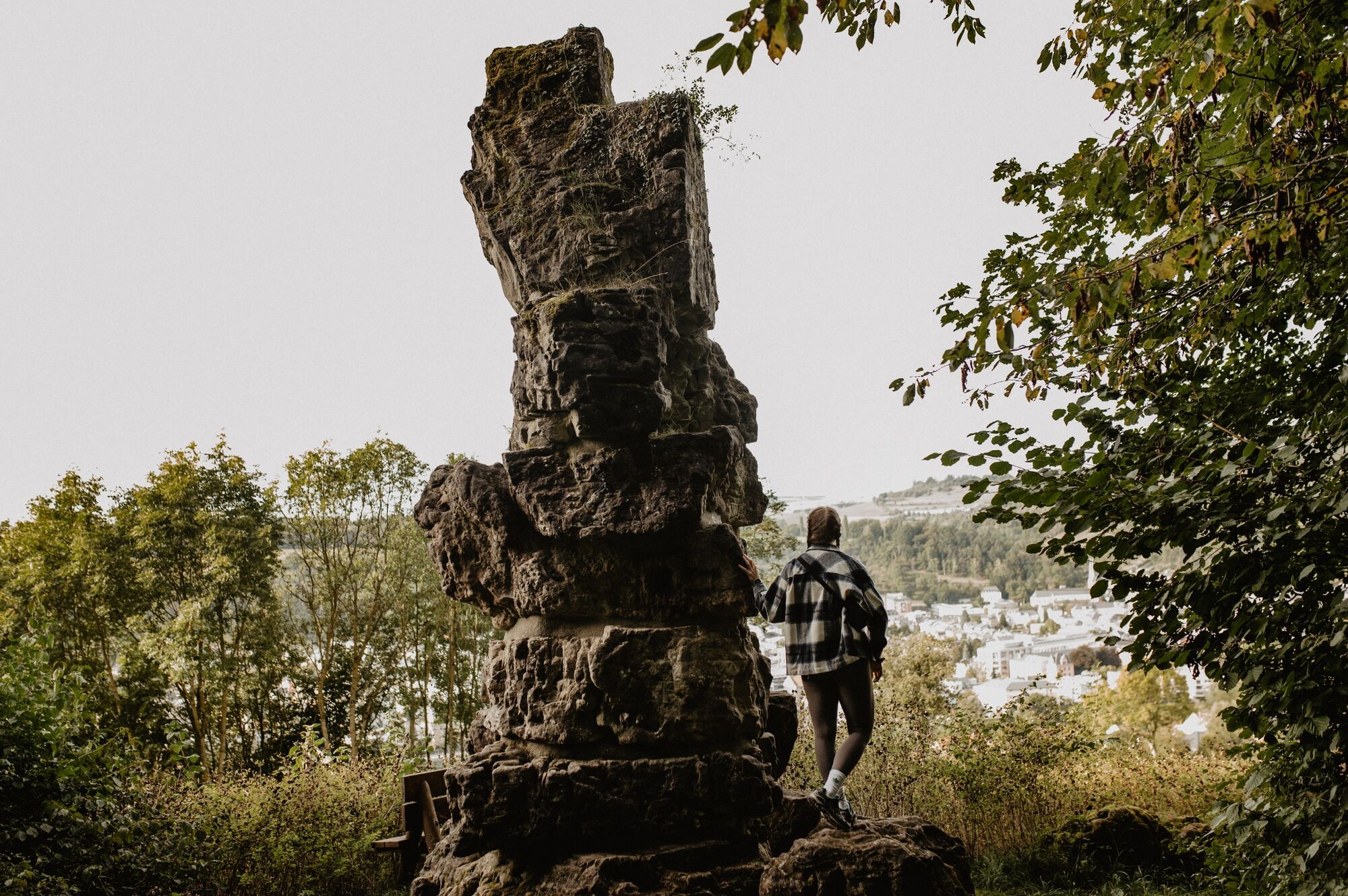
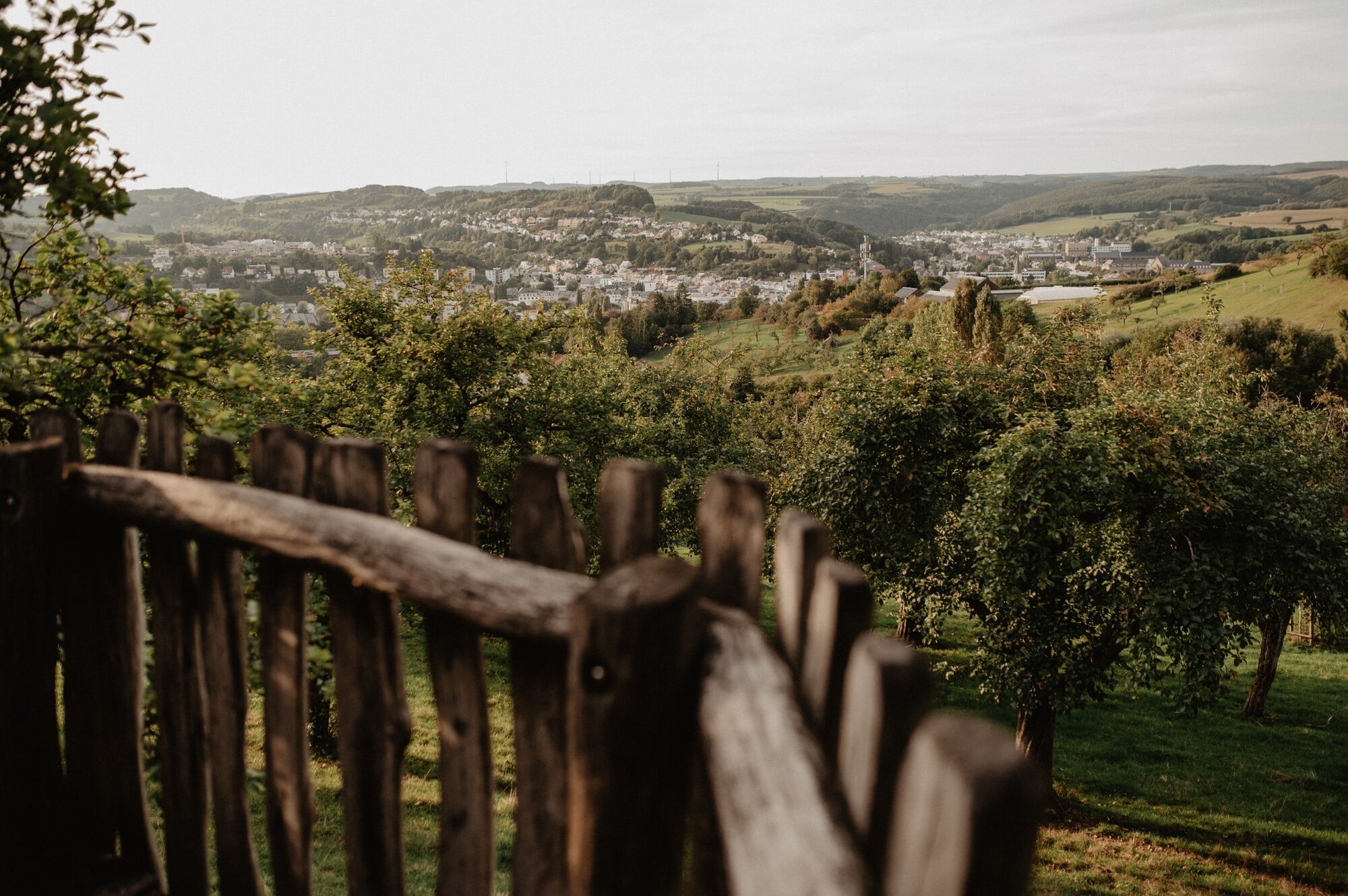
Fresh air, wide views and unexpected corners await you above the Nordstad. From time to time, you can catch views of the Nordstad from above. The Deiwelselter, in English Devil's Altar, forms a contrast to the city. This monument was built from the stones of a prehistoric grave.
- Directions
-
The hiking trail is marked in both walking directions. Please follow the Éislek waymarks.
- Highest point
- 367 m
- Endpoint
-
Field path at the end of the road, In Bedigen, Diekirch
- Height profile
-
 © outdooractive.com
 - Equipment
-
Sturdy shoes and something to drink.
- Safety instructions
-
Weather conditions such as wetness, ice and wind can make a tour difficult. The information given refers to optimal conditions.
- Tips
-
Highlights: Views of the Nordstad, Béibert, Deiwelselter
- Additional information
- Public transportation


- Author
-
The tour Éislek Pad Diekirch is used by outdooractive.com provided.
GPS Downloads


General info
Refreshment stop
Cultural/Historical
Flora
Fauna
A lot of view