- Brief description
-
Der Pizzo Stella ist ein Berg mit eleganten Formen, vor allem am Nordhang, der in Richtung der Alp Angeloga abfällt.
- Difficulty
-
difficult
- Rating
-
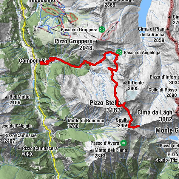
- Route
-
Gampolschin0.0 kmGenzianella1.8 kmFraciscio (1,341 m)1.9 kmRifugio Chiavenna5.9 kmAlpe Angeloga (2,042 m)5.9 kmPizzo Stella (3,163 m)13.0 kmSpalla (2,959 m)14.2 kmBivacco Chiara e Walter15.4 km
- Best season
-
JanFebMarAprMayJunJulAugSepOctNovDec
- Highest point
- 3,111 m
- Endpoint
-
Fraciscio
- Height profile
-
 © outdooractive.com
- Author
-
The tour Pizzo Stella is used by outdooractive.com provided.
GPS Downloads


Other tours in the regions
-
Comer See
766
-
Valchiavenna
214
-
Campodolcino
46