
- Brief description
-
The tour Col d'Anzana is a pleasant surprise for all bikers who do it for the first time. Despite the relatively low altitude of 2212 metres above sea level Col d'Anzana offers a fascinating descent on a difference in altitude of about 1800 metres.
- Difficulty
-
difficult
- Rating
-
- Starting point
-
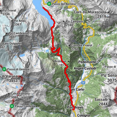
Brusio
- Route
-
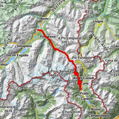
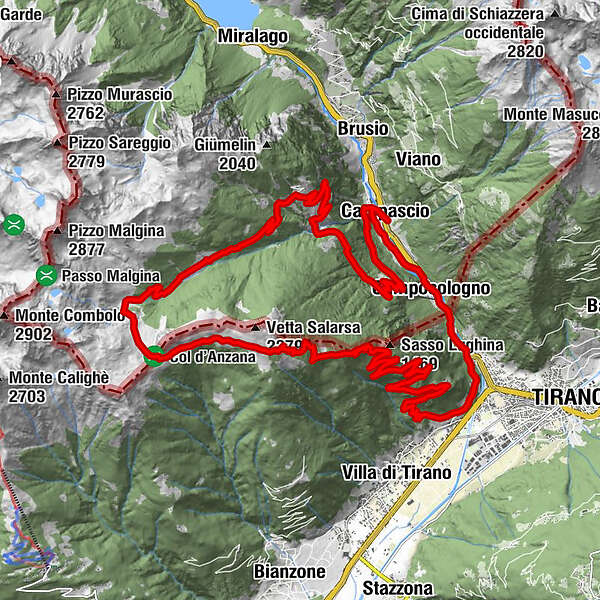
Campascio0.1 kmScala2.6 kmCavaione-Söl6.5 kmCavaione6.8 kmFrontelone (1,764 m)19.1 kmLughina20.7 kmSanti Sebastiano e Rocco27.3 kmSanta Perpetua29.8 kmTorri31.3 kmCampocologno31.7 kmLi Geri32.4 kmZalende32.9 kmCampascio33.5 km
- Best season
-
JanFebMarAprMayJunJulAugSepOctNovDec
- Description
-
The tour starts close to the sports field of Campascio. From here a narrow asphalted road leads to the village of Cavaione which is located 800 metres higher. Here it ends and flows into a well developed gravel path that leads to the refuge Rifugio Anzana.
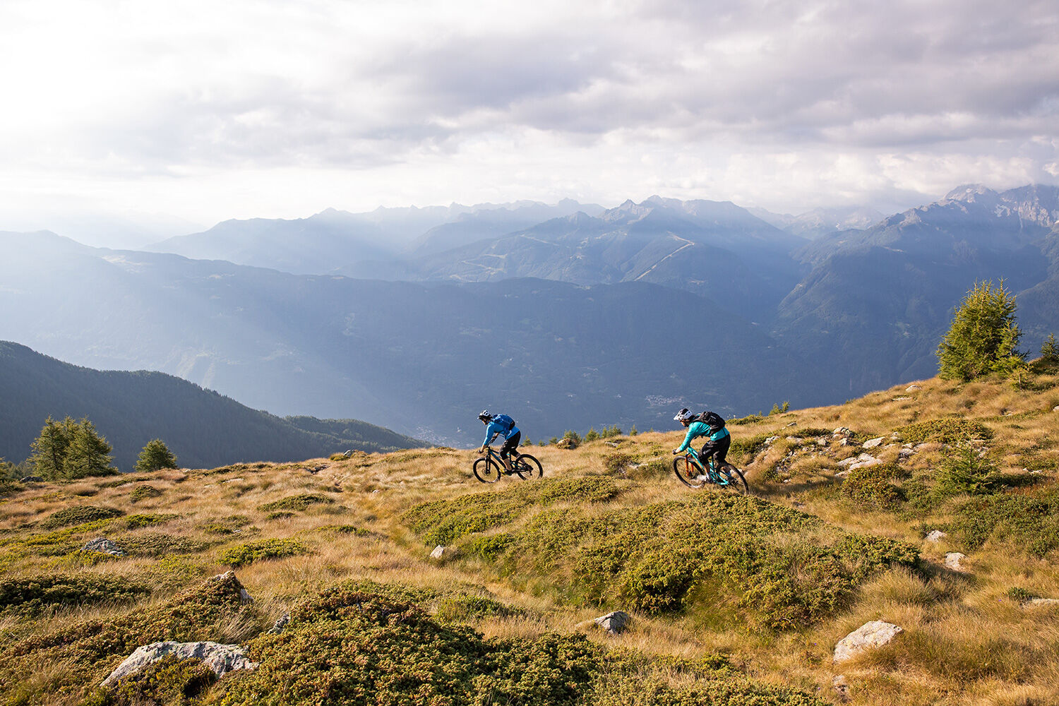
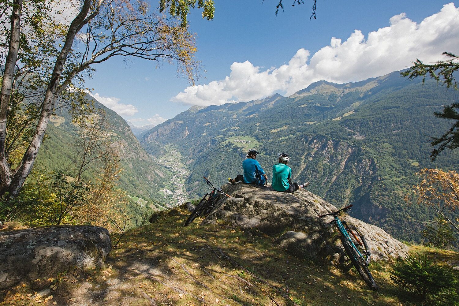
There the not very steep trail starts to go up and leads over Alpine pastures right to Col d'Anzana. The flat mountain pass offers a fantastic panorama and builds at the same time the borderline Switzerland-Italy. Except the shepherds you won't meet anybody up there. For hikers it is simply too far away and for mountaineers not enough demanding. So, it is the ideal area for mountain-biking.
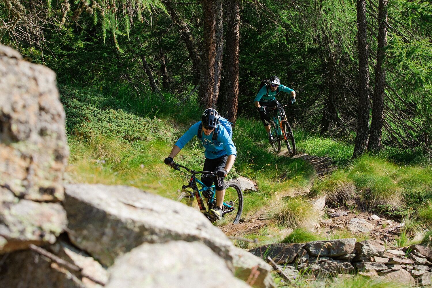
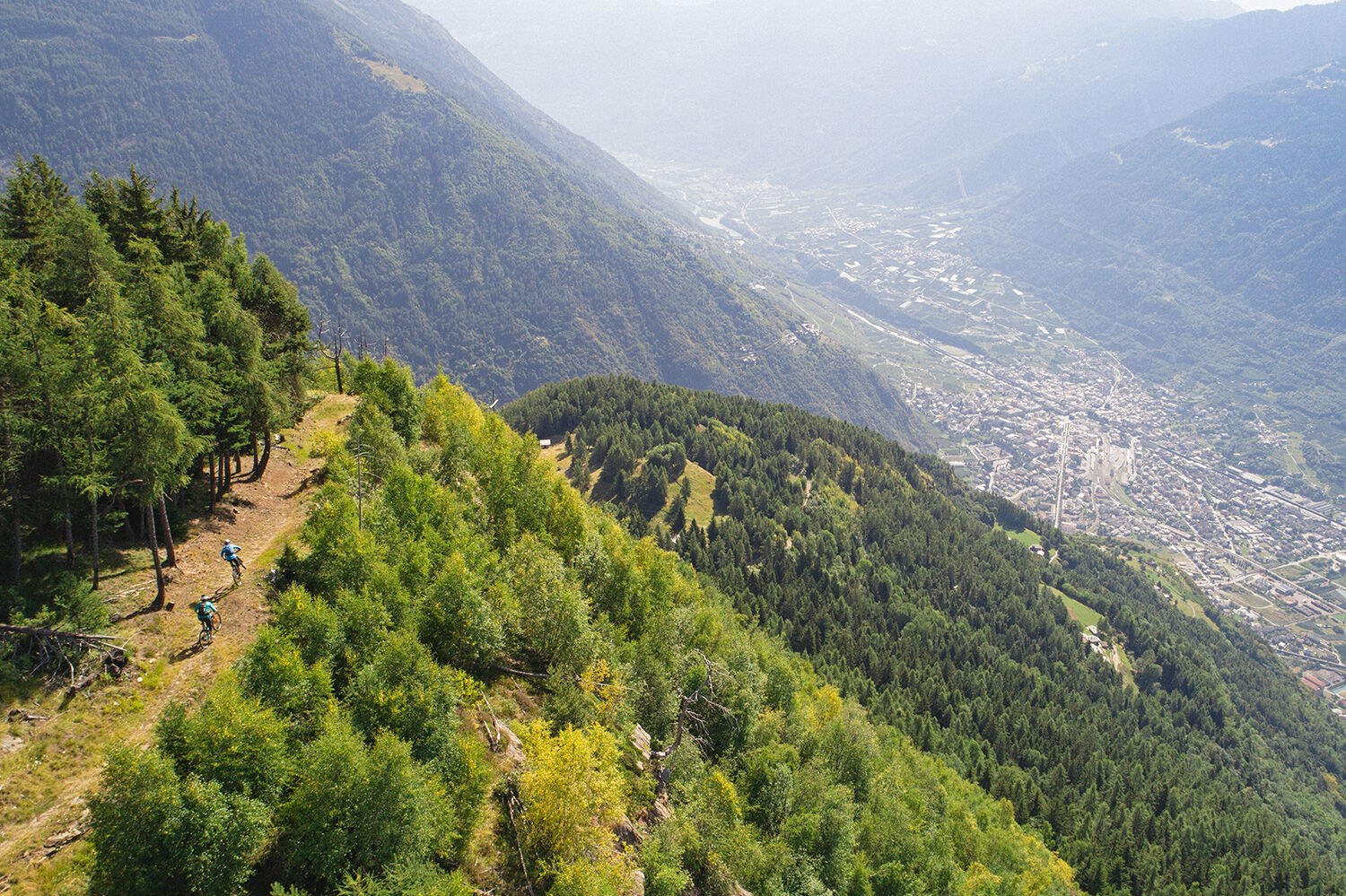
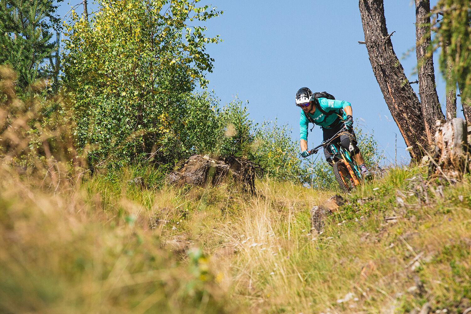
The descent starts with a great panorama-trail that goes along the mountain ridge towards east. The panorama goes from the Ortler group to the Bergamasc Alps and down to the bottom of the valley of Valtellina. Some larch trees that grow up to over 2000 metres above sea level line the trail that continues slowly on an old military road. Endless serpentines with drystone walls lead downhill, and the constructors of these paths would probably not have imagined that they would someday be so much fun for other people. From the place of Lughina you can use the new, well developed gravel road or follow the old path with the large cobblestones. The latter is a real pleasure for the ones who love driving techniques. On the last 200-300 metres in height there is a rich selection of trails and paths that lead through orchards and vines down to Tirano.
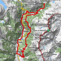
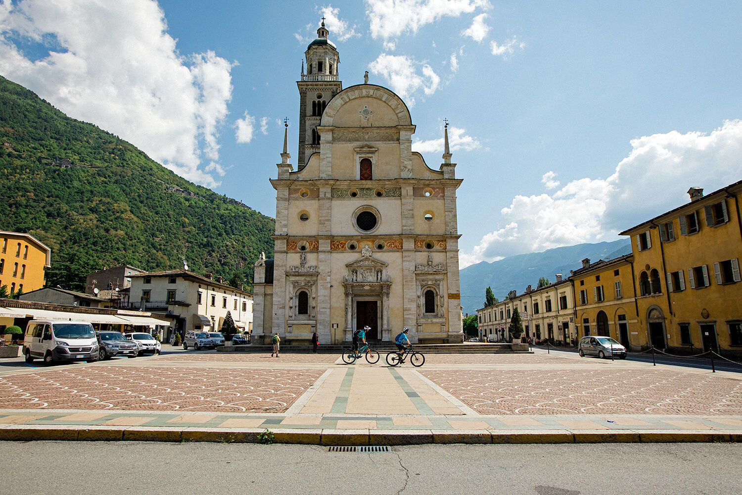
In Tirano it is recommended to visit the Basilica della Madonna (pilgrimage church) and the old town with the historic Palazzi. The way back to Campascio is mainly done on natural roads and side roads, whereas about 200 metres in altitude have to be climbed. Passing by the little church Santa Perpetua dating from the 12th century is quite remarkable, it was constructed on a natural kind of a balcony with view to Tirano. For the ones who prefer enjoying one of the excellent vines from Valtellina that are available here or who do not want to cycle the last ascent, there is the possibility to take the Rhaetian Railway back to Valposchiavo.
- Highest point
- 2,213 m
- Endpoint
-
Tirano
- Height profile
-
 © outdooractive.com
 - Safety instructions
-
Attention: Snowfields possible into summer months on high-level sections.
This is a cross-border tour - take your ID card or passport along
- Additional information
-
Cavaione
The hamlet of Cavaione is located on the western side of the valley high above Brusio, it snuggles to the steep south slope of the mountain Giümelin. Cavaione is the youngest place in Switzerland: Thanks to the change of the border between Switzerland and Italy in the year 1865 Cavaione was integrated into the municipality of Brusio and its inhabitants got the Swiss citizenship in 1873. Before the people of Cavaione could often escape the liability to pay taxes and the obligation of military service in pretending they would, according to the need, belong to one or to the other country.
Lagh dal Mat and Lagh da la Regina
From Capanna Anzana it is possible to reach the mountain lake Lagh dal Mat (lake of the fool) in a hike of a little bit more than half an hour and with another hike of 30 minutes one reaches the lake Lagh da la Regina (queen's lake). They are absolutely clear and the water has got unique colours. Additionally both of them offer a breathtaking view of the eastern valley flank of Valposchiavo, of the small town of Tirano and of fertile Valtellina.
Ente Turistico Valposchiavo
Stazione
CH-7742 Poschiavo
Tel: +41 (0)81 844 05 71
Fax: +41 (0)81 844 10 27
E-Mail: info@valposchiavo.ch
Internet: www.valposchiavo.chCapanna Anzana Gemeinde Brusio
Plozza Giancarlo
CH-7743 Brusio
Tel: +41 (0)81 846 54 61
E-Mail: cancelleria@brusio.ch - Public transportation
-
Arrival: The road from Cavaione to Pescia Bassa is open to traffic, however, it’s little traffic.
Shuttle bus - PubliCar
The tour can be shortened by using the shuttle bus from Poschiavo to Cavaione. Information and booking at Post Bus. Post Bus: T +41 81 844 10 42 autopostale.poschiavo@bluewin.ch, www.balzarolo.ch/de/personentransport
Rhaetian Railway
The Rhaetian Railway offers the possibility to take the train from Tirano back to Valposchiavo. Please check the timetable, not all trains do transportation of bicycles

- Author
-
The tour Col d'Anzana is used by outdooractive.com provided.