
- Brief description
-
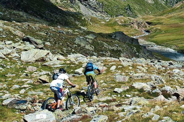
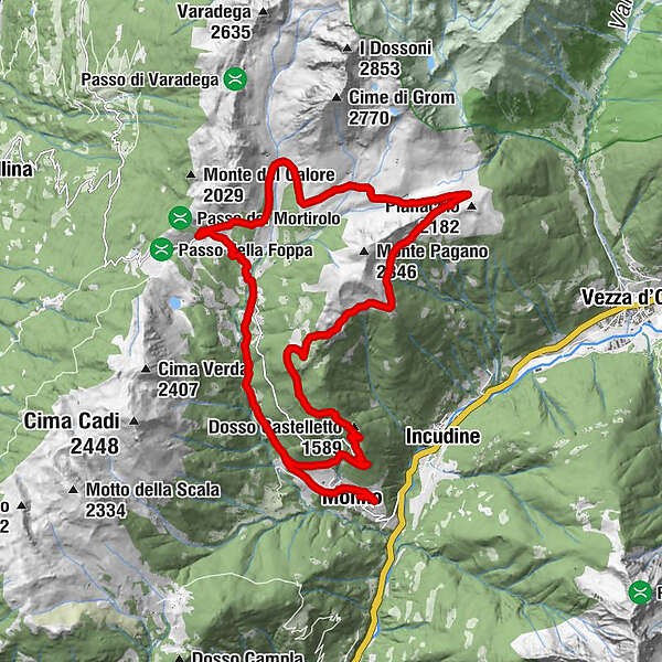
An interesting trail circumnavigating Monte Pagano. The initial climb is quite hard but on an asphalt road, and takes you to the splendid location of Pianaccio where you begin a scenic and panoramic ride along a technical tract of quite historical importance, becoming an enjoyable descent on the old military roads of Caret and Pozza.
- Difficulty
-
medium
- Rating
-
- Starting point
-
Monno
- Route
-
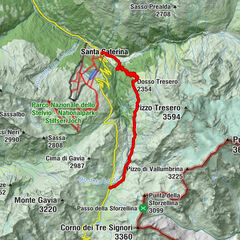
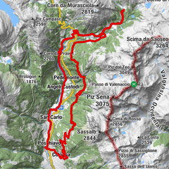
Monno (1,066 m)Bü de Pothzöl (1,083 m)0.4 kmSorlorto0.7 kmSàles0.7 kmLucco (1,139 m)0.9 kmMustù (1,226 m)2.1 kmPrato del Lares (1,308 m)2.5 kmRonchi (1,420 m)3.5 kmCornèl (1,520 m)3.9 kmPonte Palö5.1 kmChiesa di San Giacomo5.7 kmRistorante San Giacomo5.7 kmAlbergo San Giacomo5.7 kmAlbergo Passo Mortirolo6.8 kmCaretto (884 m)17.9 kmDosso Castelletto (1,589 m)20.1 kmLucco (1,139 m)23.9 kmSàles24.1 kmSorlorto24.2 kmBü de Pothzöl (1,083 m)24.3 kmMonno (1,066 m)24.9 km
- Best season
-
JanFebMarAprMayJunJulAugSepOctNovDec
- Description
-
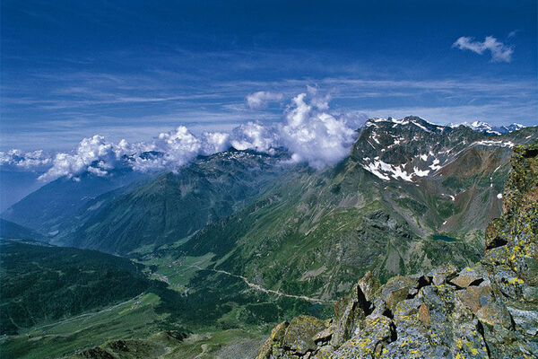
From Monno reach the hamlet Mostone and continue straight along the "Strada Vecchia del Mortirolo" (Mortirolo old road) up to rejoin the "new" on the flat section before the "Ponte Palù" bridge. Cross the bridge, continue uphill until you pass the hotels in the locations San Giacomo, Belvedere and Pasarì. Come to the crossroad above the villages, turns sharply right and drive with more pleasant and scenic route up to the climax of the paved road. Once you left it, turn right along a dirt path that short climb leads to artifacts of great war of Pianaccio, a splendid balcony the mountains and glaciers of the Adamello group. With always very scenic location, it continues now in slight slope along the former military mule track coasting the southern flank of Mount Pagano, sin near the Pian di Locher, more picturesque plateau overlooking the basin of Mortirolo, the mountains of Valtellina and the rear of the Bernina group. Continuing downhill along the military road of Caret, with its wide bends excellently preserved walls raised, you reach the locality of the same name; at the huts, turn left along the road (former military) the descent becomes continuous and with wide bends leads to Mortirolo road, along which it comes back to Monno.
- Directions
-
Monno
- Highest point
- 2,158 m
- Endpoint
-
Monno
- Height profile
-
 © outdooractive.com
 - Equipment
-
Helmet, gloves, a change of clothing, waterproof clothing, for high mountain bike trails bring winter clothing, tool kit, lighting, goggles, first aid kit, emergency numbers, sun protection, water, hiking map, possibly GPS device
- Tips
-
Length: 25 km.
Ascent: 1.110 mt.
Average elevation: 8,5%
Asphalt: 66%
Dirt: 20%
Muletrack: 14% - Public transportation
-
By bus to Monno
- Parking
-
Monno
- Author
-
The tour N° 63 - Tour del Mortirolo is used by outdooractive.com provided.