
- Brief description
-
Mountain bike trails in the Portofino Park to enjoy with all senses.
- Difficulty
-
medium
- Rating
-
- Starting point
-
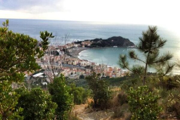
Santa Margherita Ligure
- Route
-
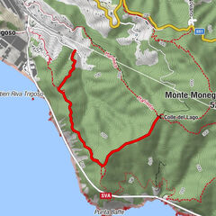
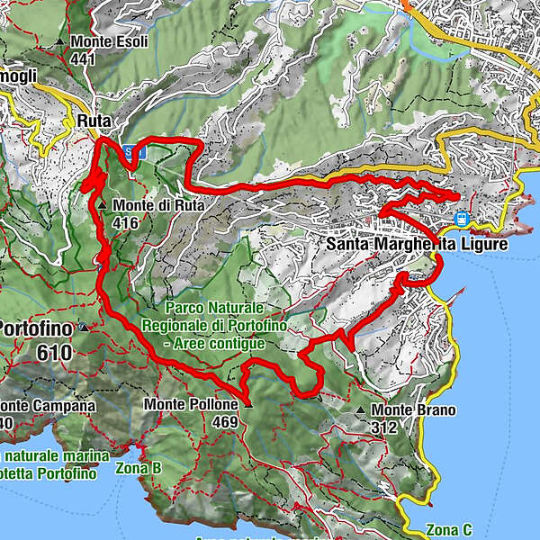
Santa Margherita Ligure0.1 kmRapallo1.7 kmTrattoria degli Amici4.1 kmTrattoria da Oreste4.2 kmChiesa di San Lorenzo4.3 kmSan Lorenzo della Costa4.4 kmAlega6.1 kmTaverna Revello6.4 kmRuta6.5 kmChiesa di San Michele Arcangelo6.5 kmRuta Bistrot6.6 kmPortofino Vetta9.2 kmGaixella9.6 kmPietre Strette10.5 kmCastelluccio10.7 kmMonte delle Bocche (506 m)11.1 kmBocche11.5 kmMonte Pollone (469 m)11.7 kmMonte Croci di Nozarego (391 m)13.0 kmS. Erasmo16.2 kmChiesa dei Cappuccini16.3 kmRapallo16.3 kmSanta Margherita Ligure16.3 km
- Best season
-
JanFebMarAprMayJunJulAugSepOctNovDec
- Description
-
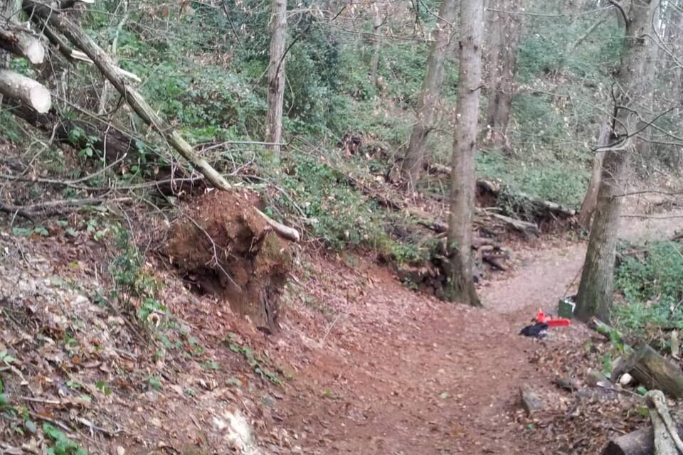
The route starts from the centre of Santa Margherita Ligure with a climb on asphalt that takes you to San Lorenzo della Costa. From there, follow the Aurelia road, pass through a small tunnel and then turn left onto the road that goes to Portofino Vetta. Leave the hotel behind and enter the network of trails of Parco di Portofino Portofino Park: ride into the woods along a gravel road and pass next to Pietre Strette, a picnic area with some tables and a fountain. Stay on the wide dirt road in the direction of Portofino and reach Bocche, where you will find another water point. From there take the dirt track that climbs in front of you, passing in front of the sawmill. This is the start of one of the enduro trails that has been used in the past - and will be used again - in the Enduro race of Santa Margherita Ligure. At the end of the single-track, on the left, pass behind a crag and reach the other side of the mountain. At the bottom of the track, you will be in Busseto (Nozarego); turn right there and head down until you reach the stop sign. Turn left and return to the beachfront of Santa Margherita Ligure, start point of the route. The route runs within the Parco di Portofino whose regulations state that the access and transit of bicycles is permitted only along the signposted tracks and only during the weekdays; bicycle usage is forbidden on weekends and on the days prior to the holidays, as well as during the period between 1st April and 30th June. As exception to the Park regulations, cyclists can use the trails any day of the year when accompanied by a MTB guide of the sport association A.S.D. Portofino Bike.
- Highest point
- 468 m
- Endpoint
-
Santa Margherita Ligure
- Height profile
-
 © outdooractive.com
 - Additional information
-
Classification: EN Difficoltà: moderate/difficult Rideability +/- : 100% Water points: 4 Local Knowledge: Portofino bike www.portofinobike.it/
- Directions
-
Access by car: Exit the motorway at the tollbooth of Rapallo, then continue towards Santa Margherita Ligure.
- Public transportation
-
Shuttle Service: available www.portofinobike.it/
- Parking
-
Santa Margherita Ligure

- Author
-
The tour Pollone is used by outdooractive.com provided.