- Brief description
-
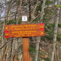
From Colle del Melogno to Giogo di Giustenice
- Difficulty
-
medium
- Rating
-
- Starting point
-
Colle del Melogno
- Route
-
Bric Agnellino (1,335 m)6.1 kmCatalano11.8 km
- Best season
-
JanFebMarAprMayJunJulAugSepOctNovDec
- Description
-
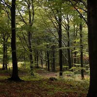
From the Calizzano side of the Melogno Fort (1028m), take the dirt road heading south-west. After a few meters, where it branches off, take the main branch on the right. The dirt road is wide and it goes straight into the Barbottina Beech Forest: cool and shady in summer, bare and bright in winter.
Ignore the crossroads which, on the left, heads to Fort Tortagna (private) and continue straight on a slightly uphill dirt road. Bypass the following crossroads as well, as (on the left) it leads to the Fort Merizzo ruins. Instead, walk through a gate which prohibits the passage of off-road vehicles.
The dirt road continues flat and the atmosphere is quite pleasant, surrounded by the silent beech forest. Walk up to a clearing where you can find the "Casermetta forestale" (forest ranger station) (1175m) as well as some wooden tables and a spring.
Two more dirt roads branch off from this point: the one on the left goes back to the Melogno Fort, the one on the right goes to Calizzano and Bardineto. The Alta Via continues straight and flat and then it drops with a couple of switchbacks to 1125m into the Conca dei Carbonari woods.
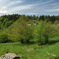
You have now reached Casa Catalano, an isolated farmhouse (you can find another picnic area and water nearby) with a large field and an ancient well. Continue straight ahead and then take a forest track on the left among the beech trees. It’ll first climb up and then begin to descend. Now skip the path on your left (variant of the Alta Via) and keep walking the same direction to get back to the previously abandoned dirt road. One last stretch uphill and you will arrive at the Giogo di Giustenice (1143m), where you can find a picnic table with a built-on roof. This Alta Via stage ends here.
Now you have several options: you either continue towards Monte Carmo or descend towards Bardineto or towards the sea, perhaps stopping at Pian delle Bosse or Cascina Porro refuges.
If you want to walk backwards instead, you can tackle the (less easy) variant of the Alta Via which, crossing a striking stretch between junipers and rhododendrons, touches the summit of Bric Agnellino (1335m) and the panoramic peak of Balzi Rossi (1294m). A steep downhill then takes you to Casa Catalano. From here follow the same route backwards.
- Highest point
- 1,317 m
- Endpoint
-
Giogo di Giustenice
- Height profile
-
© outdooractive.com
- Equipment
-
Trekking shoes or boots.
- Additional information
-
Picnic areas (not served): Casermetta forestale and Casa Catalano.
Water point available.
Shaded path.
- Arrival
-
From Finale Ligure or from Calizzano follow directions for Colle del Melogno.
- Author
-
The tour Alta Via dei Monti Liguri is used by outdooractive.com provided.


