


- Brief description
-
Waters, woods, and ancient buildings
- Difficulty
-
medium
- Rating
-
- Starting point
-
Quiliano
- Route
-
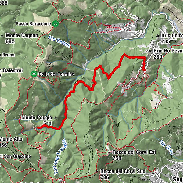
Oratorio di San Michele Arcangelo (Quiliano)6.2 kmChiesa di San Michele Arcangelo6.2 kmMontagna6.4 km
- Best season
-
JanFebMarAprMayJunJulAugSepOctNovDec
- Description
-
The hike starts from Montagna, hamlet of Quiliano. From the main square, take via Veirasca, the road that climbs up towards the church and the cemetery. This paved road, that takes you to thehamlet of Cervaro, climbs up for a hundred meters. When you get to a sharp turn keep right. The dirt road runs halfway up the S. Sebastiano hill, on the right side of the Trexenda stream and it is initially flat, well maintained, and peaceful.
Leave behind you the first crossroad that goes down to the hamlet of Lanrosso and keep waking among chestnut, ash, hornbeam trees until you reach Ca de Gumbe. On the left you can find the turnoff for San Sebastiano hill. Further on you will come across the yellow signs indicating the road to Le Tagliate. From here, if you want, you can walk down, cross the stream, and go back to Roviasca walking along the Trexenda stream.
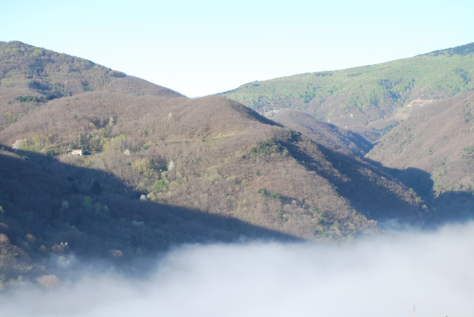
However, if you want to keep going, you will get to the first of the 5 bridges. From here you can admire the river and its crystal-clear waters and bask in an unforgettable tranquillity. The stunning landscape gives a sense of freshness with its deep green colour, the sound of water, and its ponds in the smooth, time-worn rocks.
Walking on, you come across the ruins of a now-disappeared rural civilization that tells us the story of our past: an old stone building and a wood shop, powered by the running water belonging to the famous De Mari family.
- Directions
-
Connecting trail with the Alta Via.
It is possible to get to Rocche Bianche and Le Tagliate areas in Monte Alto.
A red diamond signpost is used to indicate the 5 bridges trail.
- Highest point
- 468 m
- Endpoint
-
Montagna
- Height profile
-
 © outdooractive.com
 - Tips
-
The trail is accessible even in winter, but the area is exposed to northern winds hence colder than the opposite side.
- Additional information
-
Shaded path.
Water point available.
There’s really no chance of finding refreshments along the trail.
- Directions
-
By car: from Quiliano, after Mulini you come to a crossroads and turn left.
- Public transportation
-
By bus: TPL line n° 9 Savona-Quiliano and then bus n° 11.

- Author
-
The tour 5 bridges trail is used by outdooractive.com provided.


General info
-
Savona und Umgebung
153
-
Savona
33