
- Brief description
-
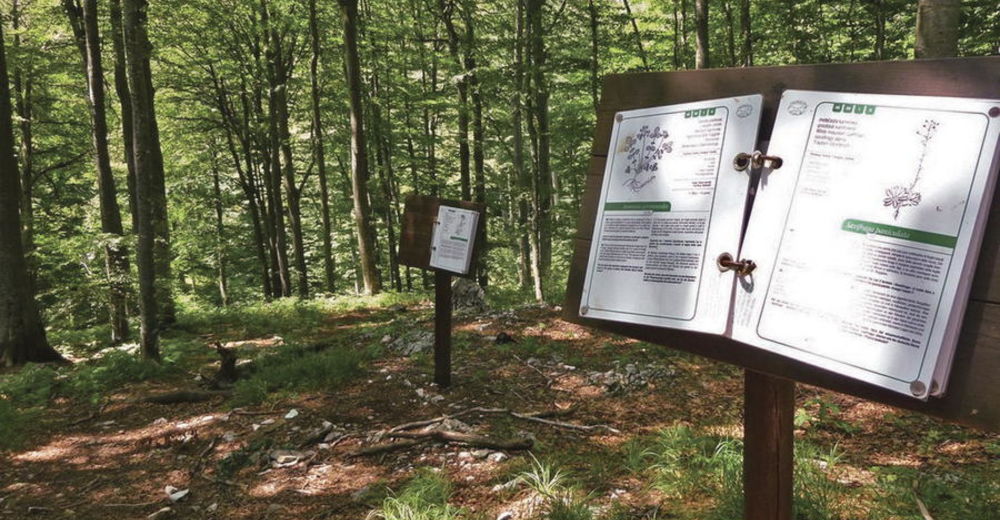
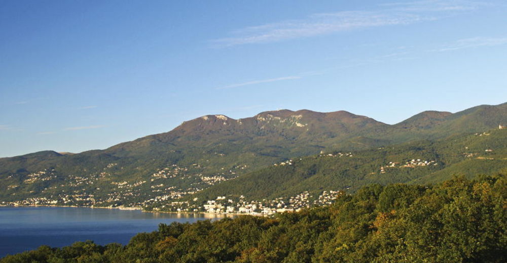
Učka is a mountain with a simple shape, with two steep sides and sharp ridge. The ridge is highest at the beginning (Vojak, 1396 m.a.s.l.). From there, the ridge gradually descends southwards, with peaks of Brgud (906 m.a.s.l.), Šikovac (780 m.a.s.l.) and Sisol (883 m.a.s.l.), before suddenly disappearing into the sea at the bay of Plomin. The western side of Učka is more steep, sharply descending to Vranjska Draga, Boljunsko polje and Čepićko polje. Učka is a typical karst mountain, with a multitude of pits, caves and sinkholes, but also rich in springs and lush forests. It was primarily due to the abundance and diversity of the plant world, that Učka was declared a nature park in 1999.
- Difficulty
-
medium
- Rating
-
- Starting point
-
Vrh Veliki Planik
- Route
-
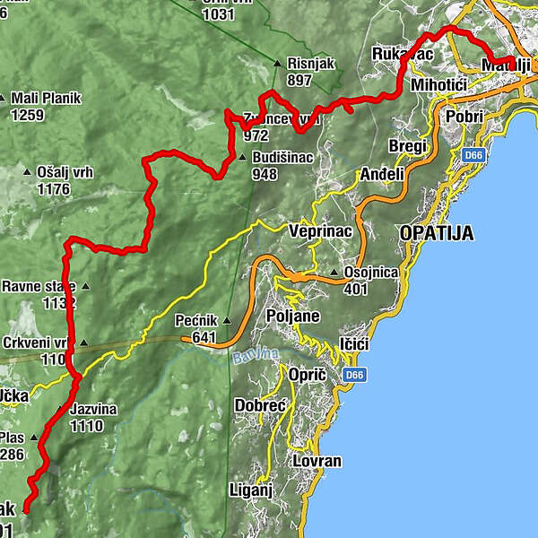
Monte Maggiore (1,401 m)0.1 kmJazvina (1,110 m)2.6 kmRadiša3.0 kmPoklon3.4 kmPlaninarski dom Poklon3.5 kmPoklon (932 m)3.7 kmVidikovac9.2 kmBrložnik (1,093 m)9.2 kmZvoncev vrh (972 m)14.0 kmMajkovac (853 m)16.1 kmMajkovac16.3 kmVedež17.7 kmOrjak (712 m)18.3 kmMamići19.9 kmDražice20.4 kmRuccavazzo20.7 kmSušnji21.2 kmMohorići21.5 kmRošići21.7 kmStacion23.3 kmMattuglie23.8 km
- Best season
-
JanFebMarAprMayJunJulAugSepOctNovDec
- Description
-
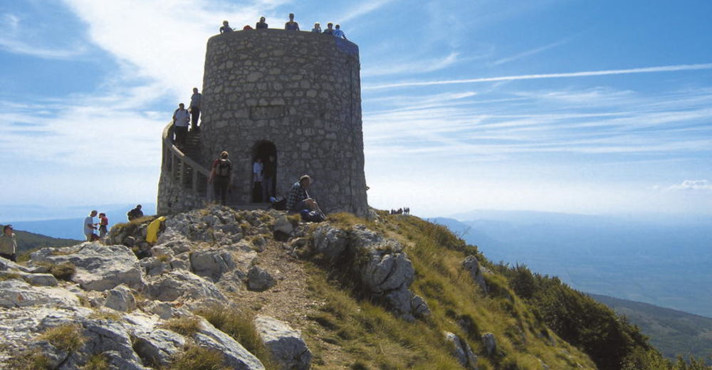
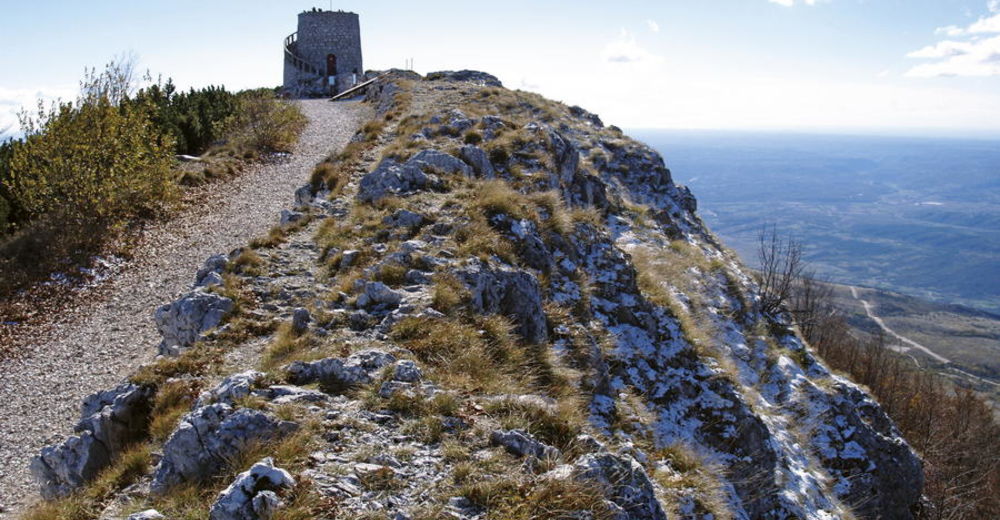
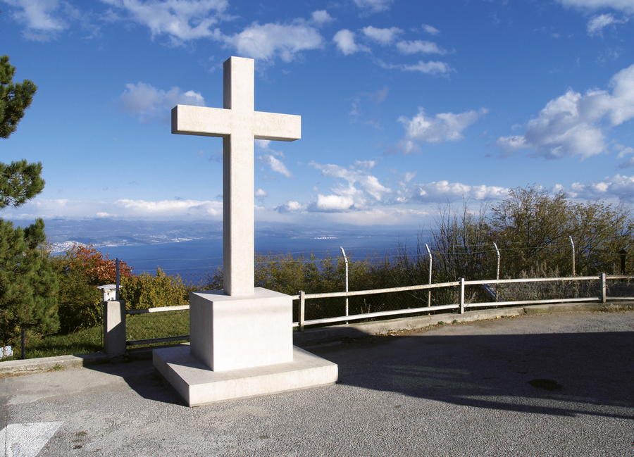
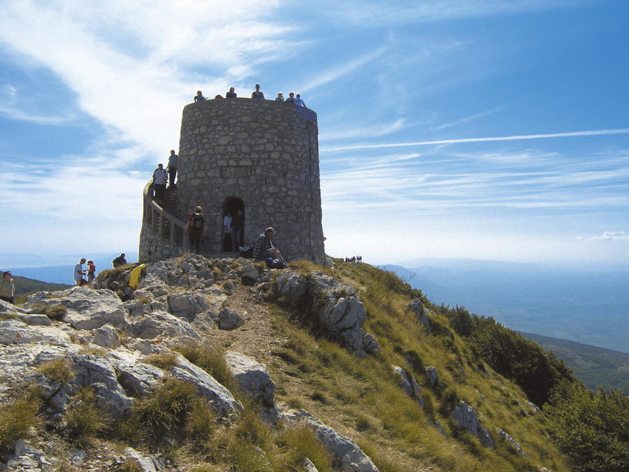
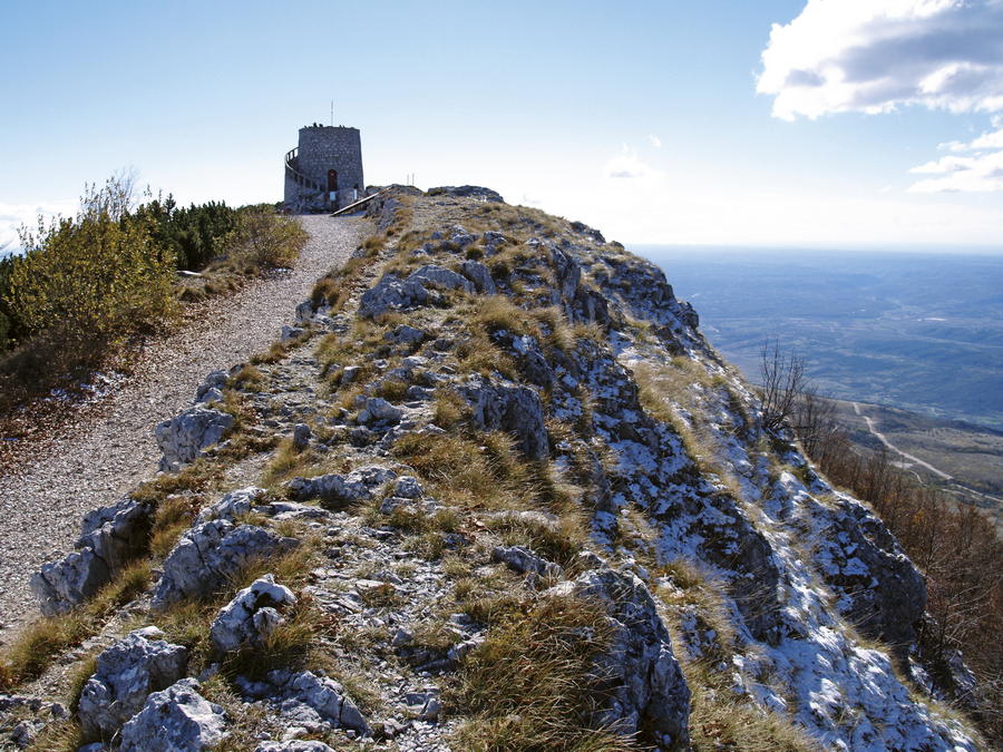
Although its appearance is common and simple, the entire massif of Učka offers plenty of wonderful views to visitors. This is particularly true for the highest peak of Vojak – one of the most amazing viewpoints of Croatia.
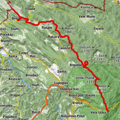
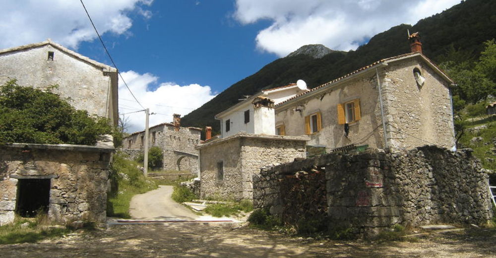
From every settlement along the Opatija riviera (Opatija, Lovran, Medveja, Ika, Ičići, Mošćenica), there is at least one access to Poklon or directly to Vojak as the highest peak. The elevation difference in these climbs is approximately 1400 meters, so hiking is long and hard, but also remarkably interesting due to the wealth of nature and its diversity from one elevation span to another. The best access to the peak is from the mountain pass Poklon, because this access is the easiest and quickest. There is an asphalt road in good condition passing over Poklon.
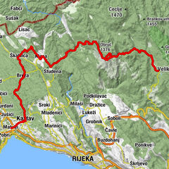
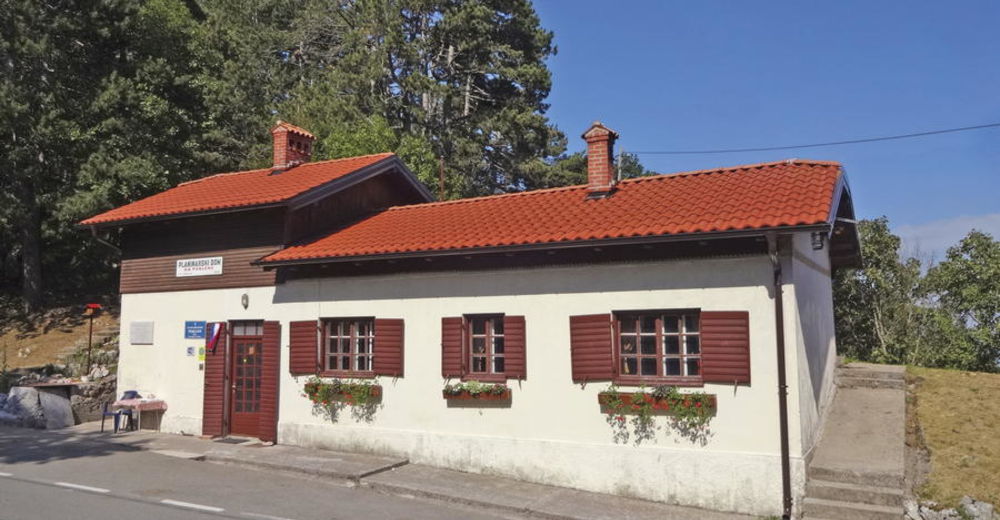
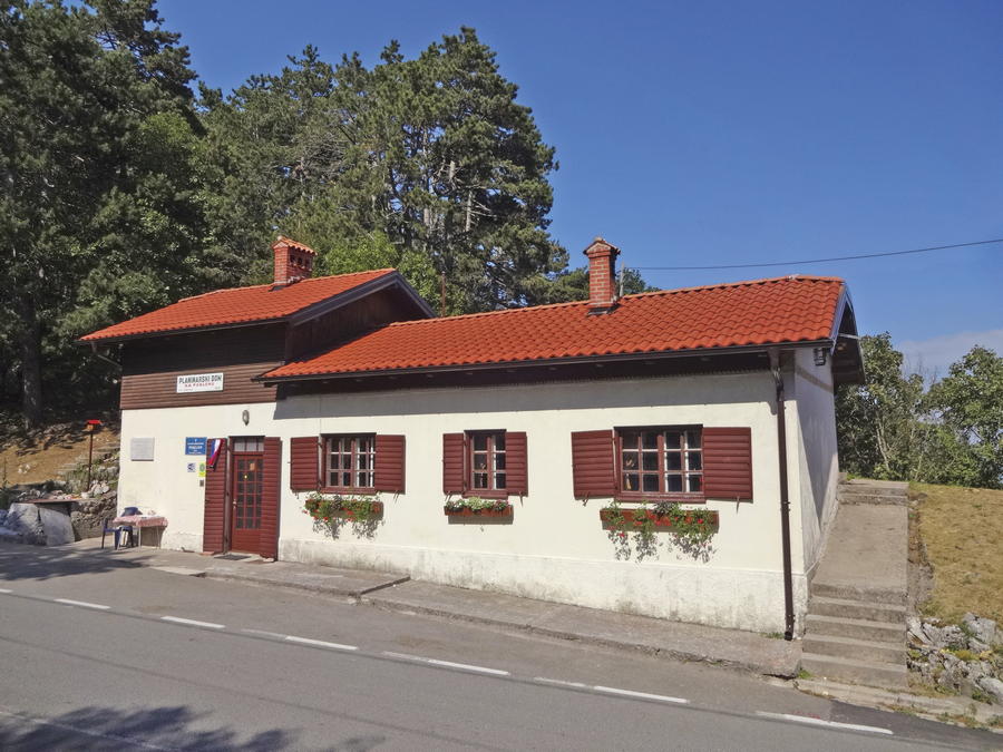
In the Učka Nature Park area, the Via Dinarica Blue Line follows the route of the Istrian Hiking Trail. From the peak of Veliki Planik, it takes 2 hours and 30 minutes to reach the mountain pass Poklon along the road. A mountain lodge and several service facilities are available there.
From Poklon, there are two routes leading to Vojak – the highest peak of Učka (the climb takes one hour and a half). After a climb to Vojak, we need to return to Poklon, and then continue from there to Veprinac. We can reach Veprinac along a road, or along a high hiking trail leading across the peak of Brložnik. However, the best route is to take a tour along one section of the Opatija Hiking Trail (Opatijska planinarska obilaznica). The route takes us across the peak of Orjak, and then to Matulji – a settlement on the outskirts of Rijeka.
- Highest point
- 1,374 m
- Endpoint
-
naselje Matulji
- Height profile
-
 © outdooractive.com

-

-
AuthorThe tour Via Dinarica HR-B-03 Učka Nature Park is used by outdooractive.com provided.


-
Opatija
11