- Brief description
-
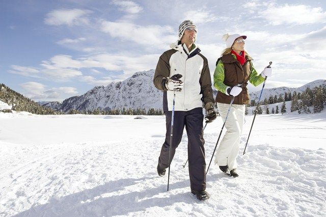
Nature lovers who need a few hours for themselves will find new serenity during winter hiking.
- Difficulty
-
medium
- Rating
-
- Route
-
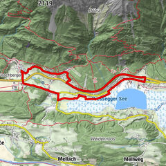
Tressdorfer Alm0.0 kmKristall0.1 kmSonnenalpe Naßfeld2.0 kmTressdorfer Alm4.0 km
- Best season
-
AugSepOctNovDecJanFebMarAprMayJunJul
- Description
-
Would you like to get to know winter from a different side? Then let's get out of here! The variety of landscapes between mountain, lake and valley opens up a real treasure trove of recreational opportunities even off the slopes. Nature lovers who need a few hours to themselves will find new serenity when they go ski touring, snowshoeing, cross-country skiing or ice-skating. Time for togetherness remains with horse-drawn sleigh rides or a relaxing wellness day. Big and small bundles of energy find the right mix of movement and fun while tobogganing or in the water and wellness oasis "Aquarena" in Kötschach-Mauthen. And those looking for a pimple-hard sporting challenge can test their limits with ice climbing.
- Directions
-
Over the 4-kilometre-long winter hiking trail they complete 110 metres in altitude.
- Highest point
- 1,585 m
- Endpoint
-
Sonnenalpe Nassfeld
- Height profile
-

- Directions
-
Begin via the B111 to the Tröpolach junction. Follow the Nassfeldpass road to the parking lot Millennium-Express or to the Sonnenalpe Nassfeld.
- Public transportation
- Parking
-
Parking spaces are available at the Millennium-Express or directly at the Sonnenalpe Nassfeld!
- Author
-
The tour Tressdorfer Alm - Sonnenalpe Nassfeld is used by outdooractive.com provided.
GPS Downloads


General info
Refreshment stop
Other tours in the regions