


- Brief description
-
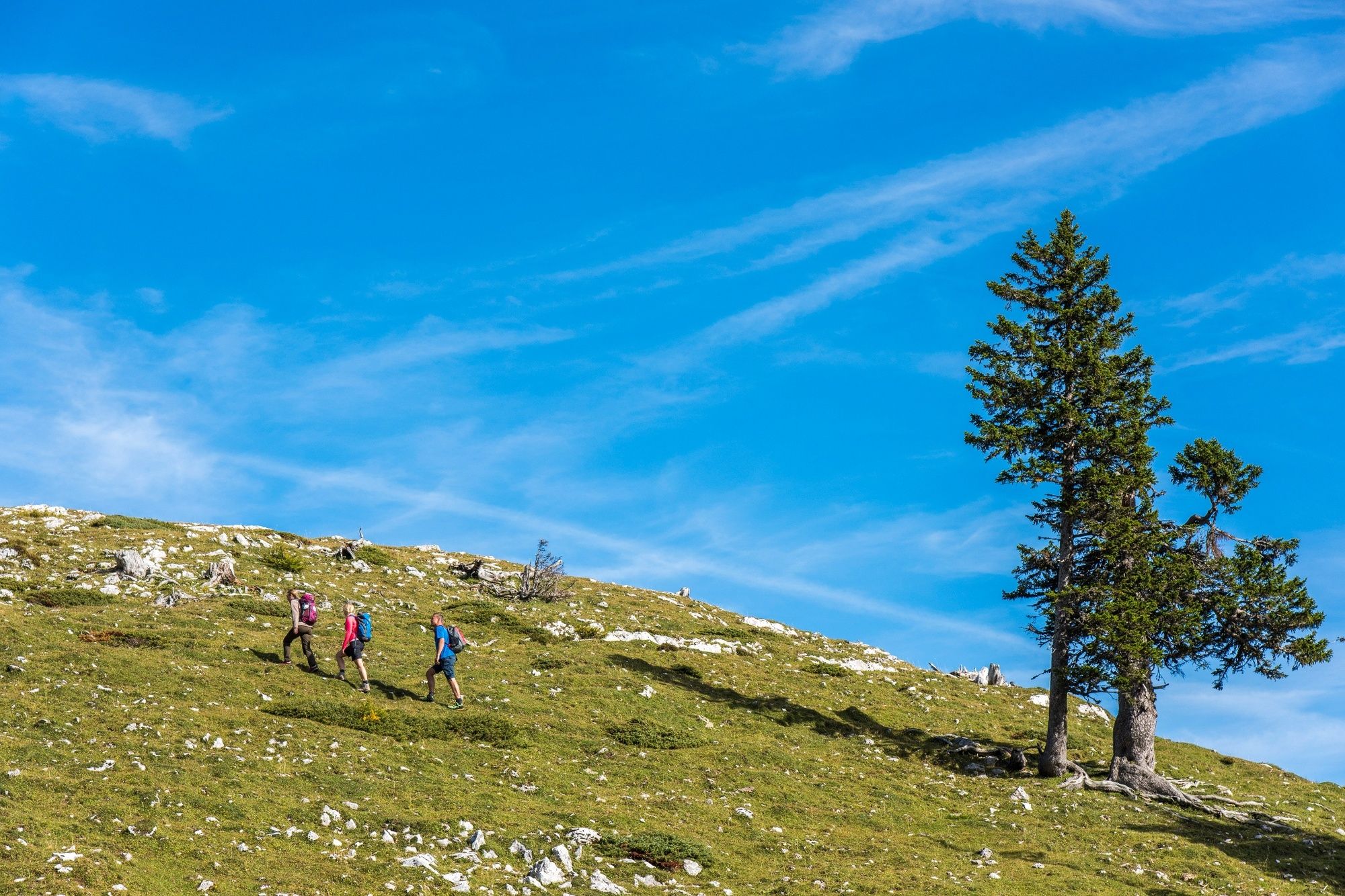
The attractive tour leads from the restaurant Rosstratte (1732 m) via the Jägersteig to the summit of the Dobratsch (2166 m) and offers fantastic views.
- Difficulty
-
difficult
- Rating
-
- Starting point
-
Restaurant Rosstratte
- Route
-
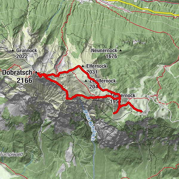
Rosstrattenstüberl0.0 kmRosstratte0.0 kmZehnernock (1,956 m)2.0 kmDobratsch Gipfelhaus4.5 kmDobratsch (2,166 m)4.7 kmHl. Maria am Stein4.8 kmElfernock (2,031 m)6.3 kmZwölfernock (2,049 m)6.7 kmRosstratte8.9 kmRosstrattenstüberl9.0 km
- Best season
-
JanFebMarAprMayJunJulAugSepOctNovDec
- Description
-
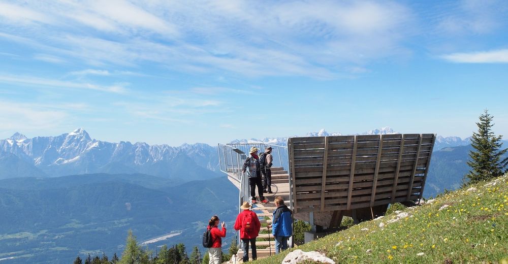
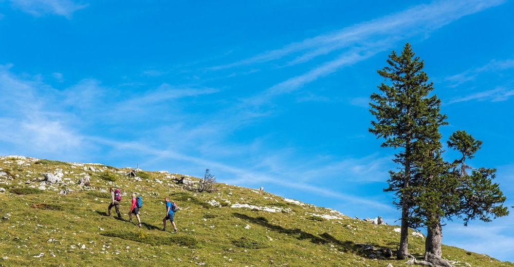
The trails at Dobratsch are very well marked. The Jägersteig is a narrow path, starting at the view point "Gamsblick", iand requires absolute surefootedness in rough and steep terrain. On the other hand, the descent is a wide gravel road, which is also well accessible for families.
- Directions
-
From the start at the Rosstratte the way leads past the adventure playground and follows the geological educational trail towards Hoehenrain. Shortly after entering the pasture area (pasture gate) follow the road (route 291). Take the first turn to the right and follow the way to the obversation deck "Gamsblick". After a short stop at the plattform, follow the way back to the main track. From there follow the grave road up to the next junction. Take the path no. 294 towards the "10er" summit and you will reach die former lift stattion with lots of information about the history of the mountain. From there follow the small path no. 294 towards west to a small ridge. From there you have to walk down towards the Bärengraben (Bear´s rift. Follow the markings trough a dwarf pine forest along the edge - just before you get to the summit house you will get back to way no. 291.
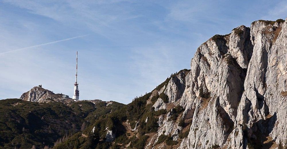
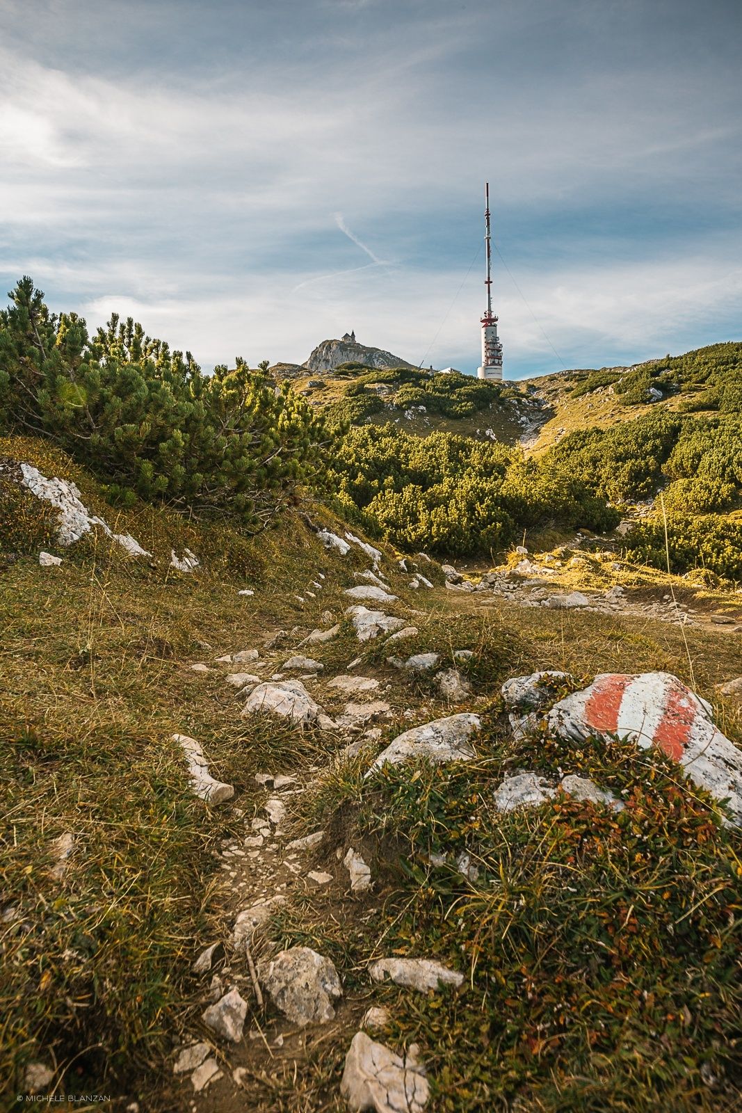
The majestic transmission tower on Dobratsch is a 167-meter hybrid tower for Radio and TV and is situated at an altitude of about 2115 metres.
Before you stop at the summit house we suggest to climb up to the summit, especially to the two churches Maria am Stein and the "Windische Kapelle". After enjoying the wonderful view it is only a few minutes back to the well deserved stop at the summit house (built in 2010). The descent is along the path no. 291 towards Elfernock and then you have to follow the road until you get to the Rosstratte.
- Highest point
- 2,155 m
- Endpoint
-
Restaurant Rosstratte
- Height profile
-

- Equipment
-
We suggest good hiking shoes, backpack, underwear, rainwear, hiking poles, food, drinks, maps, first aid and a mobile phone!
- Safety instructions
-
This tour is an alpine hiking tour with alpine dangers (some places require absolute surefootedness, change of weather, fog, lightning storms, stone chippings etc.).
Families with children ought to use the normal route via path no. 291!
- Tips
-
In the former lift house Zehnernock visitors can learn more about the history of the Dobratsch (construction of the Villach Alpine Road, construction of the ORF transmitter etc.). It is also a good idea to conclude the tour with a visit to Andrea Riedel´s Rosstrattenstüberl, where she spoils her guests with delicacies from the Carinthian cuisine.
- Additional information
- Directions
-
Via the toll road from Villach-Möltschach up to the Rosstratte car park at 1,732 m above sea level. You will cover 16.5 km, 116 curves, 1,200 hm and enjoy sensational views of the Karst mountains and mountain peaks in neighbouring Slovenia and Italy.
- Public transportation
- Parking
-
Parking at Rosstratte (Parking lot 11)


- Author
-
The tour Dobratsch - Jägersteig is used by outdooractive.com provided.