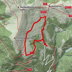
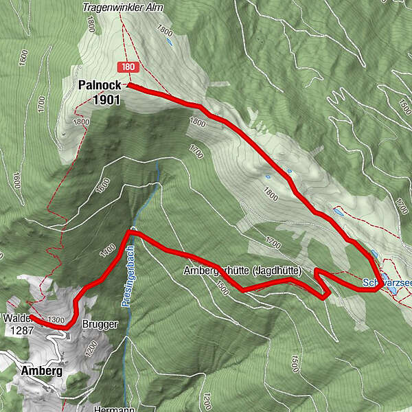
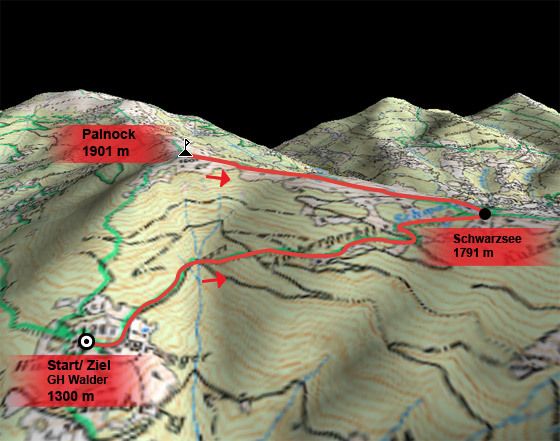
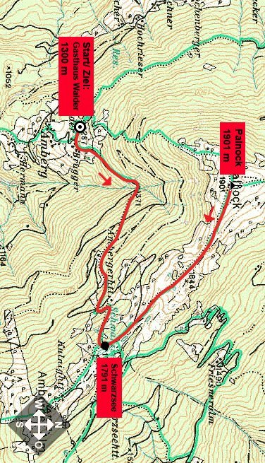
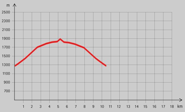
Paternion: Palnock

Logo Paternion: Palnock
Tour data
5.26km
- 1,901m
Distance
620hm
Ascent
04:45h
 
Duration
Brief description

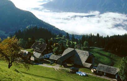
Eine landschaftlich sehr reizvolle Wanderung mit herrlicher Aussicht vom Gipfel.

Rating
Technique
Fitness
Landscape
Experience
Starting point

Gasthaus Walder (1300 m)


Highest point
1,901 m

Rest/Retreat

Gasthaus Walder

Ticket material

Info phone

+43 (0) 4766/3700-0

Link

Overall rating

5

0

%

4

0

%

3

0

%

2

0

%

1

0

%

Error
An error has occurred. Please try again.
Thank you for your review

Rating has been deleted

GPS Downloads
  • GPX GPS Exchange Format (XML)
  • KML Google Earth, Google Maps
QR Download Codes for Mobile Phones

Trail conditions

Asphalt
Gravel
Meadow
Forest
Rock
Exposed

Popular tours in the area

Mirnock vom Osten

easy Hiking
8.82km | 627hm | 04:30h

Dobratsch

Hiking
4.54km | 509hm | 03:30h

Gorge Path, Millstatt

difficult Hiking
8.58km | 997hm | 05:30h

Sonnwiesenrundweg

medium Hiking
4.67km | 230hm | 01:40h