


- Brief description
-
A hike for the body and mind around the summit of the Gerlitzen Alps.
- Difficulty
-
easy
- Rating
-
- Starting point
-
Gerlitzen Summit
- Route
-
Gerlitzen Gipfelhaus Restaurant0.0 kmGerlitzen (1,909 m)4.2 km
- Best season
-
JanFebMarAprMayJunJulAugSepOctNovDec
- Description
-
Various artists have created many places of rest and reflection on the Gerlitzen Alpe in recent years, many of which line the path of the "Traumbogen" high-altitude circular trail.
- Directions
-
The Traumbogen Höhenrundweg leads from the starting point of the Gerlitzen summit cable car mountain station first in the direction of Bergeralm (path no. 175). After a few minutes on foot, turn left in the direction of Neugarten Almseehütte and soon you will reach the so-called Bergreich, the respiratory organ of the Gerlitzen. At the next crossroads, keep to the right and continue descending in the direction of Neugarten Almseehütte.
After the sparse forest you cross the lift line of the Neugarten lift and climb slightly towards Alpengasthof Pacheiner until you cross the Gerlitzen summit road and reach the Himmelspirale, a perfect place to pause and take a deep breath. We continue in the direction of the Bergeralm, slightly sloping through the light larch trees, which in the "Alpine Battle Zone" defy the elements in both summer and winter.
The path no. 176 of the ÖAV is crossed and at the same height you cross the gentle sunny slope in a south-east direction. If you look to the left up to the summit, the German Tower (stone tower) catches your eye. This tower was built in 1943 by the German Air Force and is now part of the observatory on the Kanzelhöhe. The dome was no longer put on because of the end of the war and remained packed in the delivered boxes.
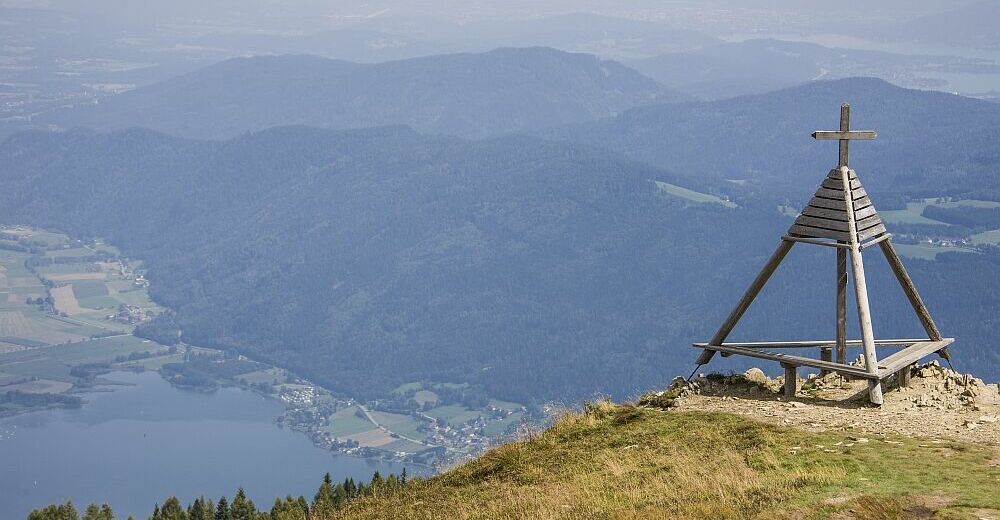
The path now continues to the source of the Finsterbach, which forms waterfalls in the valley near Sattendorf over three rock steps up to a height of 34 meters. After a slight ascent, you reach the Jakobsleiter above the Bergeralm. A magnificent view towards the Carinthian Unterland prepares itself in front of the hiker. From here you follow the ridge staying (path no. 73). After the first terrain step you cross the Greeting to Tibet, followed by a landscape picture frame and the weather cross. The weather cross marks the intersection of the municipalities of Arriach, Steindorf and Treffen and was often erected as a trigonometric survey point in the past. A look through the Viscope adventure telescope also reveals the names of the surrounding mountains.
From here, the starting point of the 360-degree panorama tour is soon reached at the summit cable car mountain station (path no. 175).
- Highest point
- 1,906 m
- Endpoint
-
Gerlitzen Summit
- Height profile
-

- Equipment
-
Hiking shoes, drinking water, binoculars etc.
- Safety instructions
-
Remember to check the weather conditions in the mountains before the hike!
- Tips
-
With this hike you should leave enough time to properly enjoy the magic of each of the spiritual places!
- Additional information
- Directions
-
Annenheim is most easily reachced with the A10 highway- exit at "Villach-Ossiacher See." From there you take the gondola to the middle station and a chairlift to the summit.
- Public transportation
-
The Gerlitzen gondola is best reached with the S2 train of the ÖBB- get out at the Annenheim stop. The gondola then takes you to the middle station and you take a chairlift to the summit.
- Parking
-
There are plenty of parking spaces in the valley station (Annenheim Kanzelbahn).


- Author
-
The tour Traumbogen Circuit is used by outdooractive.com provided.