
- Brief description
-
A short and family-friendly hiking tour with many atttractions along the way.
- Difficulty
-
easy
- Rating
-
- Starting point
-
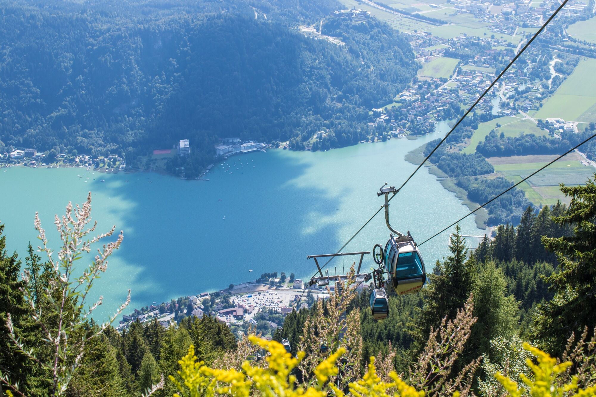
Kanzelbahn Mountain Station
- Route
-
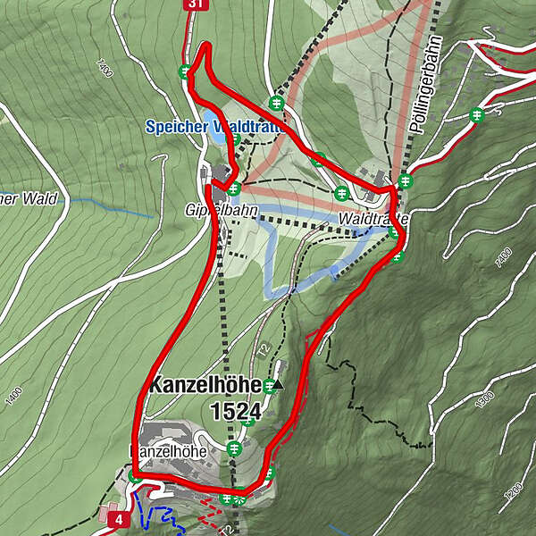
Kanzelbahn0.0 kmKanzelhöhe0.7 kmKanzelhöhe (1,524 m)1.3 km
- Best season
-
JanFebMarAprMayJunJulAugSepOctNovDec
- Description
-
The Kanzelrundweg is a circular route which leads in a family-friendly distance to sights and attractions such as the old cable railway station of the Kanzelbahn, the solar observatory, the adventure park Gerlitzen and many more. Along the way you will find information boards about the local flora and fauna.
- Directions
-
Starting from the mountain station of the Kanzelbahn, follow either the paved road or the parallel forest and meadow path to the Kanzelhöhe where you join the Kanzelhöhenpromenade (path no. 176). After a few minutes' walk, you reach the old mountain station of the Kanzelbahn on the right-hand side. The paved road leads to a lovely gravel path, along which information about the regional flora and fauna is given. A few minutes' walk after the last information board you reach the highest point of the circuit with the Waldtratte. You cross the slope here and reach a large car park. From here it goes over the paved road again through a short tunnel (caution!) downhill to a left turn. Here you turn sharp left in the direction of the reservoir (path no. 31) and reach the starting point again at the mountain station of the Kanzelbahn.
- Highest point
- 1,506 m
- Endpoint
-
Kanzelbahn Mountain Station
- Height profile
-

- Equipment
-
Light hiking boots, backpack, rain gear, hiking poles, food and drink, maps, first aid and a mobile phone.
- Safety instructions
-
This tour can be done with baby carriages - just make sure that you have the bigger tires on because parts of the way are on gravel tracks.
- Additional information
-
Region Villach Tourism
+43 4242 42000
www.visitvillach.at
- Directions
-
Annenheim is best reached via the A10 motorway exit "Villach-Ossiacher See". From there you take the Gerlitzen Kanzelbahn up to the summit.
- Public transportation
- Parking
-
There are enough parking spaces available at the valley station.

- Author
-
The tour Kanzelhöhe Circuit is used by outdooractive.com provided.