
- Brief description
-
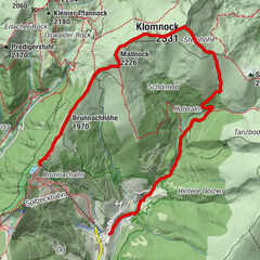
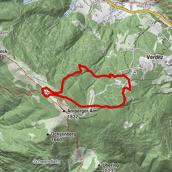
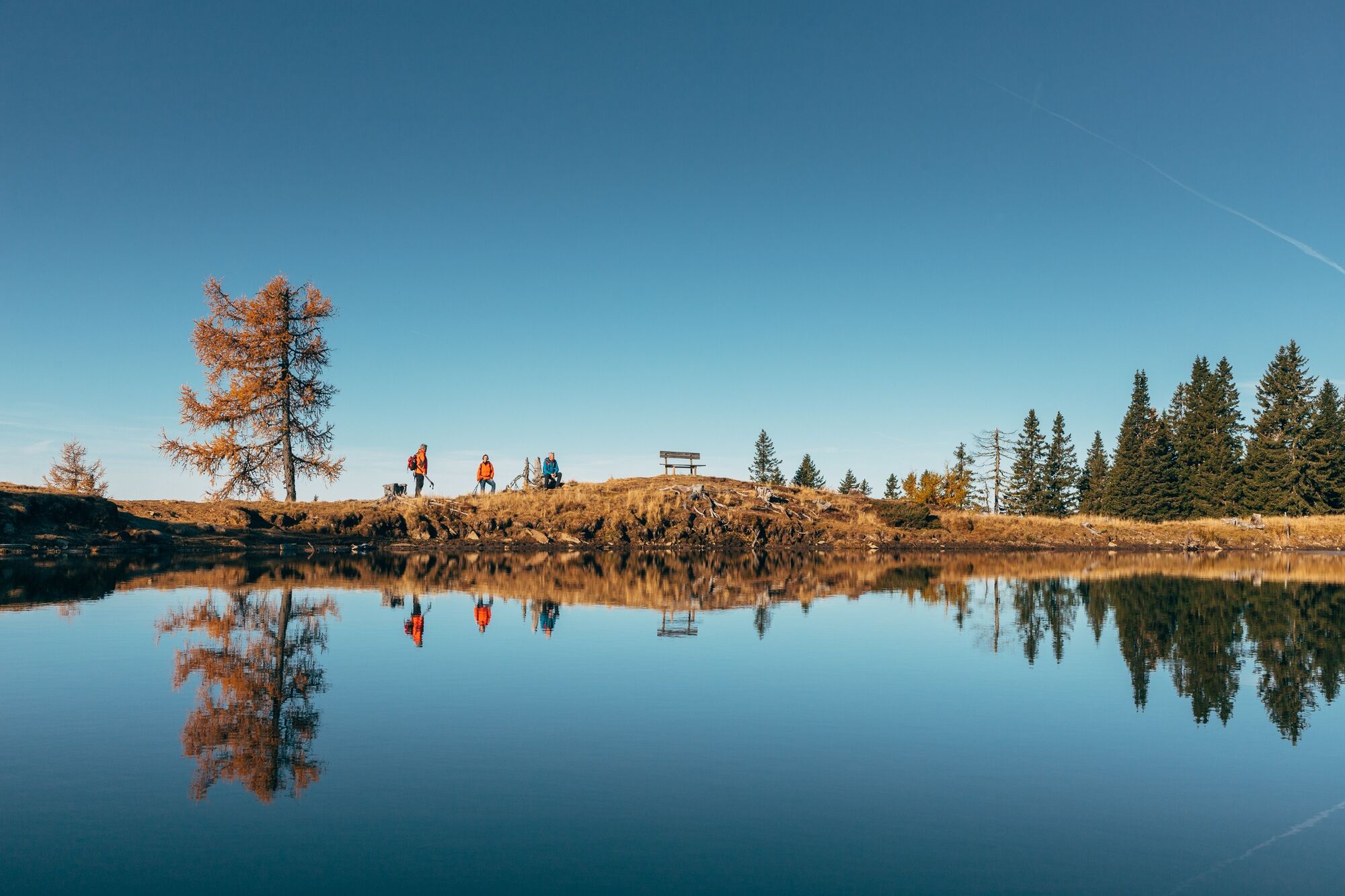
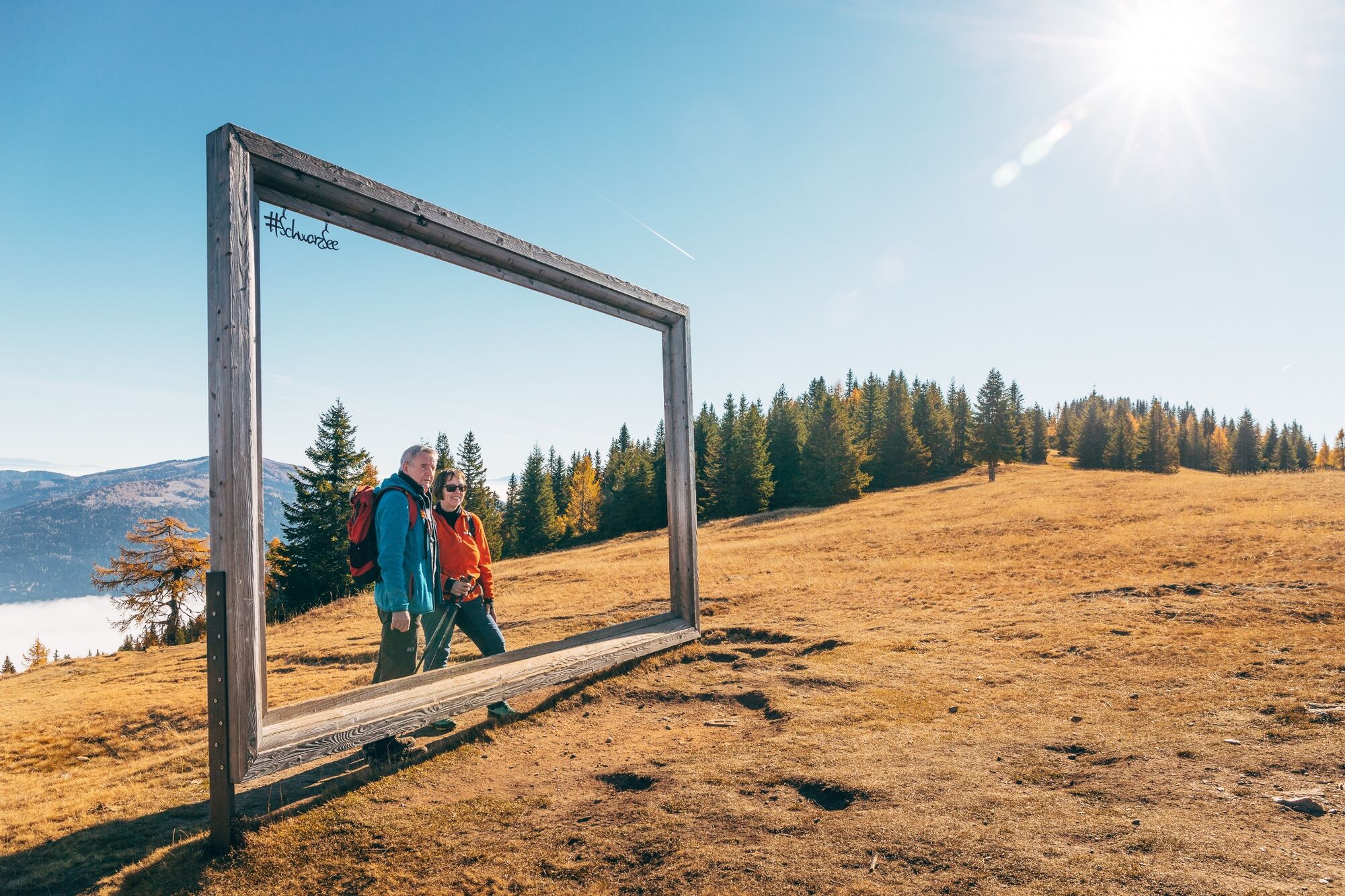
Medium to difficult hike up to Lake Schwarzsee.
- Difficulty
-
medium
- Rating
-
- Starting point
-
Lärchenboden
- Route
-
Schwarzseehütte4.0 km
- Best season
-
JanFebMarAprMayJunJulAugSepOctNovDec
- Description
-
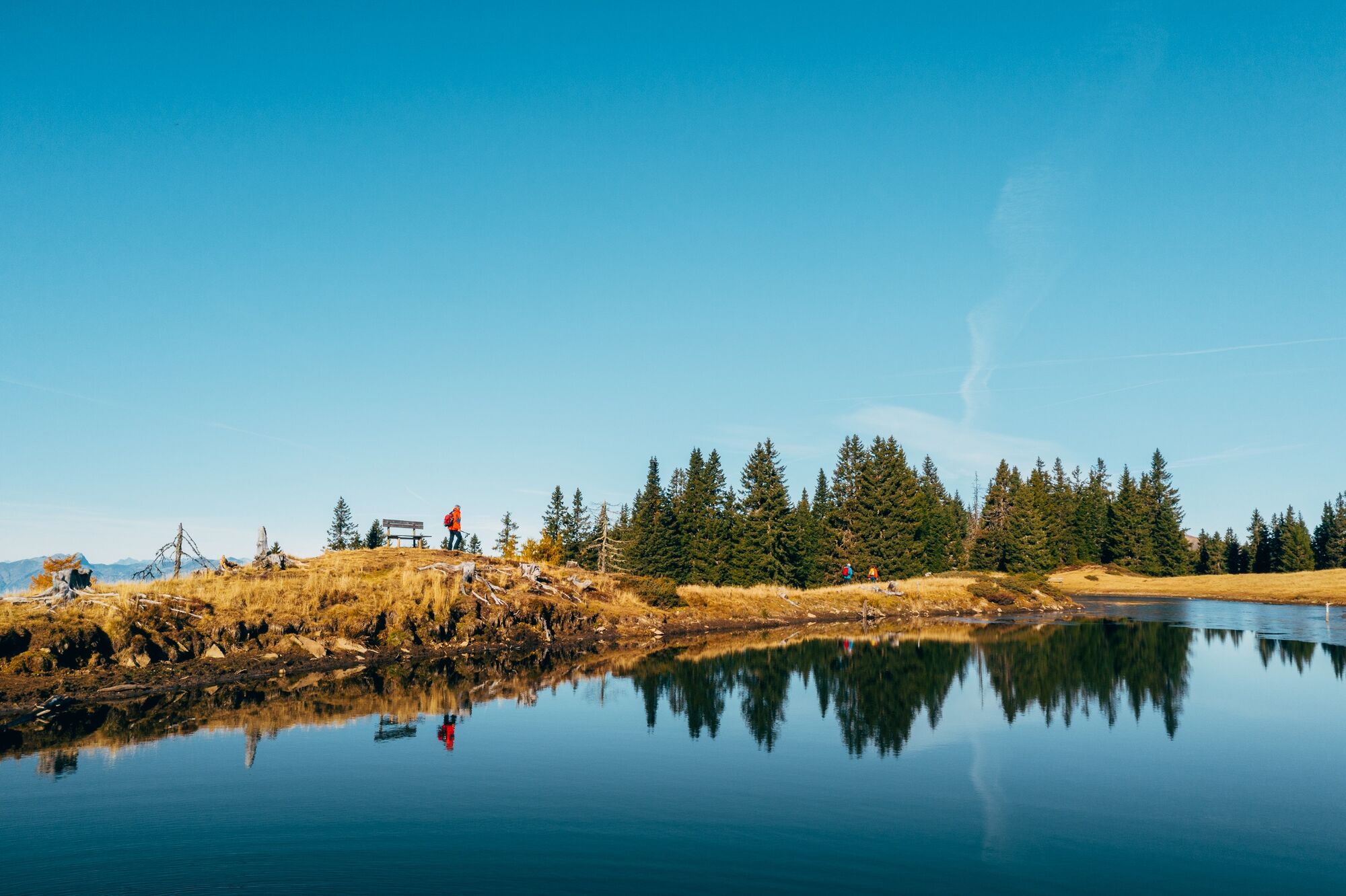
This hike takes you to the idyllic Lake Schwarzsee and then back to the starting point via a different route.
- Directions
-
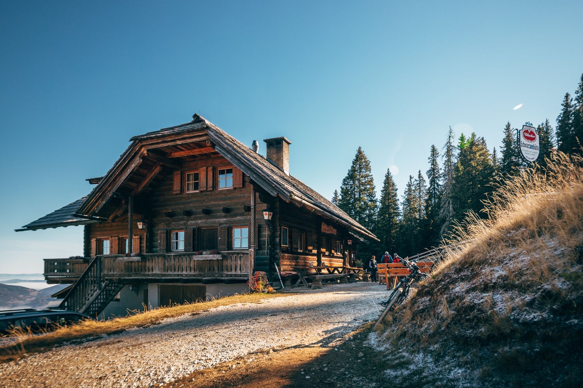
From the village of Afritz you begin the hike on Verditzer Strasse in the Lärchenboden parking lot, where there are plenty of spots to park. From there, the intermediate hike takes you to the idyllic Lake Schwarzsee. After a stroll around the small lake you can get delicious food in the Schwarzsee Hut, which is open from the middle of May until the beginning of October. After that you get on hiking trail 28 and take a right towards "Steinhauserhütte" after about 1 kilometer. Shortly after the hut you will reach Verditzer Strasse again, which you stay on until getting back to the starting point.
- Highest point
- 1,796 m
- Endpoint
-
Lärchenboden
- Height profile
-

- Equipment
-
Hiking shoes, rain jacket and drinking water.
- Safety instructions
-
Please keep the weather conditions in mind.
- Tips
-
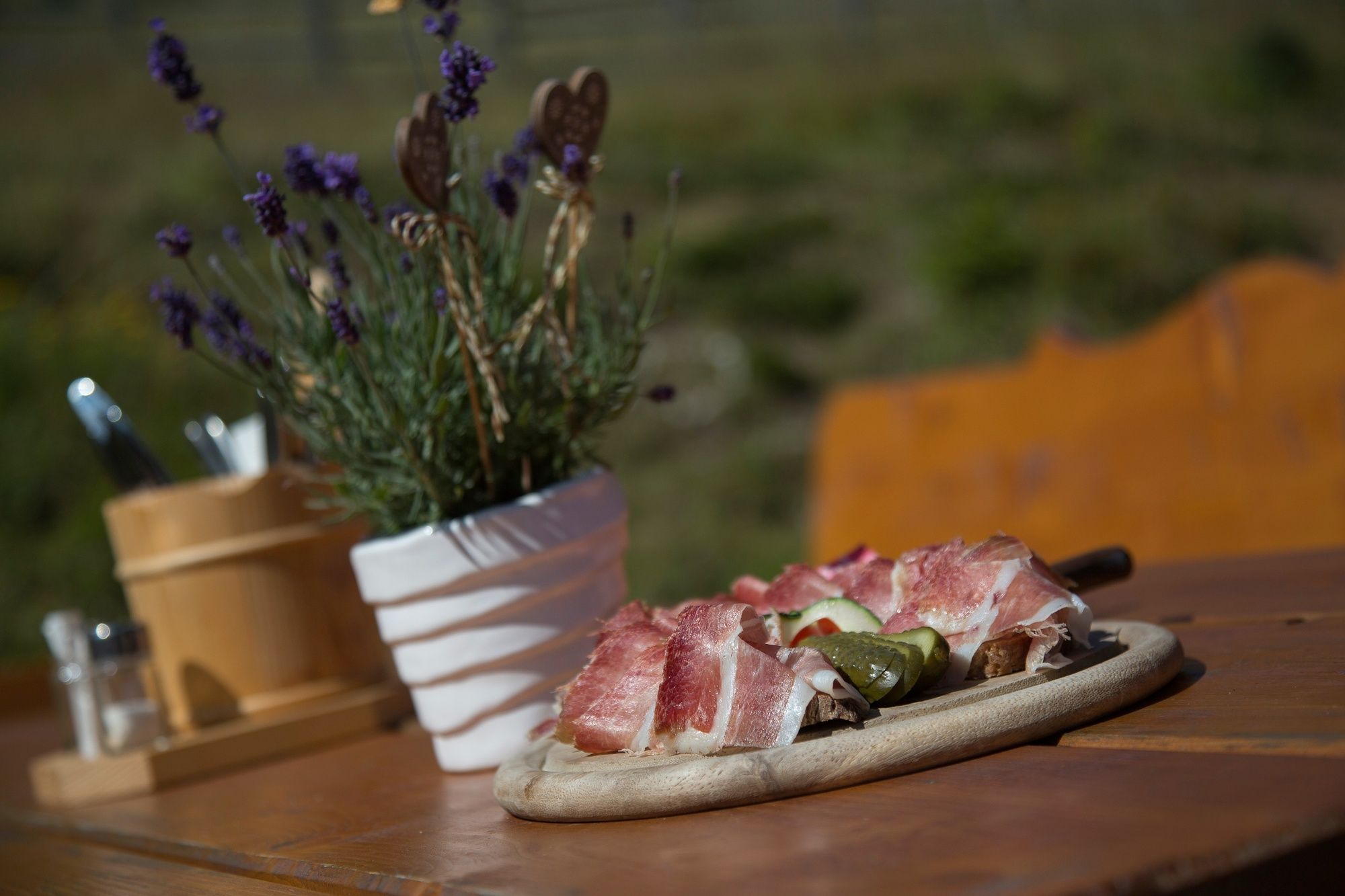
Visit the Schwarzsee Hut and enjoy Carinthian specialties! www.schwarzseehuette.at
- Additional information
- Directions
-
The easiest way to reach Afritz is taking the "Villach-Ossiacher See" exit and following the main road (Bundesstrasse) towards Treffen and Radenthein. The access road to Verditzer Strasse can be found in the middle of Afritz, on the left side.
- Public transportation
-
The starting point of this hike is not reachable with public transportation.
- Parking
-
You can find parking in the Lärchenboden parking lot.
- Author
-
The tour Schwarzsee Circuit is used by outdooractive.com provided.