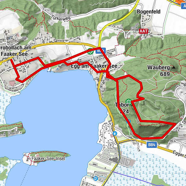
Aussichtsberg Tabor, 725 m

Hiking
Map
Hide map
Print

Which problem do you want to report on this tour?

Tour data
5.6km
554 - 710m
Distance
186hm
Ascent
02:00h
 
Duration
GPS Downloads
  • GPX GPS Exchange Format (XML)
  • KML Google Earth, Google Maps
QR Download Codes for Mobile Phones

Trail conditions

Asphalt
Gravel
Meadow
Forest
Rock
Exposed

Popular tours in the area

Mirnock Rundweg

medium Hiking
9.3km | 890hm | 05:00h

Gerlitzen- Hüttersteig

medium Hiking
5.07km | 971hm | 02:00h

Mirnock vom Osten

easy Hiking
8.82km | 627hm | 04:30h

Mittagskogel über Bertahütte

difficult Hiking
4.21km | 953hm | 05:45h