


- Brief description
-
This challenging but unique and beautiful hike leads you around the emerald-colored Lake Ossiach.
- Difficulty
-
difficult
- Rating
-
- Starting point
-
Annenheim or Steindorf
- Route
-
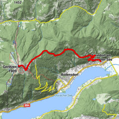
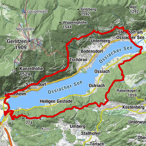
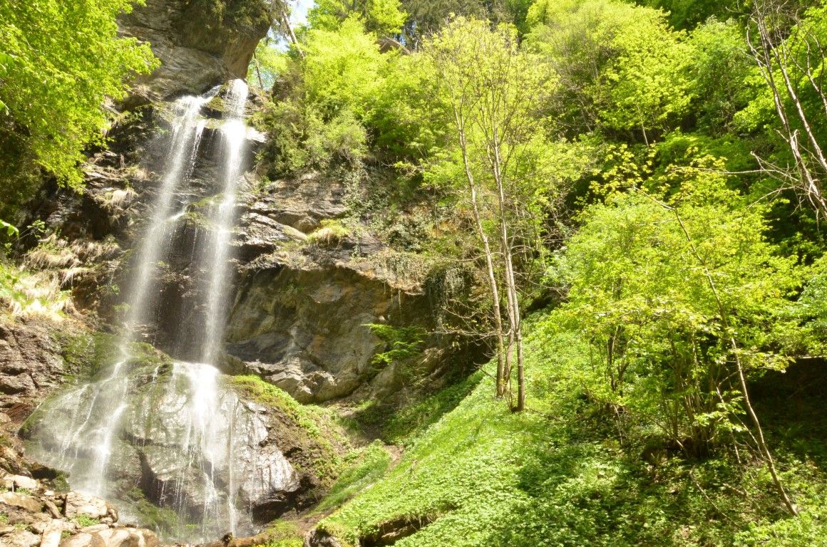
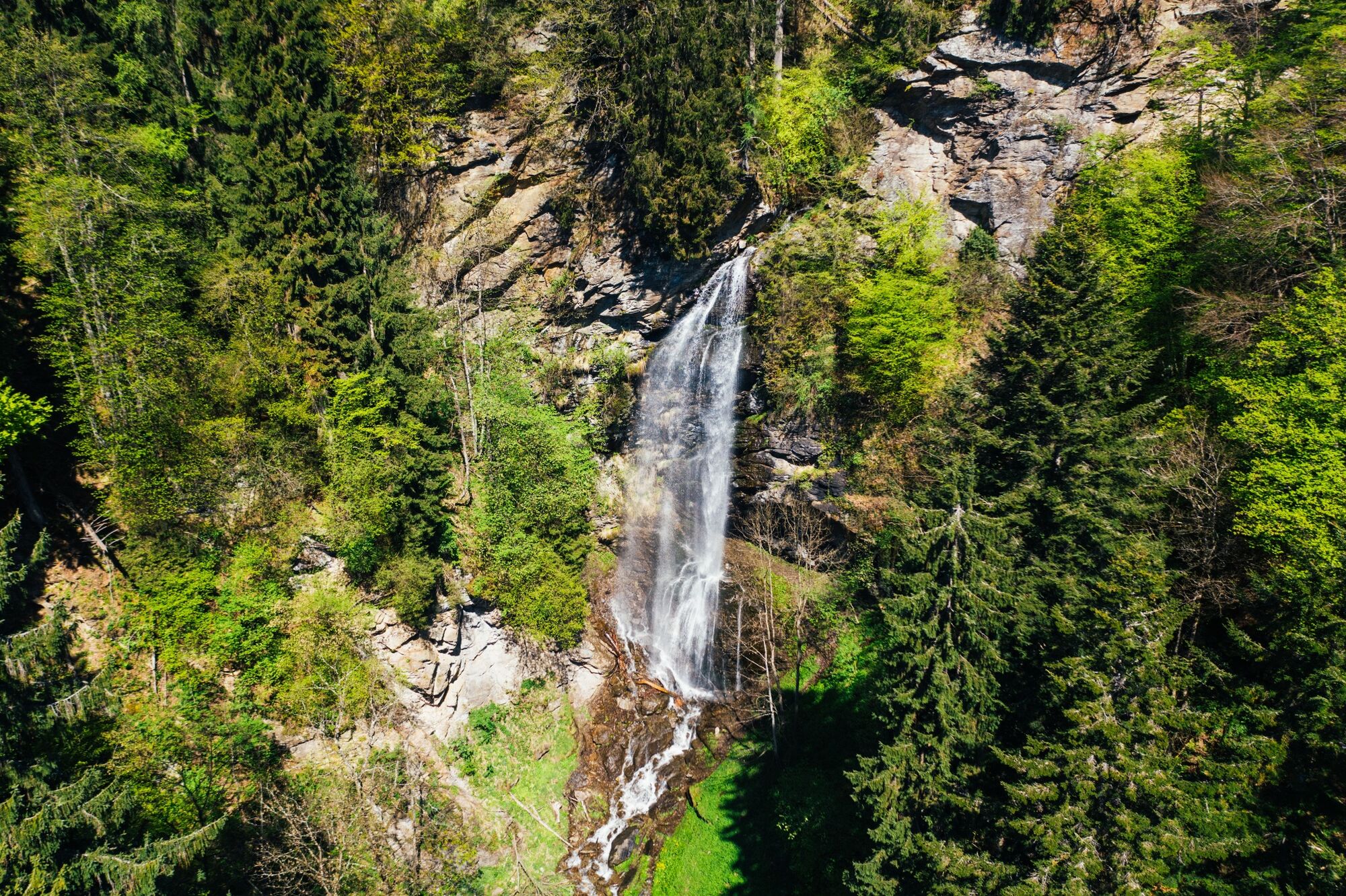
Annenheim1.1 kmFinsterbachfall (570 m)3.0 kmKesselfall (635 m)3.0 kmSattendorf3.1 kmWinkl Ossiachberg9.1 kmKathrin's Buschenschank11.1 kmOssiachberg12.3 kmSteindorfer Wasserfall13.6 kmSteindorf am Ossiacher See (510 m)14.2 kmAlt-Ossiach17.6 kmJungfernsprung30.3 kmVillach (501 m)33.5 kmAnnenheim35.5 km
- Best season
-
JanFebMarAprMayJunJulAugSepOctNovDec
- Description
-
This hike circles Lake Ossiach. It is recommended to divide the hike into two days- one day on the north shore and one day on the south shore, then take the ferry back to the starting point. The routes can also be done clockwise!
- Directions
-
Phase 1:
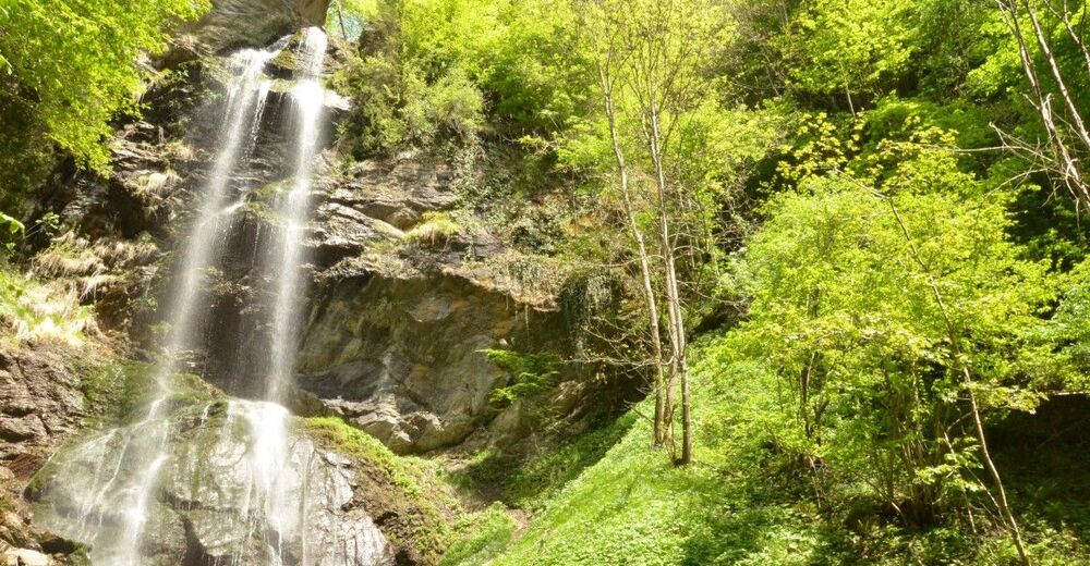
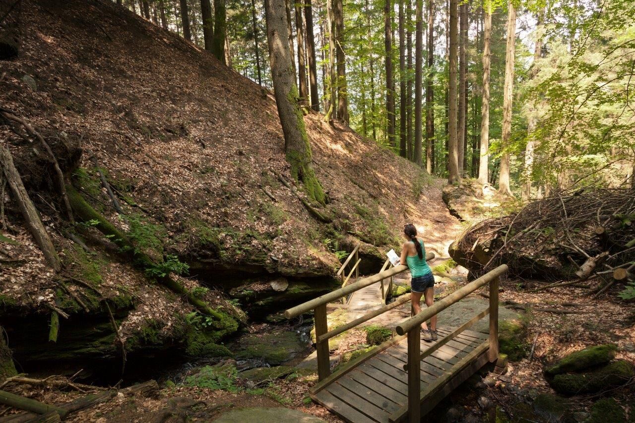
From Annenheim you set off in the direction of “Gerlitzen Kanzelbahn". Before the subwy turn left and cross the road B94. Follow the "Panormaweg", the "Bergstraße" and the "Marhofweg" until you reach the crossing of the hiking trails Nr.2 and Nr. 35. You might want to take a detour to the Finsterbach waterfalls (Nr. 2). If not, then follow the hiking trail Nr. 7, which is quite steep, until reaching Gerlitzen Bergstrasse (shortly before the “Mathiasl” Panorama Restaurant!), where you turn onto path number 3 towards “Winkl-Ossiachberg,” which leads past the “Katrin” tavern. From here you go up the mountain towards “Golk” and then take path number 41 into the valley towards the Steindorf waterfalls. After this there is just a short hike until you reach the boat pier/train station in Steindorf.
Phase 2:
From the Steindorf boat pier you follow the causeway (nr. 1) through the Bleistätter nature reserve until you reach Alt-Ossiach. You then walk across the forest boardwalk where you will reach the entrance to the “Schluchtweg” (canyon path), which is a section of the Alpe-Adria-Trail. This is a steep hike up the mountain which leads to Tauern Pond. You now take path number 8 (Obersakoparnig and Oberwinklern) and follow the Ossiach Tauern until you get to “Jungfernsprung” and further to the Landskron castle ruins. From here you follow the western shore of Lake Ossiach to the north until you get back to Annenheim.
- Highest point
- 1,000 m
- Endpoint
-
Annenheim
- Height profile
-

- Equipment
-
Good shoes, drinking water, and a rain jacket.
- Safety instructions
-
The whole tour is difficult and exhausting- it is highly recommended to split this tour into two days!
- Tips
-
Shortly before "Gasthaus Matthiasl" there is a path that leads to "Peterlewand," where there is a small pavillion with a beautiful view of the see! A perfect spot for a picnic!
- Additional information
- Directions
-
The best option for arrival is taking the A10 highway- "Ossiacher See" exit.
- Public transportation
- Parking
-
There are plenty of parking spaces in both Annenheim and Steindorf.


- Author
-
The tour Lake Ossiach Trail is used by outdooractive.com provided.