© Tourismusverein - Tourismusinfo Nassfeld-Pressegger See

- Brief description
-
Mittelschwere Wanderung mit schönem Ausblick über das Gailtal.
- Difficulty
-
medium
- Rating
-
- Route
-
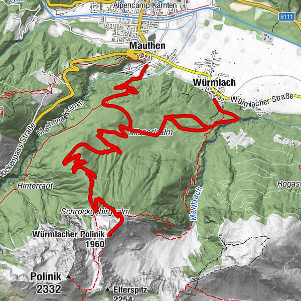
MauthenWürmlacher Polinik (1,960 m)10.0 kmWürmlach24.2 km
- Best season
-
JanFebMarAprMayJunJulAugSepOctNovDec
- Description
-
Start the hike at the parking lot, natural swimming pool Mauthen, or in Würmlach at the church via "Plattach". Hike via the Lower Missoria Alm to the Polinik Alm and on to the Würmlacher Polinik with summit cross (ÖAV trail no. 430). The hike is an all-day hike and shady. You have a beautiful view into the valleys. The difference in altitude is about 1,100 m.
- Directions
-
Take food with you, as the alp is not farmed!
- Highest point
- 1,912 m
- Endpoint
-
Würmlach
- Height profile
-


- Author
-
The tour Würmlacher Polinik is used by outdooractive.com provided.
GPS Downloads


Other tours in the regions