
- Brief description
-
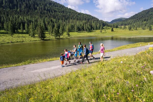
Over almost endless mountain slopes, nock-like heights and historical paths very long and very lonely on the way in the heart of the Carnic Alps.
- Difficulty
-
medium
- Rating
-
- Route
-
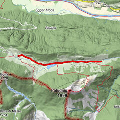
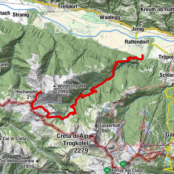
Rattendorfer Alm0.1 kmSchulter (2,057 m)3.9 kmHochwipfel (2,195 m)4.7 kmRattendorfer Alm9.2 km
- Best season
-
JanFebMarAprMayJunJulAugSepOctNovDec
- Description
-
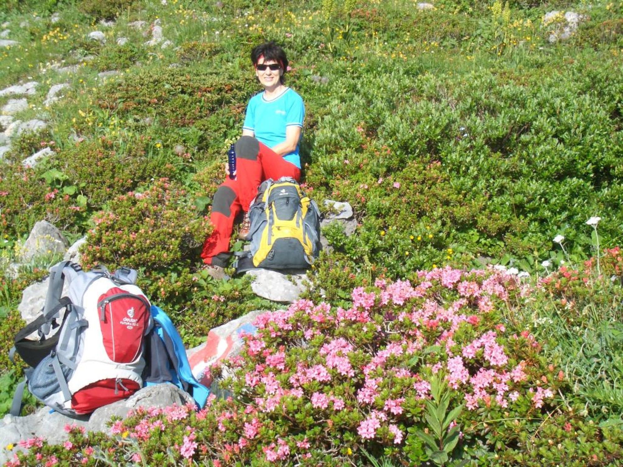
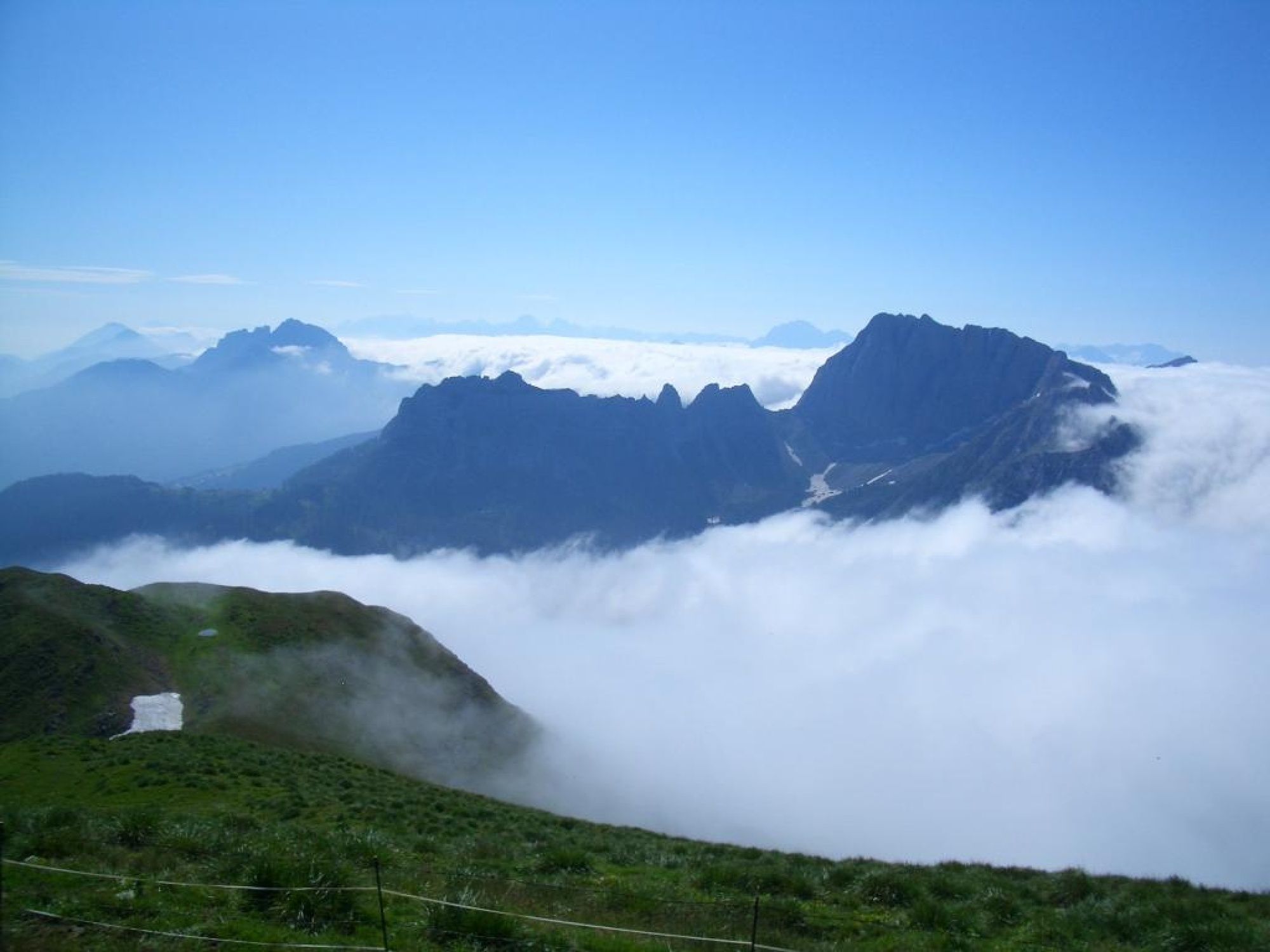
The Hochwipfel offers the hiker many special features. Starting from the Rattendorfer Alm, there is a long but easy ascent which you should be able to manage with a little endurance. The summit itself is a little bit ahead of the numerous Carnic mountain peaks in the direction of the Gailtal and guarantees - like from a pulpit - a magnificent and unrestricted panoramic view in all four directions.
Translated with www.DeepL.com/Translator (free version)
- Directions
-
DESCRIPTION (increase):
Starting from the parking lot below the Rattendorfer Alm you will reach the Alm itself in a few minutes. From here, keeping to the right, you turn south and ascend to the "Zanklhütte" after about 100 m. Above the hut a marked stone shows you the way to SW. Now you only have to walk on the well recognizable path and enjoy the treeless mountain world with its lush vegetation. Passing below the Hüttenkofel (from the top left, the ring wall looks down on you), the path leads in easy climbs and short flat passages towards the top of the mountain. In the last section immediately below the summit structure, you mobilize your strength once again and look forward to the imminent summit victory.
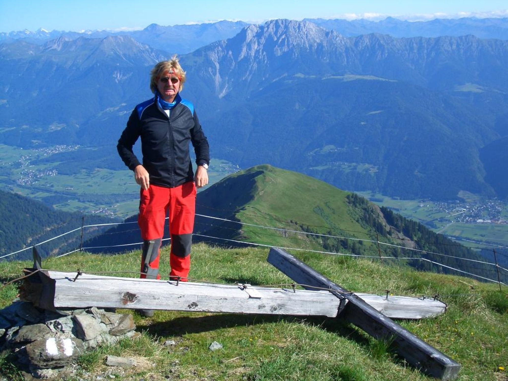
Once they reach the summit cross, they will find that the efforts of the climb were well worth it. Because the panorama is both magnificent and tremendous:
To the north, the Gailtal Alps with the mighty rock massif of the Reißkofel are just off the coast. Behind it the Hohe Tauern and various mountain groups of Upper Carinthia. From the west, the highest elevation in the Carnic Alps greets you at 2,780 m - the Hohe Warte. A little further north you can see the Lienz Dolomites, and on a clear day, the Großglockner. In the east, for example, the striking features of the Trogkofel and Gartnerkofel cannot be overlooked. And the beauty of the Julian Alps in the south speaks for itself anyway.
Let it all sink in during your well-deserved break at the summit. You have "earned" this moment for yourself.
DESCRIPTION OF THE WAY (descent):
For the descent you can choose between two options:
Either you return to the Rattendorfer Alm on the ascent path or you take the path over the ridge to the east and slightly NE, past the upper edge of the wind shovel, towards the Rattendorfer Riegelalm (1,529 m). From there, you can return along the gravelled alpine path - including numerous marked shortcuts - to the crossroads that you remembered during your car drive to the Rattendorfer Alm a few hours ago. The fact that from here they are not spared the way back to the car is only mentioned in passing. But in view of a hearty snack on the Rattendorfer Alm, even this should not be a problem anymore. In a way, as the crowning glory of a challenging mountain tour.
- Highest point
- 2,151 m
- Endpoint
-
Hochwipfel (2.195 m)
- Height profile
-

- Safety instructions
-
If you are accompanied by your four-legged friend on this tour, be sure to keep him on a leash in the alpine pasture area!
- Tips
-
There are records which show that cheese has been produced on the alpine pastures of the Gail Valley since the 13th century. The tradition of cheese-making has been handed down from generation to generation in each family for 700 years. Through the careful use of the resources that nature provides us with, the alpine dairymen contribute to the preservation of the beautiful cultural landscape.This is also the case on the Rattendorfer Alm, one of 13 member alpine pastures in this region that produce the "Gailtaler Almkäse PDO". according to a traditional, established method. The "PDO" stands for "Protected Origin" throughout Europe - you will certainly want to convince yourself of the palatability and honesty of this product after the eventful mountain tour to the top.
In the alpine hut on the Rattendorfer Alm.
In 1915-1917, this was an important supply center for the local population with numerous barracks and magazines and the top station of the cable car coming up from the Gailtal. Towards the border ridge you can still find numerous cavern entrances, foundation remains, barrel and trenches, most of which have collapsed.
If you walk up from the Rattendorfer Alm for about 30 minutes on an old war path, you will reach - directly below the "Zanklhütte" - the Scotti Chapel. In front of it are the foundations and a small flat area of a former military cemetery. The chapel, which is close to decay, was restored in an exemplary manner in 1980/81 by a local initiative. Inside an altarpiece representing the Archangel Michael, signed by "Feldwebel Cerny, k.k. steirisches Landsturminfanteriebaon Nr. 150, 1916".
- Directions
-
At the southern edge of the village Rattendorf - directly at the bottom of the valley - you will find the beginning of the well maintained mountain road (gravel road) towards Rattendorfer Alm. After a few hairpin bends, you will be greeted by the bed of the Doberbach stream, which is made up of mighty boulders. In this area you will also pass a crossroads. To the right is the Rattendorfer Riegel-Alm. You simply leave this path "on the right" and continue straight ahead. You should remember the crossroads, however, because here you may pass by again on the alternative descent from the top of the mountain. After you have passed the gate at the bottom of the alpine pasture area (please close it after passing through) the road leads you in a few last curves over free alpine meadows to the parking lot directly below the Rattendorfer Alm.
- Parking
-
Fenced parking lot a few meters below the Rattendorfer Alm. On the right side in driving direction (sign).
- Author
-
The tour Hochwipfel (2.195 m) über Rattendorfer Alm is used by outdooractive.com provided.