Tour data
3.78km
906
- 1,804m
890hm
05:00h
- Brief description
-
Wunderschöne Karawankenwanderung
- Rating
-
- Route
-
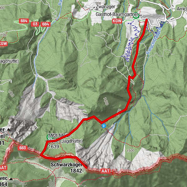
Rotschitzawasserfall1.1 kmSchwarzkogel (1,839 m)3.6 km
- Highest point
- 1,804 m

GPS Downloads


Trail conditions
Asphalt
Gravel
Meadow
Forest
Rock
Exposed
Other tours in the regions