
- Brief description
-
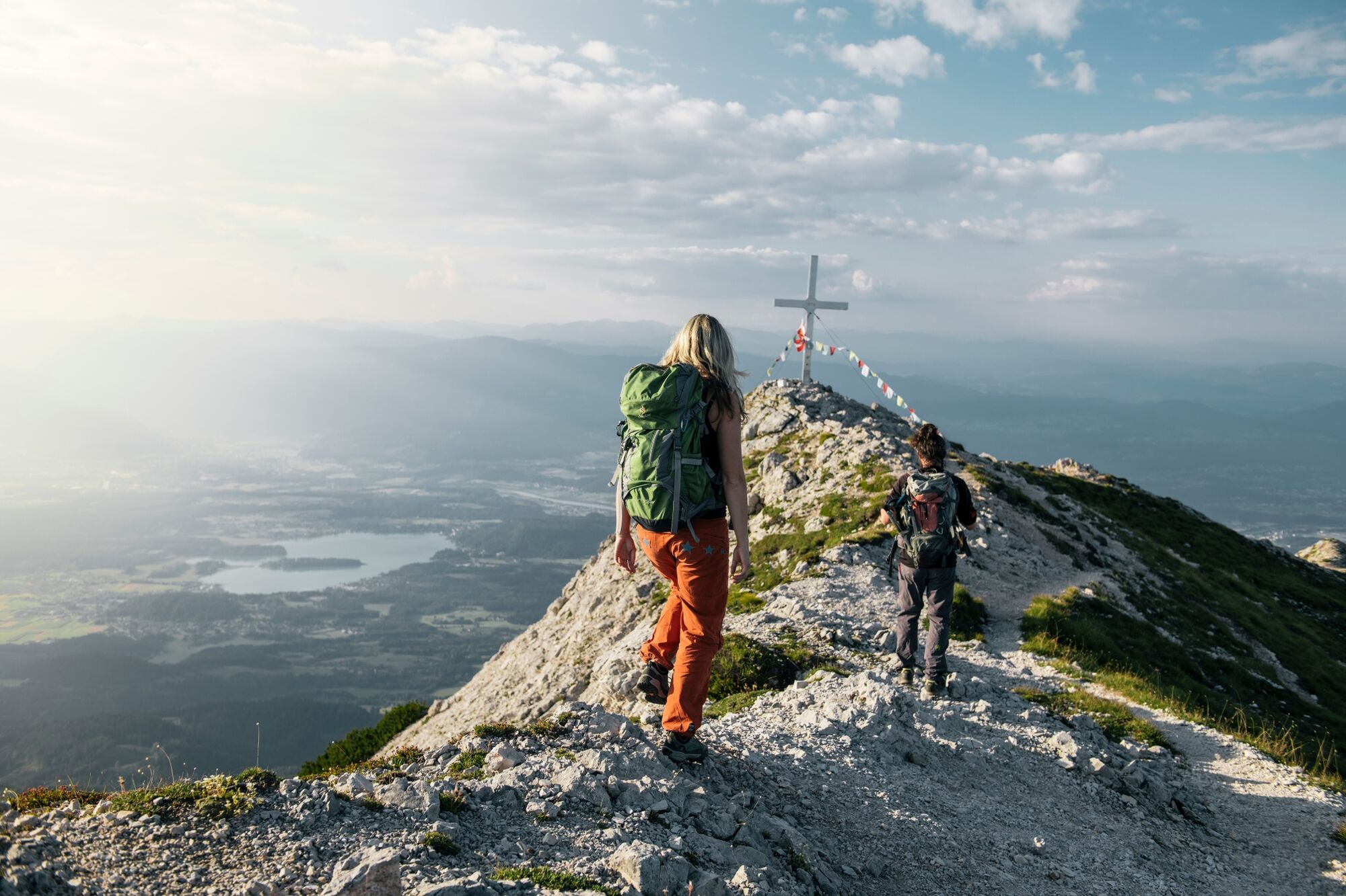
Intermediate hiking tour up to the summit of the majestic Mittagskogel.
- Difficulty
-
difficult
- Rating
-
- Starting point
-
Parking area on the forest road to the Berta hut
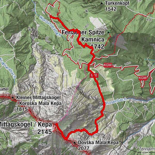
- Route
-
Bertahütte1.6 kmMittagskogel (2,145 m)4.5 kmBertahütte7.4 km
- Best season
-
JanFebMarAprMayJunJulAugSepOctNovDec
- Description
-
This moderately difficult tour starts with either the rather comfortable forest road or the steeper forest ascent to the Berta hut and from there you continue up to the summit of the Mittagskogel.
- Directions
-
With an offroad car you can drive to the parking lot on the forest road to Bertahütte. That's why the described tour starts at the parking lot, just before a gate. Follow the forest road to the barrier and then take either the forest road or the steeper forest path (path no. 680) to reach the saddle at the height of the Berta hut. From here, follow the signposted normal ascent (path no. 680) and cross right at the beginning some gorges on the east flank to the walls of the so called Hühnerkogel. From here in numerous serpentines climb and walk on the 2,070 m high saddle. Walk in a northwesterly direction to get below the summit of the Mittagskogel. The way back is on the same track.
- Highest point
- 2,131 m
- Endpoint
-
Parking area on the forest road to the Berta hut
- Height profile
-

- Equipment
-
Mountain boots with outsole, backpack, functional underwear, rainwear, hiking poles, food and drink, maps, first aid and mobile phone.
- Safety instructions
-
This tour is an alpine hiking tour and has potential dangers (thunderstorms, fog, falling rocks etc.). It requires not only a good physical state but also sure-footedness in the ascent and descent.
- Tips
-
If you prefer an easier tour, you might as well take the path from the Berta hut to the Ferlacher Spitz. Don´t forget to enjoy a traditional Carinthian snack in the hut.
- Additional information
- Directions
-
Coming from Villach or from the Rosental, take the B85 (Rosentalstraße) to Unteraichwald and turn at the Hotel Mittagskogel into the Kopeiner Straße. At the intersection Kopein, leave the road and turn right towards Bertahütte.
- Public transportation
- Parking
-
Just before the gate, there are a few parking spaces available.
- Author
-
The tour Mittagskogel Hiking Tour is used by outdooractive.com provided.