
- Brief description
-
!!! ATTENTION PARTIAL CLOSURE !!!Döbriach Brandhofer Weg to viewpoint Weißer Felsen temporarily closed due to storm damage!
- Starting point
-
Döbriach main squareHauptplatz Döbriach, Seezentrum Döbriach - parking available
- Route
-
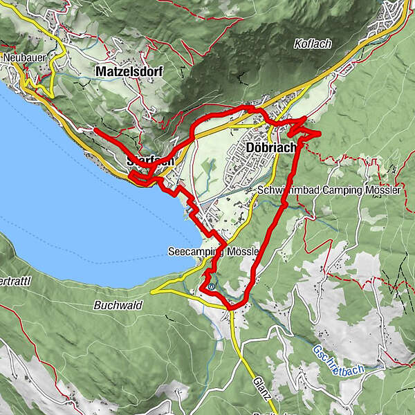
Post ScriptumDöbriach0.7 kmWeiße Wand2.0 kmGlanz3.9 kmJungfernsprung (Nockberge)6.8 kmStarfach9.4 kmPfarrkirche Döbriach11.4 kmPost Scriptum11.5 kmDöbriach11.6 km
- Description
-
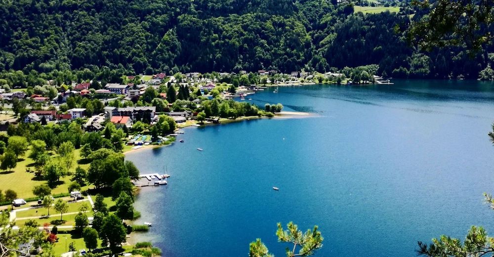
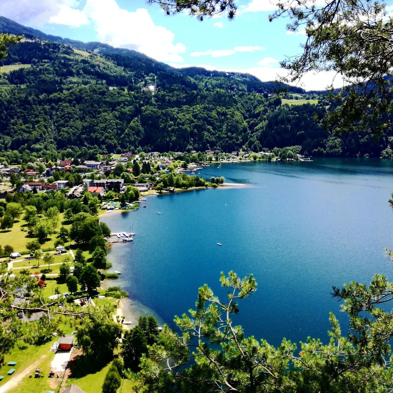
A circular trail that leads to the most beautiful places and views of Döbriach and Lake Millstätter See.
After a steep ascent at the foot of the Mirnock, the lake view circuit between the village and the countryside leads through the dark spruce forest, across the glades of the Glanz and repeatedly provides views of the lake and the Tauern massif. The lake can be experienced in its entirety here.The passage through the lake centre offers culinary variety and refreshment by the lake. At the Seespitz, site of the most beautiful sunset, and the fishermen's park with a small harbour, you can cool your tired feet and linger under shady trees.The route continues between the "Hohe Wand zu Starfach" on the traces of the Romans, once the connecting axis between Teurnia, Villach Rustica and the Gegendtal, to the church of the Knights of St. George, which was built by Millstatt Abbey in 1470.This is a very sporty, demanding loop for active hikers, which can also be completed in stages.
- Directions
-
Forest paths and tracks in the woods, partly asphalted in the villages
- Highest point
- 801 m
- Endpoint
-
Döbriach main square
- Height profile
-

- Equipment
-
Sturdy and well-worn shoes, functional clothing, sun and rain protection and drinks! No refreshment stops outside the villages of Döbriach and Glanz!
- Tips
-
Resting place "Weißer Felsen" with a wonderful view of the village of Döbriach and the entire lake - especially at sunset!
- Directions
-
from the east Südautobahn (A2) Vienna - Graz - Klagenfurt - Villach - Spittal/Drau; or from Villach via the Gegendtal to Radenthein/Döbriach - Millstätter Seefrom the south Autostrada Udine - Tarvisio - Villach - Spittal/Drau; or from Villach via the Gegendtal to Radenthein/Döbriach - Millstätter See; from the west Innsbruck - Felbertauernstraße or Brennerautobahn/Pustertal to Lienz - Oberdrauburg - Spittal/Drau to Radenthein/Döbriach - Millstätter Seefrom the north Munich - Salzburg - Tauernautobahn (A10) direction Spittal/Drau to exit Millstätter See (left turn) to Radenthein/Döbriach - Millstätter See
- Parking
-
Public car parks in Seefeldstraße, car park at the Fischerpark (chargeable in summer).
-

-
AuthorThe tour SEEBLICKRUNDE is used by outdooractive.com provided.