
- Brief description
-
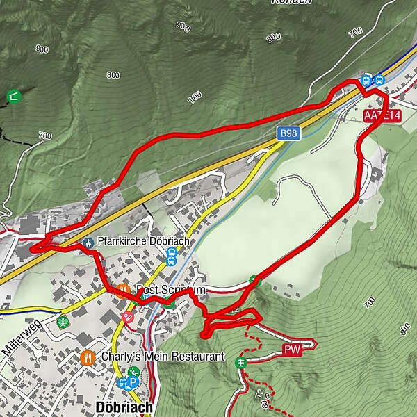
On the trail of the miners!
- Difficulty
-
easy
- Rating
-
- Route
-
Döbriach0.7 kmPfarrkirche Döbriach3.2 kmPost Scriptum3.5 km
- Best season
-
JanFebMarAprMayJunJulAugSepOctNovDec
- Description
-
Along the legend experience trail, you come to fantastic land art stations, places to stay and experience stations. Miner Peter whispers his personal stories from the mine tunnels and encounters with strange mountain spirits into the ears of the hikers. Hearonymus App: "Glück Auf - Glück Auf - The miner Peter and the mysterious voice" for free download.
- Highest point
- 673 m
- Endpoint
-
Sagamundo - Haus des Erzählens
- Height profile
-

- Equipment
-
Don't forget sturdy shoes, sun or rain protection and snacks!
- Safety instructions
-
Easy tour
- Tips
-
Delightful family hike at any time of day through forest and meadow! With fabulous resting places, swings and fabulous LandArt-Stations.
- Additional information
-
Recommendation: Legendary visit to the Sagamundo - House of Storytelling www.sagamundo.at
- Directions
-
from the east Südautobahn (A2) Vienna - Graz - Klagenfurt - Villach - Spittal/Drau; or from Villach via the Gegendtal to Radenthein/Döbriach - Millstätter Seefrom the south Autostrada Udine - Tarvisio - Villach - Spittal/Drau; or from Villach via the Gegendtal to Radenthein/Döbriach - Millstätter See; from the west Innsbruck - Felbertauernstraße or Brennerautobahn/Pustertal to Lienz - Oberdrauburg - Spittal/Drau to Radenthein/Döbriach - Millstätter Seefrom the north Munich - Salzburg - Tauernautobahn (A10) direction Spittal/Drau to exit Millstätter See (left turn) to Radenthein/Döbriach - Millstätter SeeTranslated with www.DeepL.com/Translator (free version)
- Public transportation
-
Postbus Linie 5140 Spittal - Ebene Reichenau
Nockmobil, www.nockmobil.at
- Parking
-
Car park Kurpark in the centre, Glanzerstraße 5, 9873 Döbriach (two minutes' walk from the launch site).


- Author
-
The tour Miner's path is used by outdooractive.com provided.