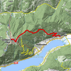
Schwarzkogel und Mallestiger Mittagskogel über 683 und 684

Logo Schwarzkogel und Mallestiger Mittagskogel über 683 und 684
Tour data
10.8km
896 - 1,792m
Distance
968hm
951hm
Ascent
02:46h
 
Duration
Difficulty
medium
Rating
Technique
Fitness
Landscape
Experience
Highest point
1,792 m

Overall rating

5

0

%

4

0

%

3

0

%

2

0

%

1

0

%

Error
An error has occurred. Please try again.
Thank you for your review

Rating has been deleted

GPS Downloads
  • GPX GPS Exchange Format (XML)
  • KML Google Earth, Google Maps
QR Download Codes for Mobile Phones

Trail conditions

Asphalt
Gravel
Meadow
Forest
Rock
Exposed
Other tours in the regions

Popular tours in the area

Hohe Gloriette

easy Hiking
5.17km | 65hm | 01:30h

Slow Trail Bleistätter Moor

easy Hiking
7.04km | 6hm | 02:00h

Mittagskogel

medium Hiking
4.4km | 926hm | 05:45h

Wanderung auf die Gerlitzen (1.911 m)

medium Hiking
11.06km | 1381hm | 04:00h