
- Brief description
-
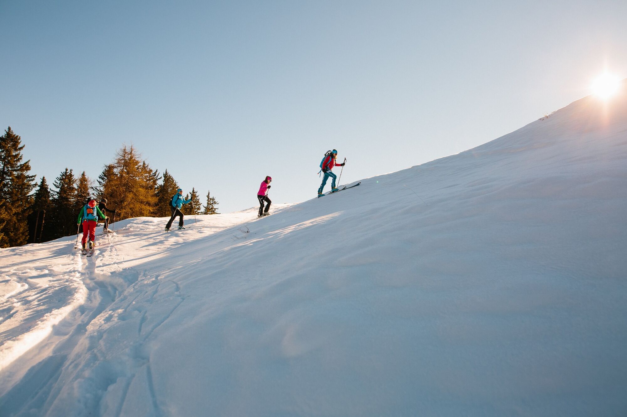
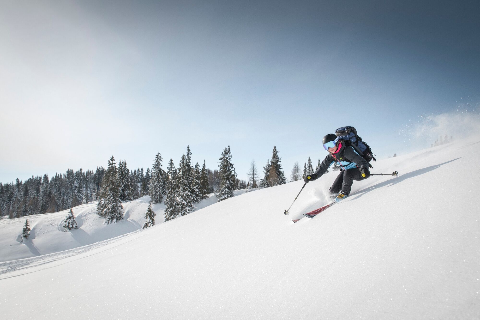
At first it goes unspectacularly higher through the forest, before you suddenly stand in the steep channel system under the Kleiner Mittagskogel. The exposed crossing into the Mittagskogel west flank is only for experienced ski tourers with a good head for heights. The west flank is not very long but simply beautiful.
- Difficulty
-
difficult
- Rating
-
- Starting point
-
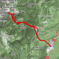
Outschena
- Route
-
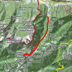
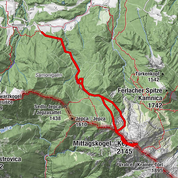
Mittagskogel (2,145 m)5.7 km
- Best season
-
AugSepOctNovDecJanFebMarAprMayJunJul
- Description
-
At the latest when you have driven the Mittagskogel west flank, you count to a true ski tourer or wild dog.
- Directions
-
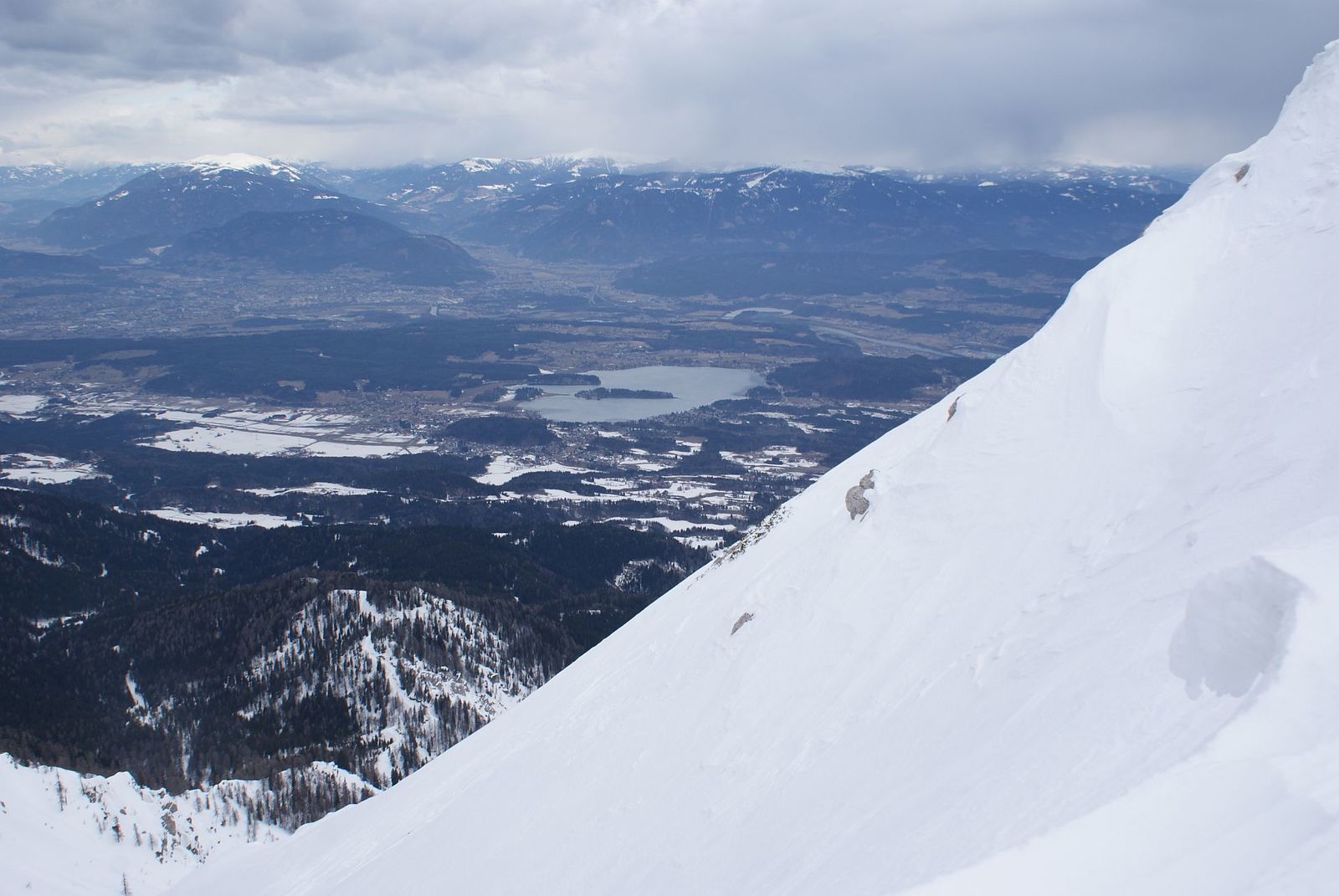
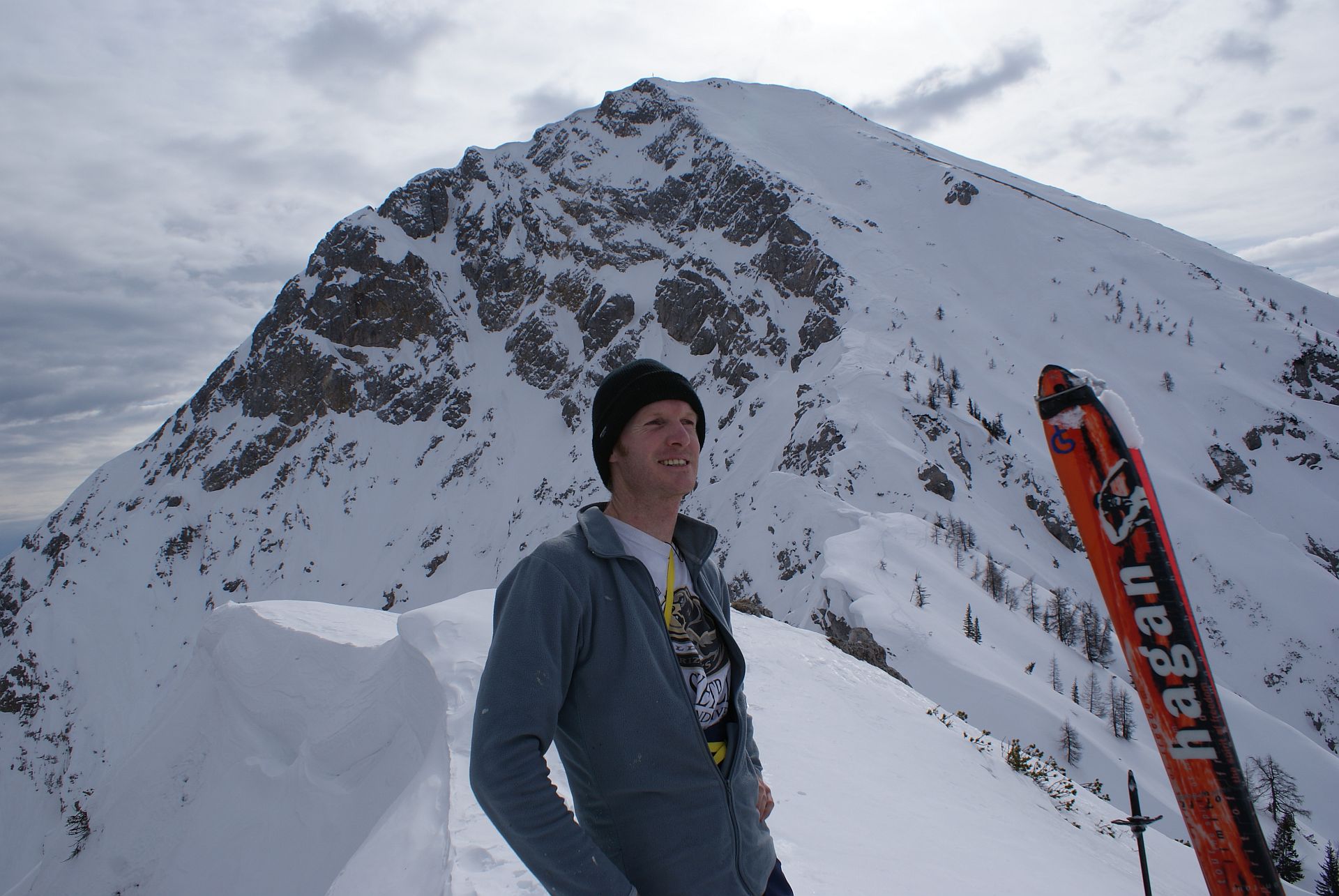
From the car park, follow the forest path to the south-east, flat uphill. At about 1000m above sea level, the ski tourer reaches a ditch, through which he passes an old customs hut (1101m) and climbs to about 1360m, where he reaches a new forest path in the sense of the summer markings. On this, keeping to the east (left), over a small saddle (1400m) into the turning north flank of the Kleine Mittagskogel. At the end of the forest path, you cross a very steep slope (danger of avalanches) onto a prominent ridge, from which the wild Mittagskogel ditches open up to the hiker. One now pulls slightly uphill under the Kleiner Mittagskogel to a small ramp, which goes higher to the south, before it flows into a channel and climbs to the southwest up to the Kleiner Mittagskogel (1815m) (in this passage the skis are mostly carried). Now you follow the ridge towards Mittagskogel (east) and reach the key point of the tour. From the lowest point of the overhang, one climbs directly along the very exposed ridge over a steep step into the actual Mittagskogel west flank, over which one then goes up to the summit.
Translated with www.DeepL.com/Translator
- Highest point
- 2,107 m
- Endpoint
-
Mittagskogel
- Exposition
- Height profile
-

- Equipment
-
LVS, probe, avalanche shovel, crampon, crampon.
- Safety instructions
-
This tour is only to be carried out in absolutely safe conditions. For the transition between the Kleinem Mittagskogel and the Mittagskogel West flank, a head for heights is absolutely necessary. For this area it is recommended to take crampons with you.
- Tips
-
The Mittagskogel West Flank is a classic spring tour. Due to the different expositions (above west and below north) you don't have to be extremely early.
During the descent, make sure not to stumble down too early from the ridge between Mittagskogel Westflanke and Kleinem Mittagskogel to the north. Here you have the possibility to cross into a channel below the Kleiner Mittagskogel and follow it to the forest path.
Translated with www.DeepL.com/Translator
- Additional information
- Directions
-
From Latschach am Faaker See or Finkenstein you drive in the direction of Gasthof Baumgartner. A few metres below the inn, a road leads east towards Outschena. After a few meters a road branches off to the right over a meadow up to a single house. Follow this until you reach the house.
- Public transportation
-
You will need a car to transport your gear.
- Parking
-
Parking is available in front of the residential building at the beginning of the Forststraße.
- Author
-
The tour Mittagskogel Western Ascent is used by outdooractive.com provided.