


- Brief description
-
This is an intense tour from the Faaker See (Lake Faak) up to the Dobratsch- Villach's house mountain and nature park!
- Difficulty
-
difficult
- Rating
-
- Starting point
-
Faak am See
- Route
-
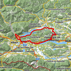
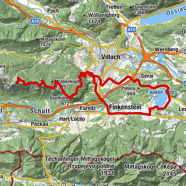
Faak am See0.1 kmPogöriach0.6 kmGasthof Feichter3.1 kmMallestig3.2 kmFinkenstein3.3 kmFilialkirche Heilige Margaretha3.5 kmTechanting4.9 kmNeumüllnern5.9 kmGödersdorf5.9 kmMüllnern6.1 kmVillach (501 m)10.4 kmJudendorfer Marterl10.6 kmMöltschach11.4 kmThomas Morgenstern (628 m)12.1 kmAlpen Arena (677 m)13.0 kmNaturschächte (729 m)13.7 kmGeklobene Wand (1,043 m)18.5 kmAichingerhütte27.1 kmRosstrattenstüberl28.0 kmGeklobene Wand (1,043 m)38.0 kmNaturschächte (729 m)43.0 kmAlpen Arena (677 m)43.8 kmThomas Morgenstern (628 m)44.4 kmMöltschach45.9 kmJudendorfer Marterl46.4 kmAuen49.3 kmVillach (501 m)50.0 kmTschinowitsch50.8 kmMaria Gail52.9 kmDobrova53.1 kmMittewald54.7 kmGreuth56.0 kmDrobollach am Faaker See56.7 kmFilialkirche Heiliger Andreas58.5 kmEgg am Faaker See58.5 kmFaak am See62.8 km
- Best season
-
JanFebMarAprMayJunJulAugSepOctNovDec
- Description
-
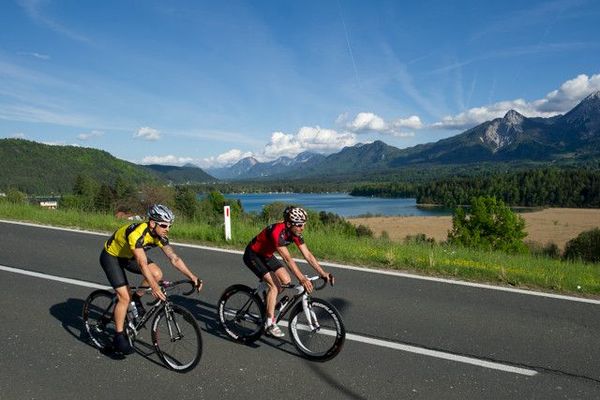
Mittagskogel and Dobratsch are the two distinctive mountains in the region that are also stamped with characteristics of Lake Faak's landscape. The tour leads from Faak to Gödersdorf and then to Warmbad, the famous home of thermal spas and the ultra-modern "Kärnten Therme." From Warmbad the paith leads to the Gipfelstrasse (Summit Road) up to the Dobratsch where magnificent views are guaranteed!
- Directions
-
From the starting point in Faak you ride south until the roundabout, where you take the first turn towards Finkenstein. Ride through Finkenstein and past a golf course. Shortly after the golf course you will reach Gasthof Zollner, after which the path goes right towards Gödersdorf and Warmbad. The tour takes you further on sparsely populated roads to the Kärnten Therme in Warmbad. Warmbad is a wellness and relaxation area- so don’t go faster than 30 kilometers/hour! J
After riding through Judendorf and Möltschach you will reach the beginning of Villacher Alpenstrasse, the road that will take you up to the Dobratsch nature park. You will be on the road for 16.5 kilometers from Villach-Möltschach (550 m) to Dobratsch (Rosstratte 1,732 m), but it does not take you all the way to the summit (2,167 m). If you want to reach the summit, you have to hike the rest of the way. The road offers grand views of Villach, the Karavanken, the Julian Alps and the Schütt landslide area on the south flank of the Dobratsch.
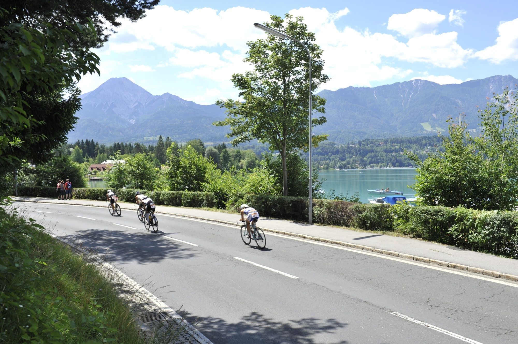
After a relaxing break in the Rosstratte area, you ride back down into the valley. From Möltschach you ride on Villacher Strasse until the “Atrio“ shopping mall. Ride past the mall towards Warmbad, then take a left at the first set of lights onto the “Auenweg.” Ride past Bauhaus and a car dealership, then follow Triglavstrasse and Handwerkstrasse to the “Karankenweg” intersection. Take a right there and ride past the Infineon headquarters to Tschinowitsch. Ride on a small side street until Maria Gail, past a soccer field, then take a right at the next intersection. You now ride through an apartment complex until reaching the main road (Bundesstrasse). The next few kilometers were a section of the 1987 World Cycling Championship route. You bike over the “Fuchsbichl” hill, through Mittewald and Drobollach, back to Lake Faak (Faaker See). With the majestic Mittagskogel always in sight, follow the main road (Bundesstrasse) past the campgrounds in Egg along the lake and back to Faak. The last part of the route is also a section of the Carinthian Ironman route.
- Highest point
- 1,723 m
- Endpoint
-
Faak am See
- Height profile
-

- Equipment
-
Racing bike or mountain bike and drinking water
- Tips
-
There are several worthwhile rest spots and information placards along Villacher Alpenstrasse to enjoy!
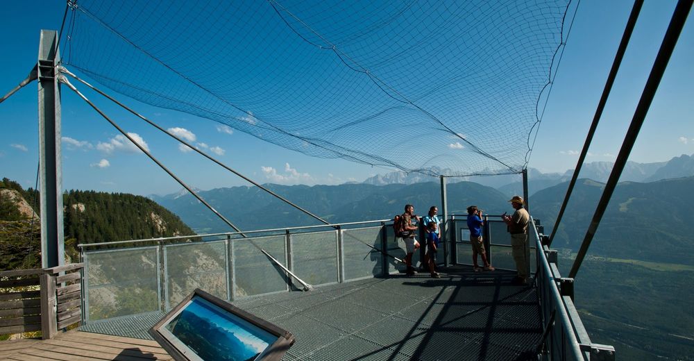
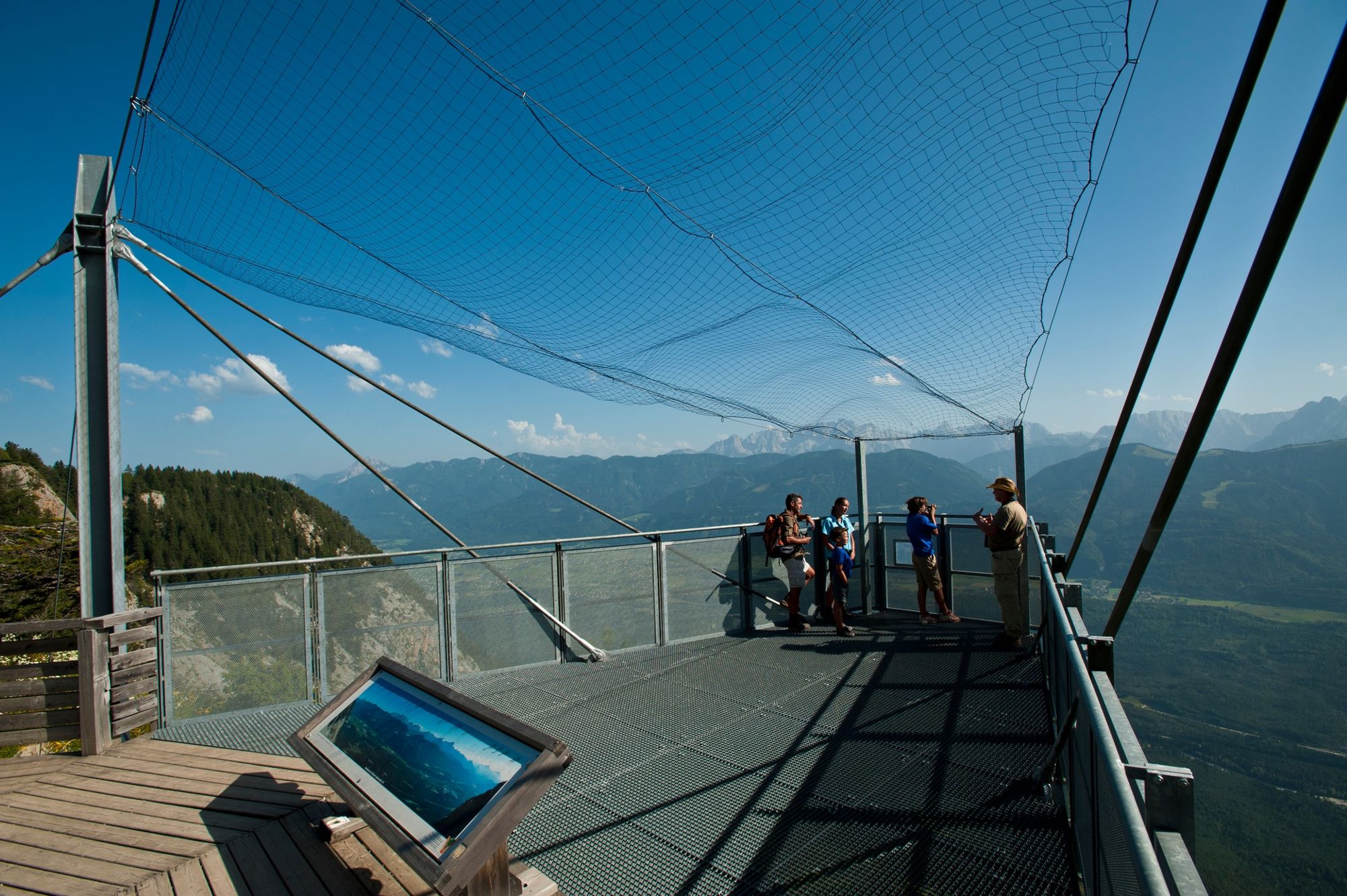
Parkplatz 2: Stadt und Seenblick" rest area at 862 meters above sea level with a view of Villach and the surrounding lakes. Parkplatz 4: Information about rare birds in the Dobratsch nature park. Parkplatz 5: "Wurzelboden" rest area at 1,307 meters above sea level- in addition to the view, this is also a picnic area. Parkplatz 6: Alpengarten (1,403 m): A 10,000 square meter garden with 800 different types of Alps flowers (separate entrance fee). Rote Wand: observation deck which takes you directly over a dramatic drop-off. Information: an information placard about the Dobratsch landslide, bird protection initiatives and the birds of prey in the area. Parkplatz 8: Aichingerhütte at 1,650 meters above sea level- information about the majestic birds of the area and the nature park information area. Parkplatz 11: Rosstratte at 1,732 meters above sea level. It offers: the geology path "From Ocean to Mountain:" 200 million year old geological structures at the foot of the Dobratsch summit/ playground for children/ "Bikers Point" for motorcycle riders/ Mountain restaurant "Rosstrattenstüberl"/ starting point for a relaxing 90 minute hike to the summit/ a relaxation and meditation area with magnificent views and interesting chairs/ a 15 minute walk to one of the best chamois spotting areas in Europe! - Additional information
- Directions
-
Faak is reachable with the A2 highway, exit at "Villach-Faaker See" and you will be on the south end of the Faaker See (Lake Faak).
- Public transportation
- Parking
-
There are plenty of parking spots across from the Faak Tourist Information Center or at the farmer's market.

- Author
-
The tour Ö-Tour Feeling is used by outdooractive.com provided.