

- Brief description
-
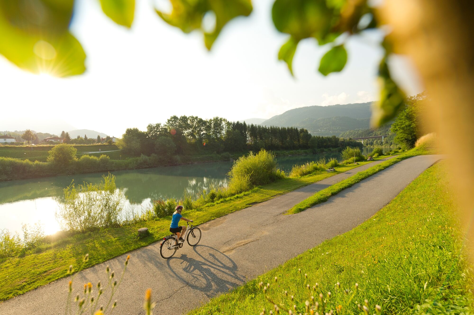
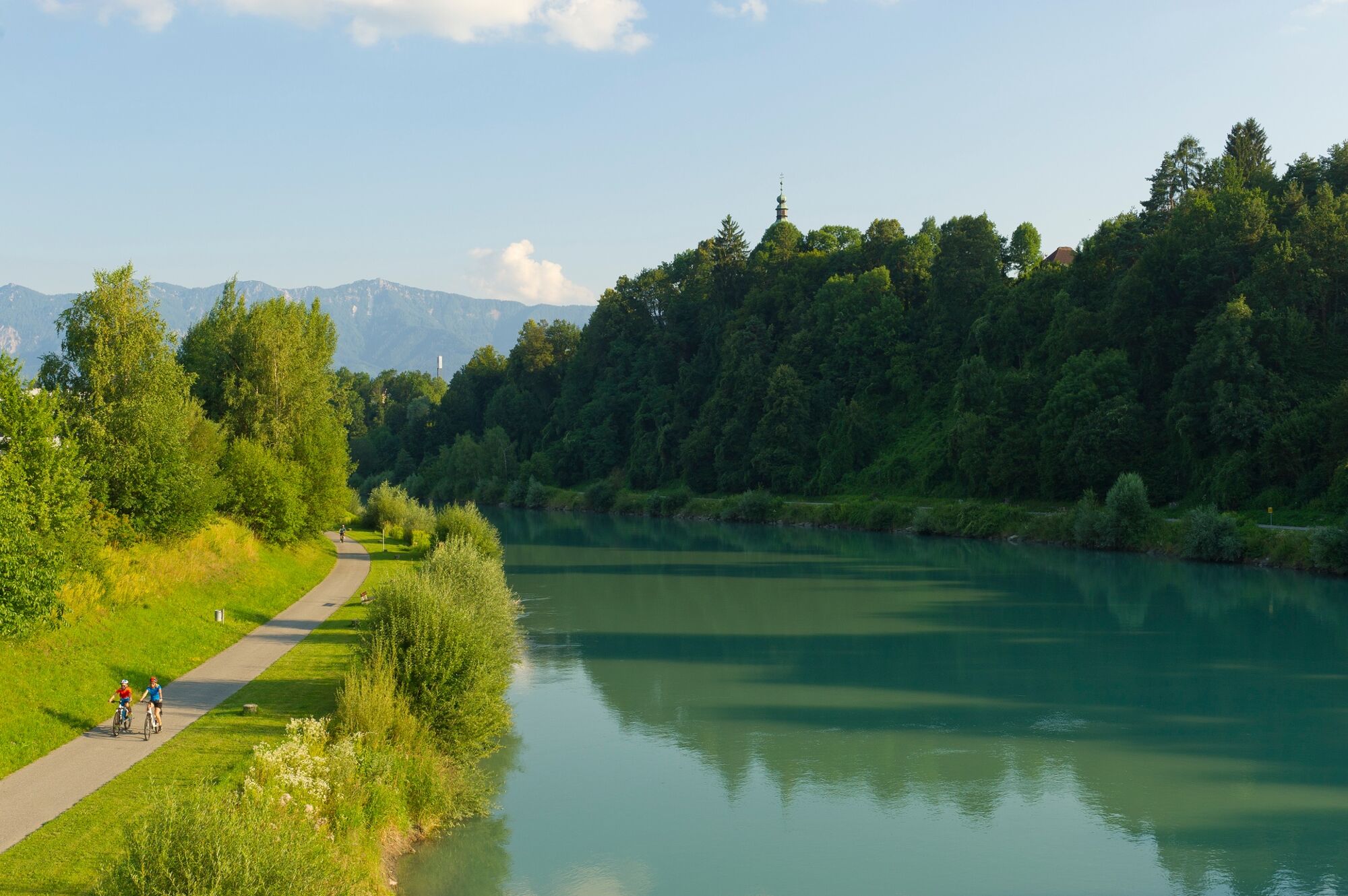
Beautful eBike or trekking bike tour from Bad Bleiberg to Puch from where you can follow the Drau Cycle Path to Villach.
- Difficulty
-
medium
- Rating
-
- Starting point
-
Bad Bleiberg
- Route
-
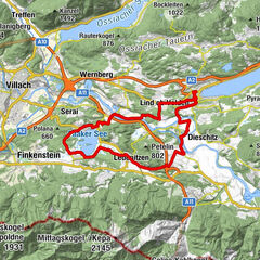
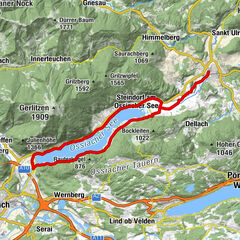
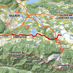
Bad Bleiberg (902 m)0.9 kmZum Mohren0.9 kmHüttendorf2.0 kmPfarrkirche Heiliger Geist5.6 kmHeiligengeist6.5 kmMittewald ob Villach9.6 kmWeißenbach11.6 kmGummern15.4 kmPuch16.2 kmGasthof Staber16.7 kmGummern19.1 kmInnere Stadt28.3 kmVillach (501 m)28.5 kmPfarrkirche Sankt Martin31.2 kmKapelle Heiliger Michael31.2 kmSt. Martin31.7 kmNeufellach32.6 kmGasthaus Wiegele33.5 kmPogöriach34.4 kmHeiligengeist38.9 kmPfarrkirche Heiliger Geist39.9 kmHüttendorf43.7 kmPfarrkirche St. Florian44.5 kmZum Mohren44.6 kmBad Bleiberg (902 m)44.6 kmDörfl45.3 km
- Best season
-
JanFebMarAprMayJunJulAugSepOctNovDec
- Description
-
EBike and trekking bike tour from Bad Bleiberg to Puch and along the Drauradweg R1 to the town of Villach. Here you can take the old town walk before you cylce back to Bad Bleiberg.
- Directions
-
Starting from Bad Bleiberg, cycle in the direction of Villach through the village along the federal road. Follow this road downhill to Mittewald where you turn left towards Weißenbach. From there continue towards Puch. The bridge leads you over the river Drau/Drava and then you continue through the small village of Puch. From there, follow the federal road to the next bridge, where you cycle again over the river. From now on follow the Drau Cycle Path/Drauradweg R1 to the center of Villach. Here you can park your bike at the Radbutler free of charge and can explore the old town of Villach on foot. After your stay in the town of Villach you cylce the Drauradweg up-river up to a bridge that leads you to the district of St. Martin. There you can have a look at the church before continuing to Pogöriach. From Pogöriach follow unpaved roads up to Heiligengeist. From here you take the main road back to Bad Bleiberg. If you don´t want to cycle back, than you can also reserve a bike shuttle back to Bad Bleiberg. More information at connect.visitvillach.at!
- Highest point
- 941 m
- Endpoint
-
Bad Bleiberg
- Height profile
-

- Equipment
-
Helmet, water, smartphone.
- Tips
-
If you don´t want to cycle back you can register for the bike shuttle, which will bring you back to Bad Bleiberg.
- Additional information
-
Region Villach Tourism
+43 4242 42000
www.visitvillach.at
- Public transportation

- Author
-
The tour Bad Bleiberg - Villach is used by outdooractive.com provided.