


- Brief description
-
The Guggenberg is a wonderfully pleasant mountain to the west of Hermagor. The route leads along asphalt roads, gravel roads and short passages along a forest road.
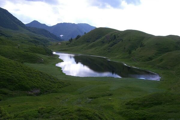
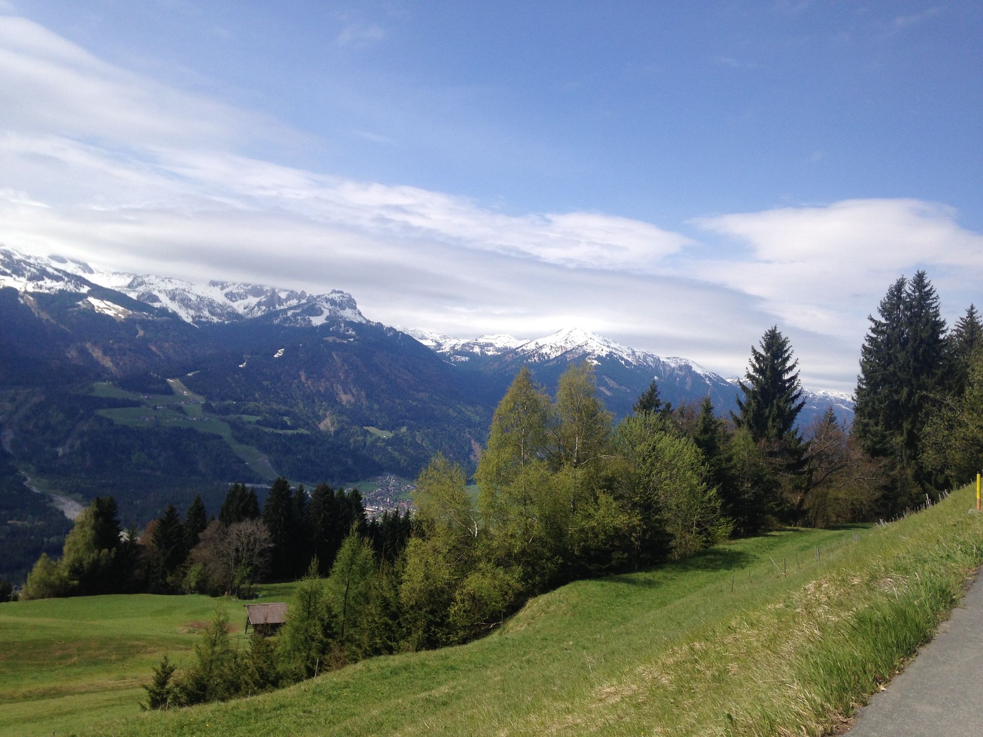
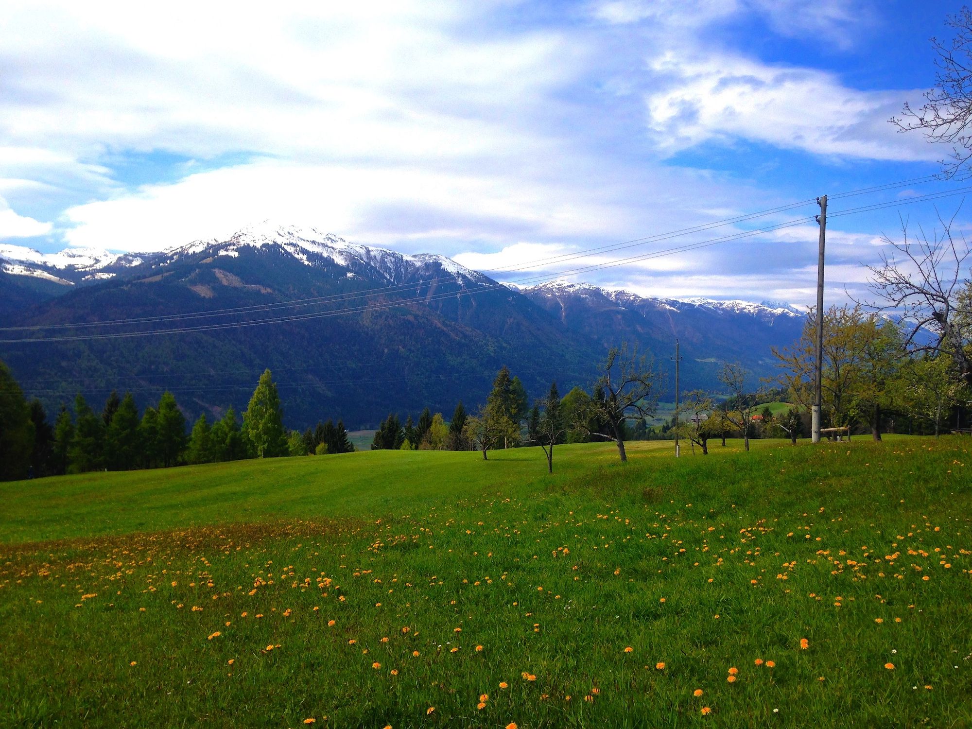
It is known for its magnificent views far over the Gailtal and reveals a unique panorama of the Carnic Alps. Especially the trail down to Jenig offers a lot of riding fun for everyone, because the route is easy to ride and all you need for safe riding is a solid riding technique.
The tour is also suitable for e-bikes.
Bike rental directly at the starting point!
The tour is signposted HP1.
- Difficulty
-
medium
- Rating
-
- Starting point
-
Tröpolach - Lower Terminus Millennium Express
- Route
-
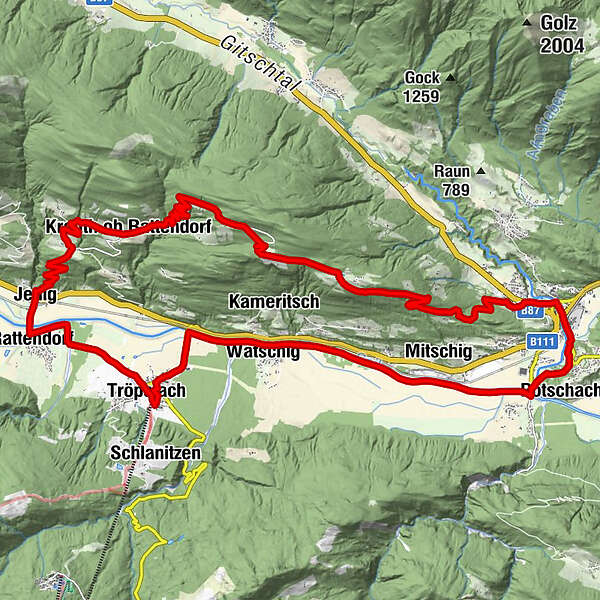
Tröpolach0.3 kmWatschig2.9 kmPostran3.9 kmMitschig6.0 kmPodlanig6.5 kmMöderndorf7.8 kmGail-Wirt7.9 kmKühwegboden8.3 kmMarienkapelle10.0 kmSant'Ermagora10.2 kmPfarrkirche10.2 kmBerggasthof Mösslacher15.7 kmGuggenberg15.8 kmKreuth ob Rattendorf22.7 kmJenig27.2 kmRattendorf27.8 kmTröpolach30.5 kmPfarrkirche Tröpolach30.5 kmZum Alois30.8 km
- Best season
-
JanFebMarAprMayJunJulAugSepOctNovDec
- Description
-
Starting in Tröpolach (lower terminus Millennium Express), on the cycling track all the way to Jenig and from there uphill to the Hohnen Schaar onto the Guggenberg road (highest point 1229m). A beautiful downhill ride on a tarmac road rewards with a view across the Carnic Alps.
- Directions
-
KM 0.3 Turn right towards Nassfeld B90
KM 0.4 turn left and follow the B90
KM 1.2 Change to the cycle path on the right of the B90
KM 1.7 Turn right and follow the R3 cycle path
KM 7.9 Turn left over the Gail bridge and follow the R3a cycle path towards Hermagor
KM 9.5 straight on and along cycle path R3b into the centre of Hermagor
KM 9.8 Roundabout - straight on R3b
KM 10.1 Turn left - continue on R3b
KM 10.2 Turn right - continue on R3b
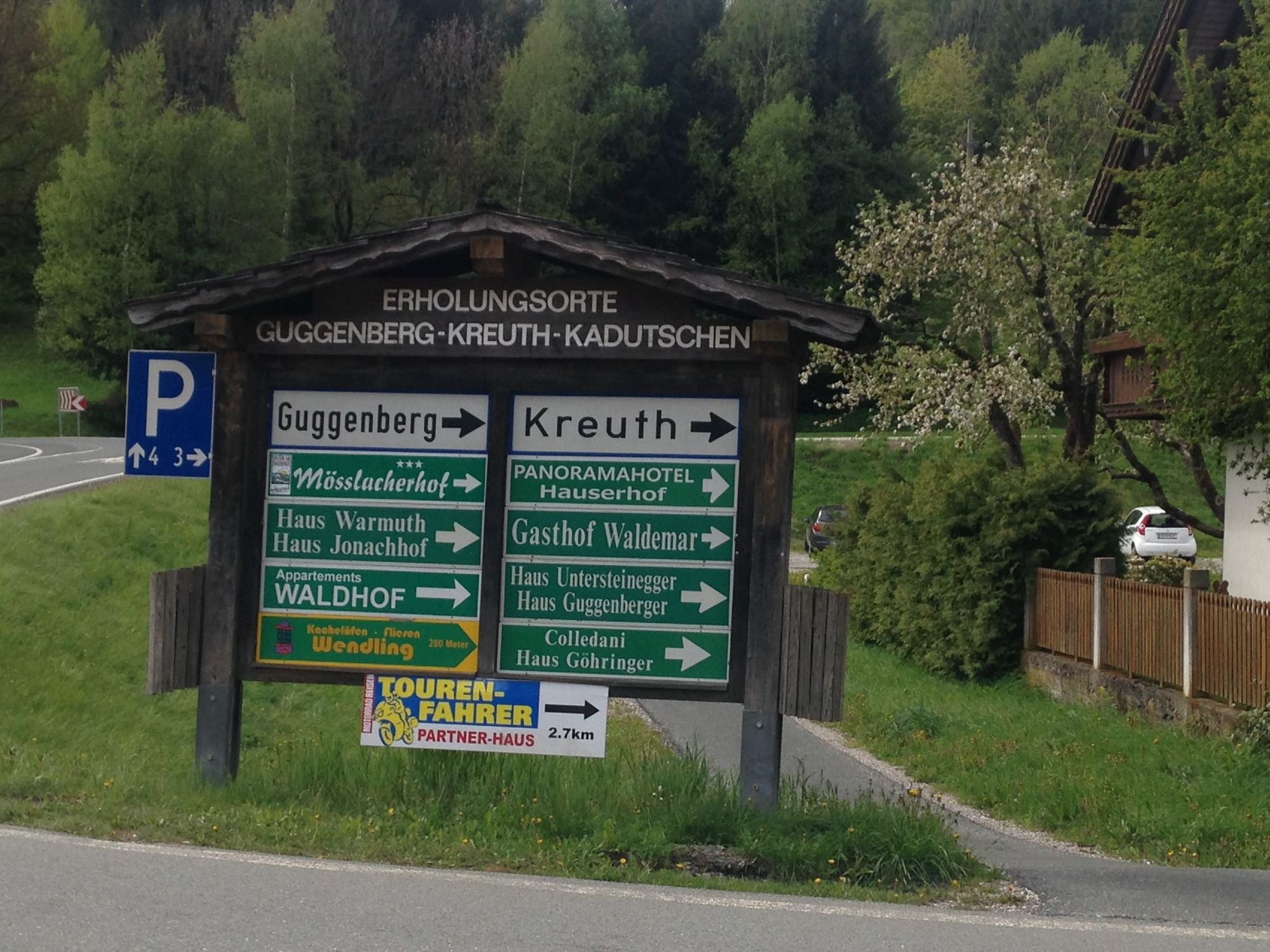
KM 10.7 Turn left and, after a few metres, turn right onto the main road towards Guggenberg
KM 12.5 Keep right - continue along the main road
KM 12.7 Bear left - continue along the main road
KM 15.8 Beautiful view of the Guggenberg
KM 17.3 Highest point: turn left onto gravel road
KM 18.5 Turn right towards Kreuth
KM 18.8 Keep left - continue downhill
KM 19.7 Straight on downhill
KM 20.8 Turn right towards Jenig
KM 22.9 Straight ahead towards Jenig
KM 25.1 Straight ahead, cross the main road
KM 25.8 After the bridge turn left onto the R3 cycle path
KM 26.4 Keep right
KM 26.8 Turn left and follow the road
KM 28.5 Turn right towards the Millennium Express valley station
- Highest point
- 1,235 m
- Endpoint
-
Guggenberg - Hermagor
- Height profile
-

- Equipment
-
Helmet duty!!!!!!
Right clothing: Do not only adapt your clothing to the current weather conditions.
Also pack warm clothing, a spare jersey and rain protection in summer, especially in the early and late seasons.
Emergency equipment: bandages, repair kit (spare hose, pump, tools), map, mobile phone and possibly GPS
ATTENTION: In the mountains reception is not guaranteed everywhere!
Take enough to drink with you and plan a stopover in good time - Safety instructions
-
When the line is closed - absolute driving ban!
Always drive on half sight.
Always adjust your speed so that you can stop in time before obstacles or avoid oncoming traffic
Watch out for pedestrians and hikers and drive slowly past
Driving on the track with motorcycles will be reported without exception.
The use of the bicycle routes is at your own risk.
In the forest, especially camping, camping in the dark, making fires, disturbing game or entering forest cultures under 3 m tree height are prohibited by law.
Check your sports equipment regularly and wear a helmet
Only the use of the approved, marked routes is permitted.
Never leave the marked path
We ask for consideration for the environment.
Avoid noise and pollution.
Restrict driving in the twilight to protect wild animals.
Observe the road traffic regulations and provide first aid if necessary.
Please always close gates and gates.
Caution during forestry work!Correct self-assessmentStart in time and plan for reserves
Leave higher altitudes in bad weather
Make sure that you can get through safely if there are impassable stretches of road.
If you do not feel safe, turn back soon enough
For a safe cooperation please follow the Fair Play rules (Link) Emergency call: (+43 4282)112 - Tips
-
You don't have to stop at the Guggenberg and enjoy the wonderful view!
- Additional information
-
Sights along the tour:
- Beautiful view - magnificent mountain panorama
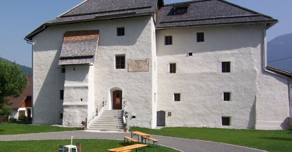
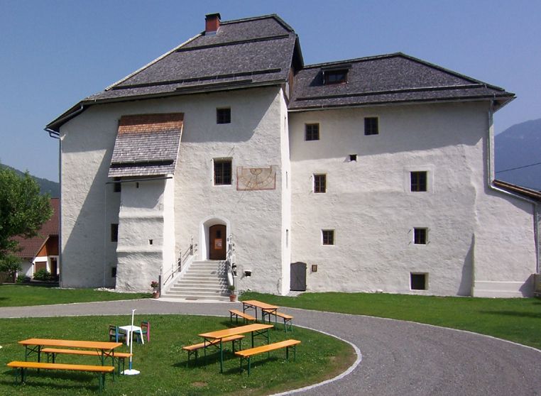
- St. Ulrich Chapel Guggenberg
- Directions
-
from Western Austria and Germany
A10 Tauernautobahn via Tauern- and Katschbergtunnel (toll) until exit Feistritz/ Drau, continue in direction Hermagor via Windische Höhe, through Hermagor ... further see above
or: alternatively, take the A10 to the Villach junction, continue on the A2 south motorway towards Italy, exit Hermagor/Gailtal to Hermagor ... further see above,
or: Motorway via Rosenheim, Kufstein (A12 Inntal motorway, exit Kufstein Süd), Felbertauern tunnel (toll) to Lienz, Gailbergsattel, Kötschach-Mauthen, direction Hermagor until the Nassfeld junction ... further see above (distance Munich - Nassfeld: 298 km)
from Eastern Austria
A2 south motorway to exit Hermagor / Gailtal, continue to Hermagor and direction Kötschach-Mauthen, junction Nassfeld, Nassfeld main road to the Nassfeld (distance Vienna - Nassfeld: 420 km)
from Italy
Take the motorway to Udine and continue towards Austria, exit at Pontebba, through the village of Pontebba take the Italian pass road to the Nassfeld (Passo di Pramollo) (distance Udine - Nassfeld: 85 km)
or:
Autostrada Udine - Tarvisio - exit Hermagor/Gailtal. Continue to Hermagor and direction Kötschach/Mauthen
- Parking
-
Public parking spaces are available directly at the starting point.
Millennium Express valley station

- Author
-
The tour Guggenberg is used by outdooractive.com provided.