


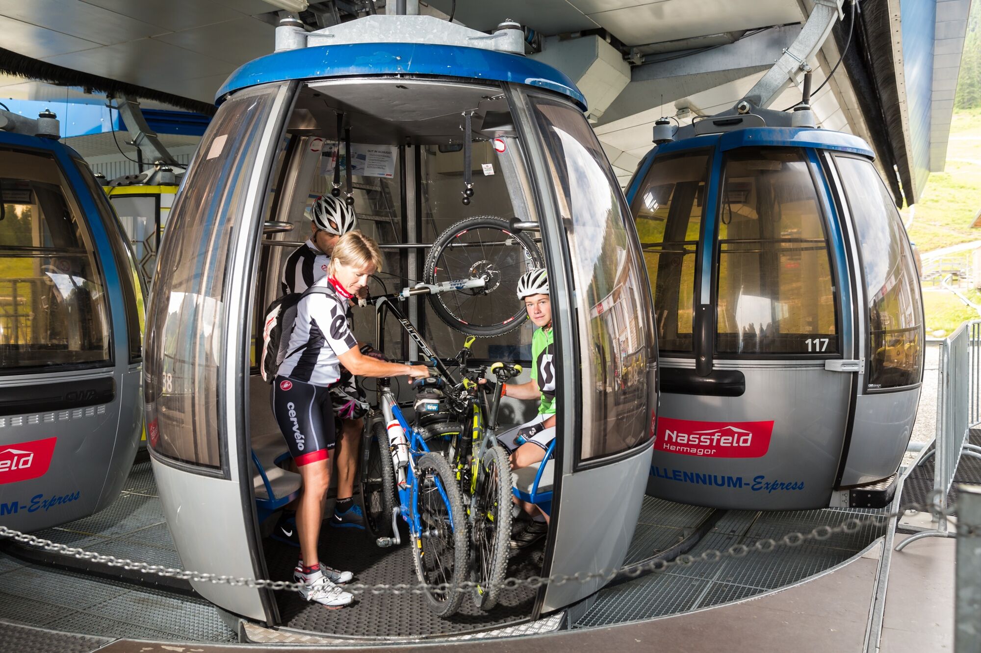
- Brief description
-
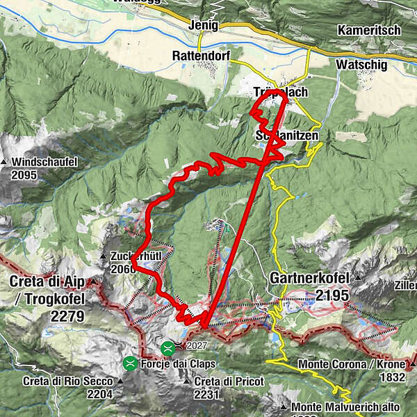
From the Tressdorfer Alm you drive in the direction of the Madritschen mountain station. From there the Bikegiro leads over a gravel path for 11.7 km downhill in direction Rudnigalm - Tomritsch and to the destination Tröpolach.
The tour bears the signposting HP7.
- Difficulty
-
medium
- Rating
-
- Route
-
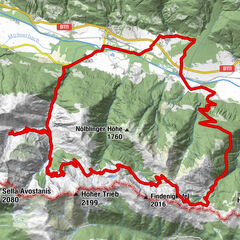
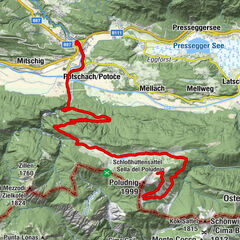
TröpolachZum AloisTalstation Millenium Express0.0 kmSchlanitzen0.9 kmMadritschen (1,918 m)1.1 kmKristall4.5 kmKofelalm5.1 kmPanorama Lockstanalm West6.3 kmRudnig Alm9.3 kmGmanberg17.5 kmSchlanitzen19.0 kmJokl's Hütte19.1 kmPfarrkirche Tröpolach21.7 kmTröpolach21.9 kmZum Alois22.1 km
- Best season
-
JanFebMarAprMayJunJulAugSepOctNovDec
- Description
-
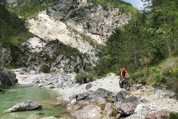
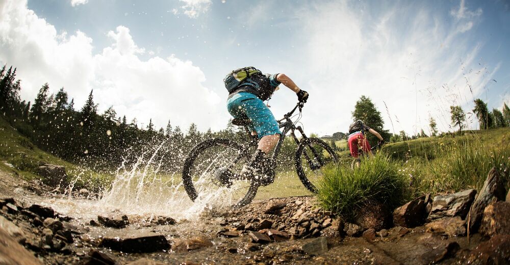
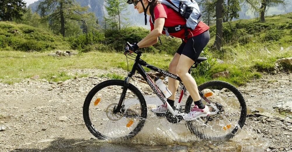
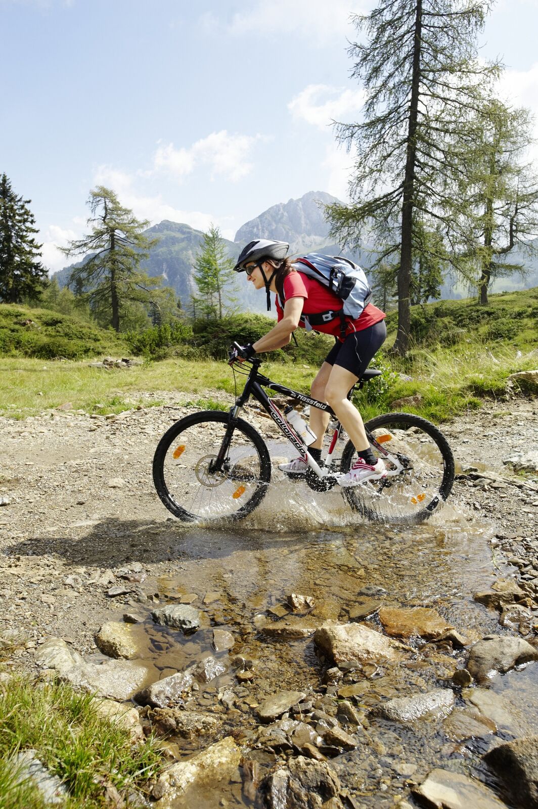
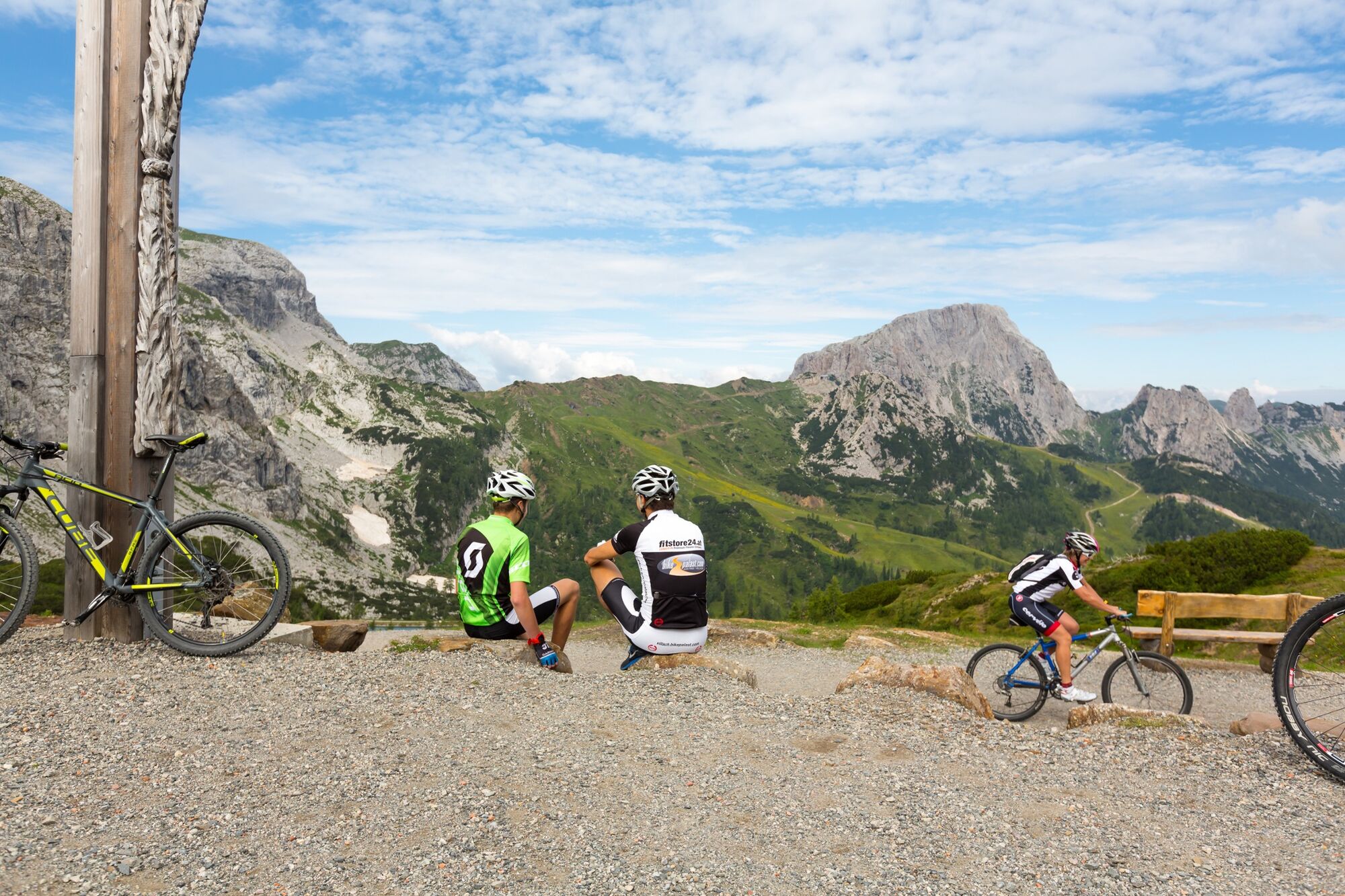
This adventure starts at the valley station of the Millennium Express in Tröpolach. A leisurely ride, including bicycle, to the top station on the Tressdorfer Alm, and optionally on to the highest point of the tour, the Madritsche. At the top there are 11.7 kilometres between you and the valley. The route downhill leads mostly over gravel and requires a good deal of fitness - especially in the upper arms. On the way through the Carnic Alps you will pass impressive rock formations and the typical flora and fauna of the region, i.e. the panorama that previously caused amazement from the valley.
- Directions
-
From the Tressdorfer Alm, a mountain path leads uphill to the Madritsche, the highest point of the tour. From there, the Lift & Bike Giro runs downhill throughout, past the Rudnigalm, via Tomritsch and the Carnia downhill run to the first intermediate station of the Millennium-Express, Gmanberg. From here, the last meters of altitude difference are downhill to the exit point and parking lot.
- Highest point
- 1,900 m
- Endpoint
-
Tröpolach
- Height profile
-

- Equipment
-
Helmet duty!!!!!!
Right clothing: Do not only adapt your clothing to the current weather conditions. Also pack warm clothing, a spare jersey and rain protection in summer, especially in the early and late seasons.
Emergency equipment: bandages, repair kit (spare hose, pump, tools), map, mobile phone and possibly GPS
ATTENTION: In the mountains reception is not guaranteed everywhere!
Take enough to drink with you and plan a stopover in good time - Safety instructions
-
Although this tour is not a downhill route, it is not recommended for children. Especially in the upper arms, the descent is very exhausting.
If the line is closed - absolute ban on riding!
Always ride on half sight.
Always adjust your speed so that you can stop in time before obstacles or avoid oncoming traffic
Watch out for pedestrians and hikers and drive slowly past
Driving on the track with motorcycles will be reported without exception.
The use of the bicycle routes is at your own risk.
In the forest, especially camping, camping in the dark, making fires, disturbing game or entering forest cultures under 3 m tree height are prohibited by law.
Check your sports equipment regularly and wear a helmet
Only the use of the approved, marked routes is permitted.
Never leave the marked path
We ask for consideration for the environment.
Avoid noise and pollution. Restrict driving in the twilight to protect wild animals.
Observe the road traffic regulations and provide first aid if necessary.
Please always close gates and gates. Caution during forestry work!
Correct self-assessmentStart in time and plan for reserves
Leave higher altitudes in bad weather
Make sure that you can get through safely if there are impassable stretches of road.
If you do not feel safe, turn back soon enough
For a safe cooperation please follow the Fair Play rules (Link) Emergency call: (+43 4282)112 - Tips
-
Don't race downhill, but enjoy the landscape that surrounds you and consciously perceive the environment, the pure mountain air and the flora and fauna! There is certainly still time for a stop at the Rudnigalm - Gailtaler Almkäse, buttermilk, yoghurt, Scots and of course Brettljausn are waiting for hungry bikers!
- Additional information
-
Further information - also about the +Card PREMIUM, with which among other things the ascent with the mountain railway is free of charge, can be obtained here!
- Directions
-
Take the B111 from Hermagor in the direction of Tröpoalch, from there along the Nassfeld road to the village of Sonnenalpe-Nassfeld and on to the Tressdorfer Alm.
- Public transportation
-
With the Millennium-Express from Tröpolach to the Tressdorfer Alm, ascent is also possible up to the Madritsche. With the +Card PREMIUM the ascent including bike transport is free!
- Parking
-
Tröpoalch car park - at the Millennium-Express valley station

- Author
-
The tour HP7 "Lift & Bike Giro" - Madritschen Tour is used by outdooractive.com provided.