


- Brief description
-
"The Carnic Milky Way" as the best of the Carnic Highway and the Constellation Hikes is "Hiking in New Dimensions".
- Difficulty
-
medium
- Rating
-
- Route
-
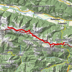
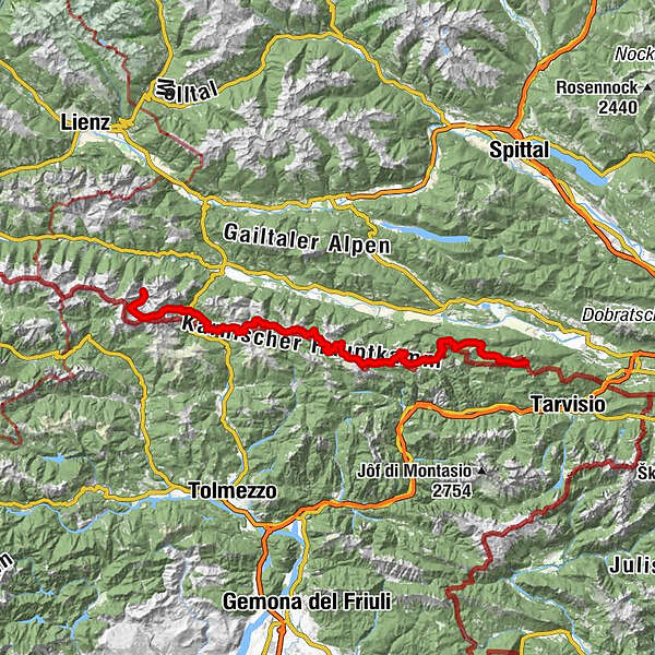
Feistritzer AlmDolinza Alm (1,499 m)2.2 kmWirtshaus Starhand2.2 kmRudi`s Skihütte15.0 kmEgger Alm15.0 kmAlmgasthaus "Zur Alten Käserei"15.0 kmGarnitzenalm (1,640 m)24.0 kmGartnerkofel (2,195 m)26.9 kmWatschigerAlm29.1 kmPlattner29.5 kmSchwefelquelle30.1 kmRudnik-Sattel35.7 kmRattendorfer Alm40.6 kmGrotta di Attila43.0 kmStraniger Alm50.5 kmHöhenlager Straniger Alm (1915-1917)51.2 kmLodintörl (1,871 m)53.2 kmFindenigkofel (2,016 m)53.9 kmZollnersee Hütte57.0 kmCasera Promosio Alta64.6 kmCasera Pal Grande di Sopra67.3 kmGasthof Plöckenhaus73.1 kmTheresienhöhe74.1 kmAlmgasthof Valentinalm (1,220 m)75.7 kmWolayerseehütte81.4 kmBimbaumer Törl (2,080 m)81.6 kmHubertuskapelle88.2 km
- Best season
-
JanFebMarAprMayJunJulAugSepOctNovDec
- Description
-
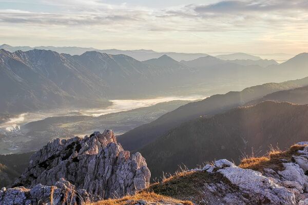
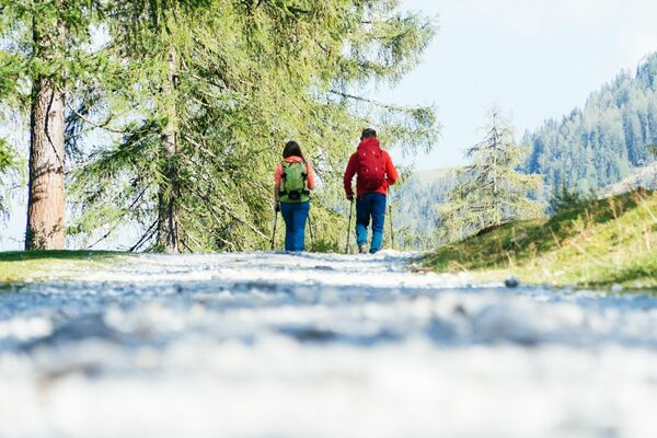
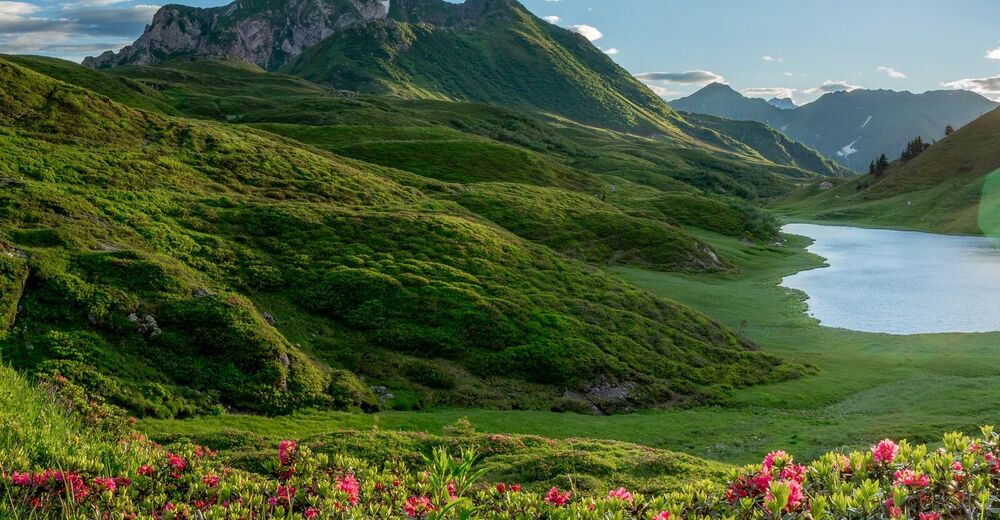
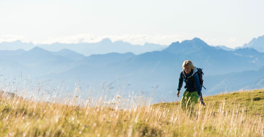
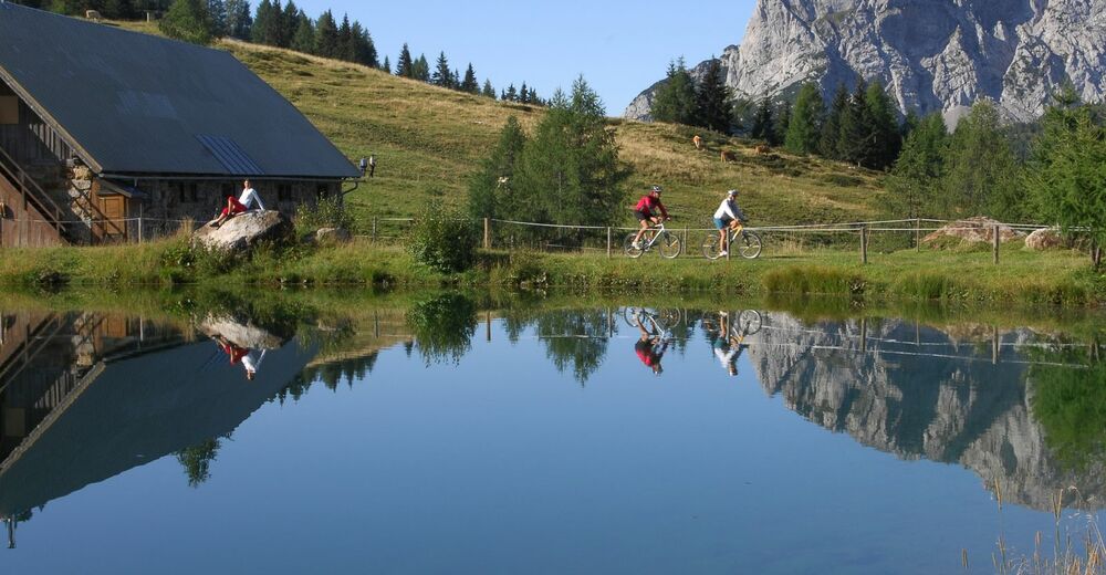
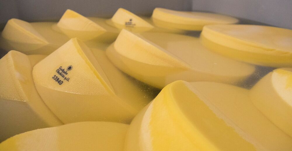
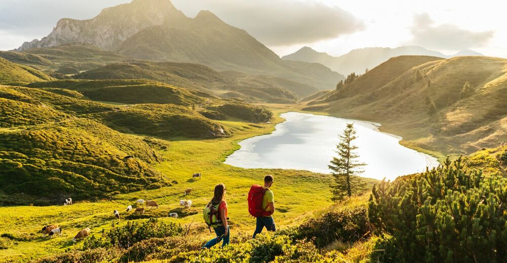
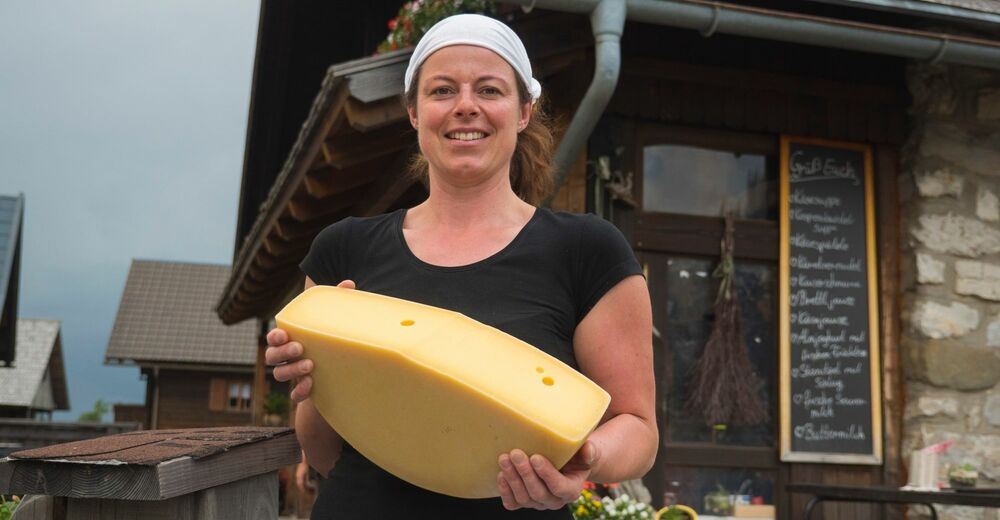
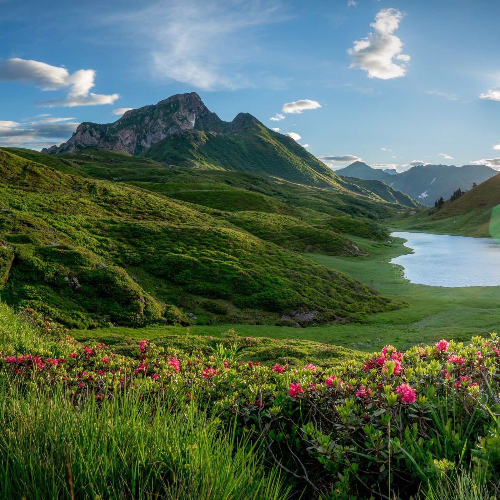
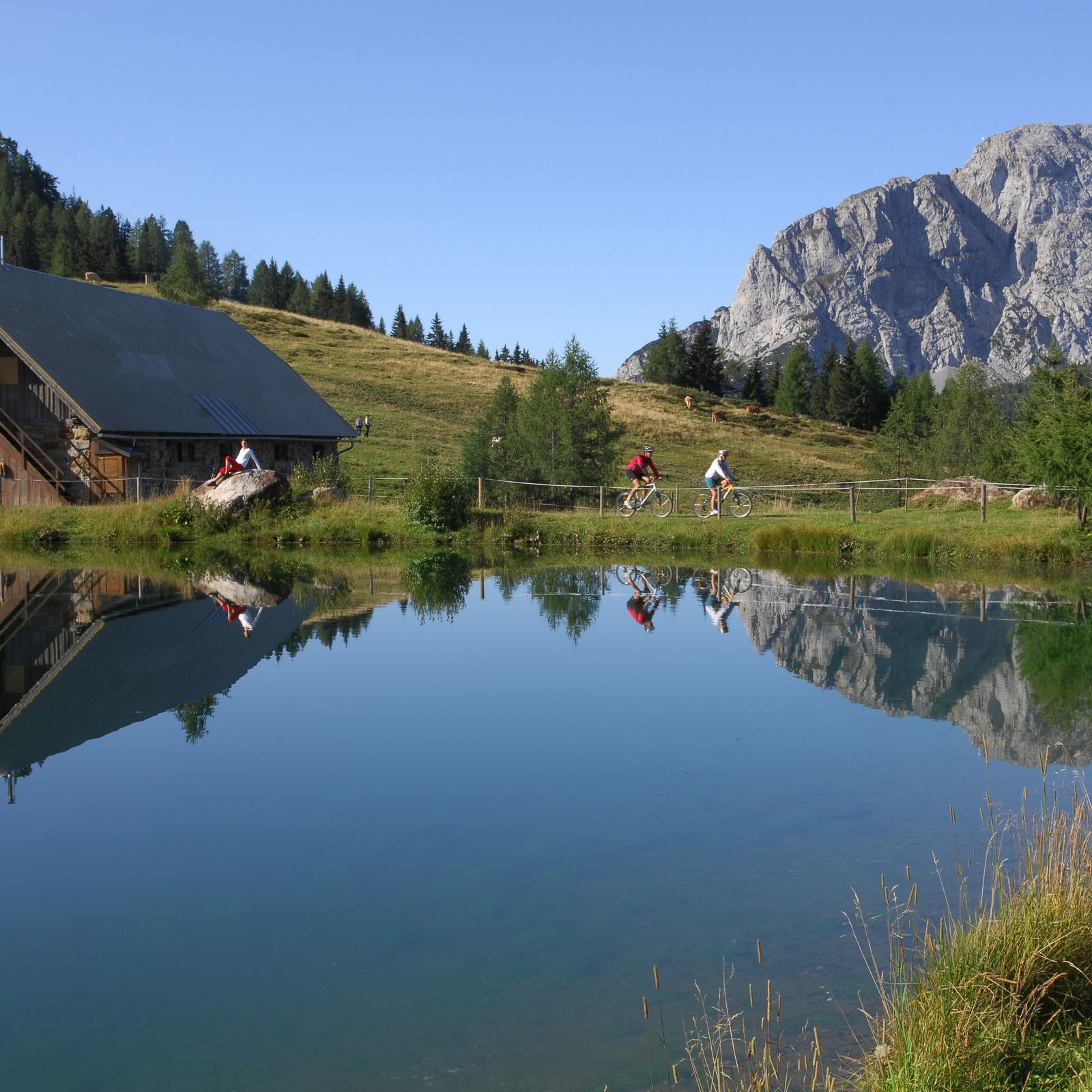
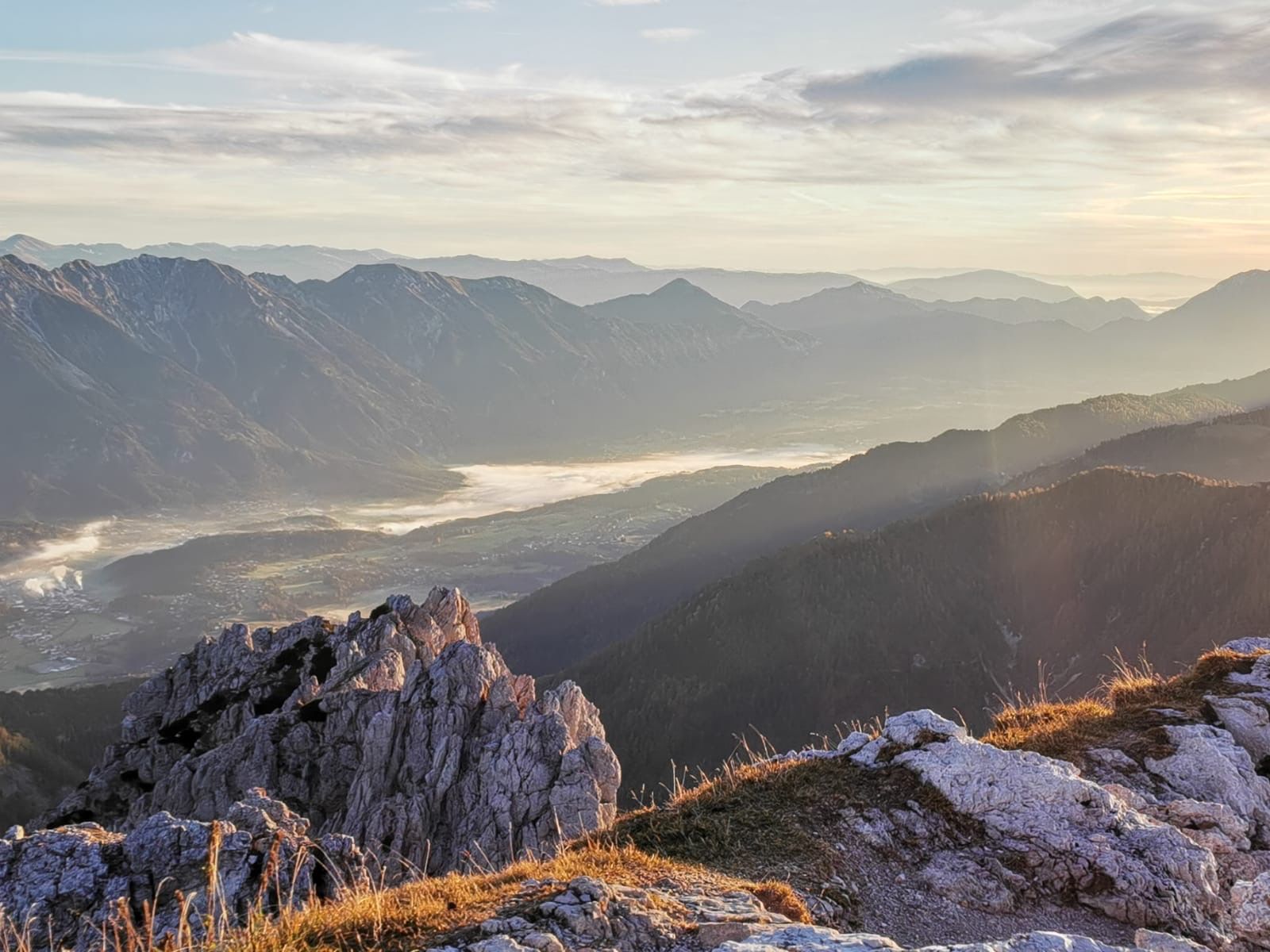
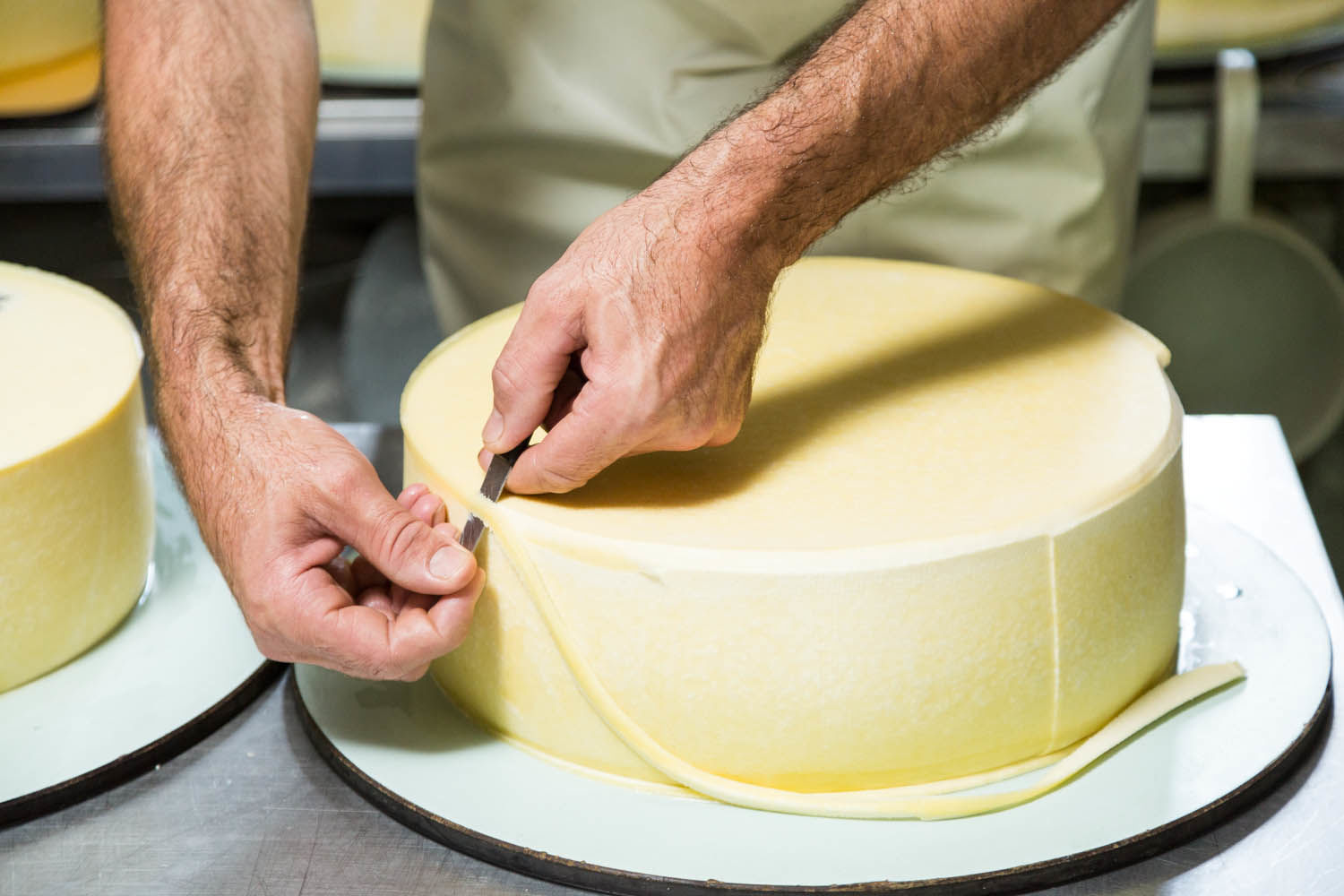
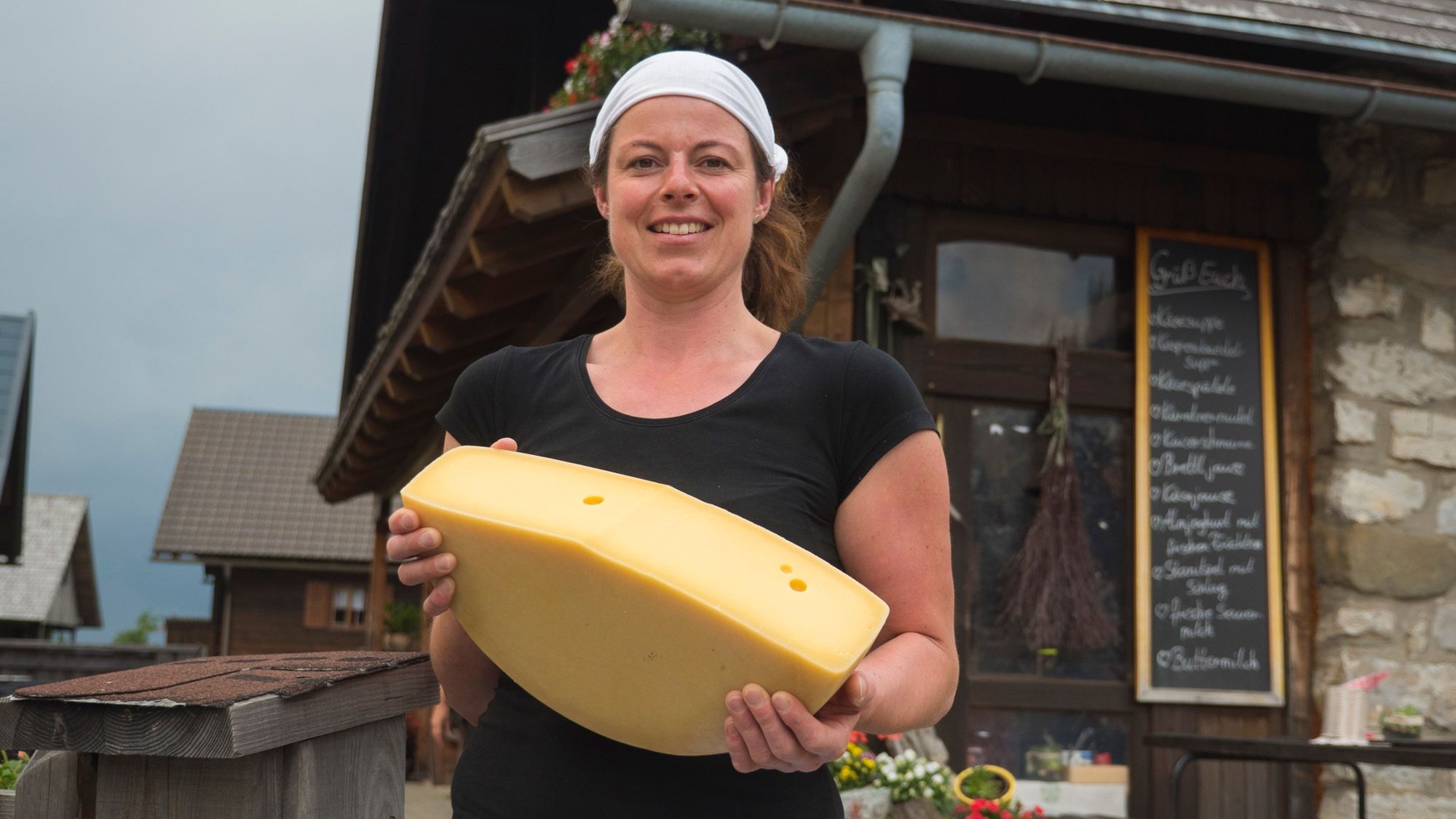
The Carnic Alps - an adventurous and fantastic mountain landscape, which is offered to the hiker. Above, ridges of peaks like bizarre limestone reefs that seem to rise directly from an invisible sea, and below, a hidden peaceful world of lush green mountain basins with a magnificent flora and fauna. Right through the middle, the famous Karnische Höhenweg (KHW 403). And right in the middle, the Kasmacher with their cheese cauldrons, in which all the beauty and variety of the landscape is processed into a wonderful and tasty product, the Gailtaler Almkäse. In each cauldron, a world of its own, a different world awaits you.
Each cauldron has its own story, but all cauldrons together are mysteriously connected with their own and common stories: Like the stars on the Milky Way, the alpine pastures are strung together along the Karnischer Höhenweg: The cauldrons, alpine pastures and mountains thus form a special Milky Way, namely the Carnic Milky Way. The picture of the Carnic Milky Way is completed by the "constellations".
- Directions
-
While the western part of the Karnischer Höhenweg (from Sillian to Wolayersee Hut) leads over often demanding paths through high alpine terrain and is highly sought after by experienced mountain hikers, its eastern part (from Wolayersee Hut to Thörl Maglern) opens up the previously described wonder world of cheese alpine pastures protected by rugged battlements on mostly good-natured paths. For this part, we have combined the best of all the elements described above to form the long hiking trail of the Carnic Milky Way: So from the Carnic High Trail (KHW 403), the hikes on the constellations and all the stories about the alpine pastures, mountains and people. So to speak, the Karnische Höhenweg can be experienced in a new way! This is how the famous long-distance hiking trail becomes the Carnic Milky Way - hiking in new dimensions!
We have not made any compromises for its experience: We have reversed the walking direction for you (from east to west to the magnificently situated Wolayersee Hut as a worthy destination), because this corresponds better to the dramaturgy of the landscape, and have set up our own official Trail Information and Booking Center. This means that all the proven services of the award-winning Trail Angels team are available to you.
Stages:
ET01 Feistritzer Alm - Egger Alm
ET02 Egger Alm - Nassfeldpass
ET03 Nassfeldpass - Rattendorfer Alm
ET04 Rattendorfer Alm - Zollnersee Hut
ET05 Zollnersee Hut - Lower Valentina Valley
ET06 Lower Valentine - Hubertus Chapel near Birnbaum
- Highest point
- 2,174 m
- Endpoint
-
Hubertuskapelle
- Height profile
-

- Equipment
-
For the Carnic Milky Way, "normal" equipment is sufficient for alpine hikes on unpaved and partly stony paths in the southern limestone Alps. However, sturdy shoes with a good profile sole for unpaved paths are a "must" and the carrying of telescopic hiking sticks to relieve the knees on the sometimes longer descents is recommended. In summer, good sun protection and sufficient water are very important (there are not refreshment stops on every stage). Sufficiently warm clothing for possible weather drops is also important in midsummer. For all the refuges along the trail you should also bring a sleeping bag and a towel.
Click here for the detailed equipment list of your trail trip.
- Safety instructions
-
Technically, the Carnic Milky Way has moderate difficulties. Sure-footedness on rooty and stony hiking trails in alpine terrain is an absolute requirement.
All stages run on mountain paths with a red dot, so they are classified as moderately difficult mountain paths according to the classification of the Alpine Club >> see here. By definition, paths categorized in red are "predominantly narrow, often steep and can have passages that are dangerous to fall. There may also be short insured walking passages (e.g. wire rope)".
Even if the terrain does not present any major technical difficulties, you will still often move above the tree line in an alpine region with altitudes of up to 2,200 m. You should therefore have alpine hiking experience for the Carnic Milky Way, have orientation skills for finding your way and be able to deal with the dangers of sudden changes of weather in the mountains.
The Carnic Milky Way is more demanding in terms of stamina: individual stages have ascents of up to 1,000 meters in altitude, descents of up to 1,400 meters in altitude and/or 20 km of trails. This means pure walking times up to 7 hours per day. As always, the walking times are calculated with the (however, quite fast) Outdooractive formula. Therefore, an appropriate physical preparation is recommended.
For children, the Carnic Milky Way is suitable from 12 years of age with good physical condition.
Long-distance hiking and trekking routes are little or not suitable for people with reduced mobility due to their requirements. In order to clarify individual cases (degree of reduced mobility), it is recommended to contact the Trail Info & Booking Center before booking.
More information about the classification of the trails and the technical and conditional preparation of the tour can be found here.
- Tips
-
On these day hikes you can immerse yourself deeply into the history, nature and culture of the hiked landscape.
- Additional information
- Directions
-
Arrival shuttle service - not included in the price: Brings you to the starting point of your trail journey and at the end of the tour back to the ideal train station or airport. The Trail Info & Booking Center will gladly organize this shuttle service.
- Public transportation
-
By train: The following train stations are at your disposal: Arnoldstein and Hermagor, both accessible by S-Bahn from Villach main station. With the
Airplane: The following international airports can be recommended for travel by plane - Klagenfurt and Ljubljana.
- Parking
-
With your own car: Parking is available at the respective starting points of the trail tour. Detailed information is included in the booking documents. Most of the parking spaces are free of charge and not monitored! The return transport will bring you back to your car.


- Author
-
The tour Die Karnische Milchstraße is used by outdooractive.com provided.