- Brief description
-
A circle on Sečovelje salt fields
- Difficulty
-
easy
- Rating
-
- Starting point
-
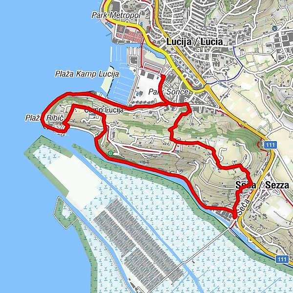
Marina Lucija
- Route
-
Ribič1.7 kmSezza4.7 km
- Best season
-
JanFebMarAprMayJunJulAugSepOctNovDec
- Description
-
A nice family walk around salt fields, some still operational, with the view of Garden of Cactuses and Forma Viva.
- Directions
-
Lucija - Camp site Lucija - cape Seča - Forma viva - channel Sv. Jernej - Sv. Jernej - peak of the Seča hill - Lucija
- Highest point
- 59 m
- Endpoint
-
Marina Lucija
- Height profile
-
 © outdooractive.com
 - Arrival
-
Just follow the road along the coastline towards Croatian border
- Public transportation
-
Local bus
- Parking
-
At Marina Lucija
- Author
-
The tour Donkey's trail along the Seča ridge is used by outdooractive.com provided.
GPS Downloads


General info
Healthy climate
Cultural/Historical
Other tours in the regions