

- Brief description
- Difficulty
-
easy
- Rating
-
- Starting point
-
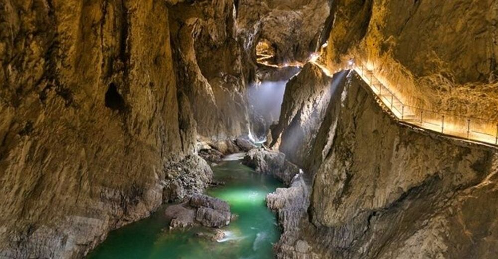
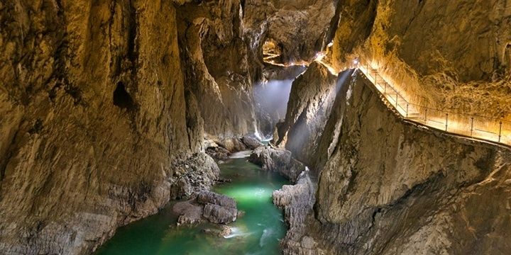
Škocjan Caves
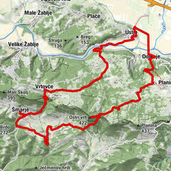
- Route
-
UlurjeMahnič0.0 kmMattauno0.0 kmBelvedere0.3 kmGradischie di San Canziano1.4 kmGaberce Auremiano8.3 kmSenosetsch10.0 kmSan Bartolomeo10.2 kmGostilna NANOS16.3 kmPrevallo16.5 km
- Best season
-
JanFebMarAprMayJunJulAugSepOctNovDec
- Description
-
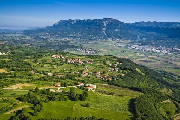
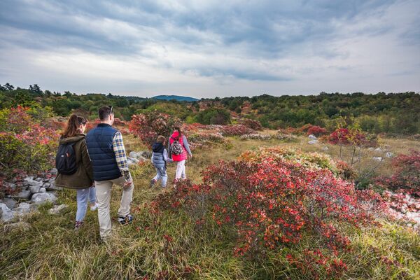
The Škocjan caves, which are on the UNESCO list of world heritage, illustrate the Karst's most important characteristics, both above and below ground, where the Reka river carved out huge canyons and cavernous halls. There are guided tours through the most interesting part of the caves. The path to the north leads across Gabrk past the grassy Vremščica.
This was once barren land, blasted by the brutal Bora wind during winter. The Bora is a cool and jerky northern wind that is created by the disparity between high atmospheric pressure on land and low atmospheric pressure over the sea. The cold, dense air blows down the Karstic plateau towards the sea and can reach speeds of up to 200 km/h. Beyond Gabrk is the Senožeško podolje valley system. Senožeče is said to lie in a draught because of the Bora. In the background stands the massive Nanos mountain, known as Okra in ancient times, below which lies Razdrto, an important pass between the sea and the interior.
- Directions
-
The stage starts at the Škocjan caves near Matavun. After viewing the caves, follow the Slovene balcony train (No. "1") to the view point above the 164-m tall rock face. 15 min. Continue walking in the same direction until you reach the junction with the road from Divača. There is no accommodation in Matavun so take the road to Divača, where you can spend the night. Follow the Via Alpina route towards the village of Gradišče 15 minutes away. Walk through the village past the Church of Sv. Helene (St. Helen), which is renowned for its frescoes, and turn right onto the macadam road at the junction. Cross the regional road and follow the macadam road on the other side to the Gabrk sports airfield. Bypass the airfield along its western side then turn left across the meadow to reach the pine forest. At the railway line, walk through the low pedestrian underpass. Climb up the other side to reach the fire road. 1h 15 min.
Turn left at the road sign and walk to the first junction, then turn right and follow the power line through the forest. The macadam road brings you to the Divača - Senožeče main road. Make a sharp right turn here, and after about 100 m make a sharp left turn onto a footpath. Follow the power line again until you reach a macadam road. Cross the road and walk past a sheep pen until you reach the military road, then turn left. Go straight through the first junction and turn right a few metres later onto a dirt track. The track leads you to the village of Gabrče. Walk through the village to the main road and follow it to Senožeče (560 m). 1h 15min. Senožeče was most probably named after the meadows (senožeti) in the valleys and surrounding hills. It lies at the foot of Stari grad. The hike from the Škocjan Caves takes 2h 30 min. There is a crossroads of several balcony trails in the centre of Senožeče.
The Via Alpina route follows the Slovene balcony trail. Cross the main road and walk past the church and cemetery, then climb up a forest road across fields and meadows. The road leads you to the top of Mazni vrh. 45 min. As you approach the motorway in the valley below, make a sharp right turn and climb down to the Volčji potok valley. Turn right at the bottom of the valley, then left where the forest roads cross paths. You will reach the motorway and turn left and up when you reach the fencing. Turn right and walk down the forest road, then turn left onto a poorly market dirt track. You will come to a meadow after about 200 m. Continue walking along the side of the forest then cross the meadow to the tarmac road opposite the quarry. Turn left and follow the road to the centre of the village of Razdrto (575 m). 45 min. The hike from Senožeče takes 1h 30 min.
- Highest point
- 716 m
- Endpoint
-
Divača
- Height profile
-
 © outdooractive.com
 - Equipment
-
Windstopper is a good addition.
- Safety instructions
-
Mind the wind on the stage, it can reach dangerous speeds.
- Tips
-
It is almost obligatory to visit the UNESCO site Škocjan Caves, the small tour takes only 1.5h, the landmark of this stage.
- Additional information
-
You can book the tour in Škocjan caves in advance.
- Directions
-
By car, by train or by bus.
- Public transportation
-
Divača is accessible by train or bus. From there yu have couple of kilometers to the starting point.
- Parking
-
Parking available

- Author
-
The tour Via Alpina Slovenia: Red trail Stage 2 (Matavun-Razdrto) is used by outdooractive.com provided.


General info
-
Notranjsko-Kraška
68
-
Škocjan
13